
Storms
E N D
Presentation Transcript
Large scale circulation • Movement of air masses • Circulation cells • Warm air rises, cools then sinks • Water vapor decreases air density and warm air can hold more water vapor
Features of the model • Air moves vertically at the boundaries • Air moves horizontally within the cells from areas of high pressure to areas of low pressure • Tropical areas – Hadley cells • Surface winds are strong and dependable • Trade winds or easterlies centered at ~15oN (northeast trade winds) and ~ 15oS (southeast trade winds) • Surface wind moves from horse latitudes to doldrums so come out of northeast in N hemisphere • Mid-latitude areas – Ferrel cells • Westerlies centered at ~ 45oN and ~45oS • Surface wind moves from horse latitudes to polar cells so comes out of southwest in the N hemisphere
Polar front • About 50o N and S • Persistent boundary between converging warm and cold air masses • Get highly variable weather at these latitudes • Made up of a succession of waves that appear on weather maps as warm or cold fronts • Succession of warm, moist, subtropical air and cold dry polar air • Weather typical of N America and Europe • Narrow bands of strong winds called jet streams at altitudes of about 10 km
Weather • A result of smaller atmospheric motions and eddies • Usually caused by differences in atmospheric pressure, temperature and humidity (remember all of these affect density) • Weather forecasts try to predict smaller scale air movements
Pressure systems • Low pressure where air masses or winds diverge • High pressure where air masses or winds converge • Air moves from high pressure areas to low pressure areas • Meteorologists map highs and lows to predict air movement
Air masses • Comparable to a water mass • Large body of air with uniform temperature and humidity (so density) throughout • Air over land or water will take on characteristics of surface below • Cold, dry land yields cold, dry air (high pressure) • Warm ocean surface yields warm, wet air (low pressure)
Air masses • Air masses form over land and water acquiring characteristics of their sources • Dry, cold air forms over Canada and Siberia… • Wet, moist air forms over equatorial waters… • When air masses move, they change characteristics • Temperature changes • Humidity or water content changes (lose water)
Air masses • Air masses can move within or between cells • Density differences prevent air masses from mixing (like water) – dense air slides beneath • Turbulence at boundaries between air masses • Fronts are boundaries between air masses of different densities • Fronts marked by changes in temperature and humidity
Fronts • A cold front is the leading edge of a cold-air mass advancing on a warm air mass • Displaces warm air • Cold air pushes under warm air (more toe shaped) • Get precipitation (rain or snow) just behind the front • A warm front is the advancing edge of a warm air mass • Displaces cold air • Rises over cold air in a wedge shape • Drops water in front of its leading edge
Ocean influence on weather • At mid-latitudes, warm and cold water masses steer weather patterns on land • Size and energy of water masses permits this • Large cold water masses in the N Pacific shift prevailing westerlies blowing across E North America • Cold, dry air from Canada displaces warm, moist air from the Gulf of Mexico and the tropical N Atlantic • So get cooler winters in the SE USA • Shifts in positions of water masses can cause changes in patterns • Warm equatorial surface waters in the Atlantic cause prolonged drought in Africa?
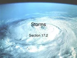
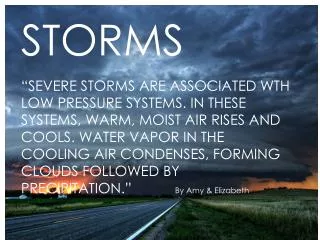
Storms • Regional atmospheric disturbances characterized by strong winds and, often, precipitation • Cyclones are intense storms around low pressure centers • Tropical disturbances (in Hadley cells/tropics) – cyclones (hurricanes) • Extratropical disturbances (in Ferrel cells/mid-latitudes) – also cyclones, usually in winter
Cyclones • Low pressure air • Rotates as winds converge and ascend (may bring water with them so get precipitation) • Form between or within air masses
Extratropical cyclones • Form at the boundary of polar and Ferrel cells (polar front) – mid-latitudes • Occur mainly in winter when temperature and density differences across the front are most pronounced • Cold air poleward of front is moving from the pole and east (more dense) • Warm air equatorward of the front is moving from the equator and west (less dense) • Cold air tries to slide below the warm air at the low pressure interface of a stationary front
Extratropical cyclone • May get alternating high and low pressure systems that bend the front • May get a twist in front due to opposite wind directions • Twisting air mass becomes cyclonic and circulates CCW in the N hemisphere (opposite Coriolis) • CCW flow is Coriolis driven because of the dominant flow of air masses at the edges • Part of the front is cut off • Wind speed increases as storm condenses • Air rushing toward center rises making a low pressure zone (air rises and loses moisture)
Cold air tries to dive below or push under warm air Higher pressure N of cold front so bending is towards lower pressure Cold air pushes warm air/front Low pressure intrusion into cold front Warm air rises (with or without water) at both fronts & yields precipitation at the fronts Cold front pushes warm front Eventually part of front is cut off and moves east
Extratropical cyclones • Cyclone gets embedded in the westerly winds so moves eastward • Typically 1000-2500 km in diameter • Last 2-5 days
Extratropical cyclones • Precipitation begins as circular flow develops • Precipitation caused by the lifting and cooling of the mid-latitude air (warmer air from the Ferrel cell) involved in the twist • Cold air advances behind it and does the lifting creating a cold front • Warm front occurs as the warm air is lifted on top of the retreating cold edge • Often these are called frontal storms and are the principle cause of weather in mid-latitudes
Nor’easters • Most powerful wind approaches from the east (polar cells) • Occur along the east coast of the US in winter
Tropical cyclones • Masses of warm, humid, rotating air • Occur in all tropical oceans except the equatorial South Atlantic • Large tropical cyclones (winds at least 119 km/hr) are: • hurricanes in the North Atlantic & eastern Pacific (about 100/year) • Typhoons in the western Pacific • Tropical cyclones in the Indian Ocean • Willi-willis in the waters near Australia • Smaller tropical cyclones are tropical storms or depressions
Appear as circular spirals • May be 1000 km in diameter and 15 km high • Calm center is the eye & can be 13-16 km • Occur June – November in N hemisphere
Tropical cyclones • Usually generated within one air mass • Usually generated between 10o and 25o latitude (Coriolis effect closer to equator is too weak to initiate rotary motion) • Typically last ~9 days • Origins not well understood • Convergence of warm, wet winds that rise • Usually develop from a tropical depression • Power if from the condensing water vapor and rising air currents at the eye
Tropical cyclones • Tropical depressions form in easterly waves • areas of lower pressure within the easterly tradewinds • thought to originate over a large, warm land mass. • Air containing the disturbance is heated over tropical water • Circular winds begin to blow in the vicinity of the wave • Some warm, humid air is forced upward • Condensation begins
Where hurricanes form (areas of high humidity and warm air over warm water)
Hurricanes • Develop in 2-3 days from tropical cyclones under ideal conditions • Centers move westward and poleward (within easterlies) in N hemisphere at 5 to 40 km/hr • Poleward motion due to general atmospheric circulation • Hurricanes lose strength over land (friction and loss of water vapor supply) or relatively cold surface water (decreases rising wind speed in eye)
Tropical cyclones • Origin not well-understood • Power and strengthening are
Take home points • Weather versus climate – scale of circulation • Frontal storms – extratropical cyclones • Tropical cyclones (e.g., hurricanes) • Pressure systems • Affects of humidity, temperature and pressure on air flow