Download
1 / 23
280 likes | 506 Vues
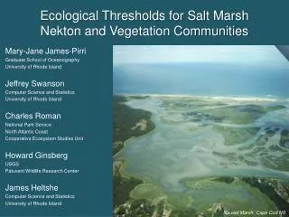
Ecological Thresholds for Salt Marsh Nekton and Vegetation Communities. Mary-Jane James-Pirri Graduate School of Oceanography University of Rhode Island Jeffrey Swanson Computer Science and Statistics University of Rhode Island Charles Roman National Park Service North Atlantic Coast

E N D
Ecological Thresholds for Salt Marsh Nekton and Vegetation Communities Mary-Jane James-Pirri Graduate School of Oceanography University of Rhode Island Jeffrey Swanson Computer Science and Statistics University of Rhode Island Charles Roman National Park Service North Atlantic Coast Cooperative Ecosystem Studies Unit Howard Ginsberg USGS Patuxent Wildlife Research Center James Heltshe Computer Science and Statistics University of Rhode Island Nauset Marsh, Cape Cod NS
Project Background & Objectives • Funded by the USGS Status & Trends Program. • Use existing data to define ecological thresholds for Vital Signs associated with the National Park Service’s Inventory and Monitoring Program. • Study Focus: Vital Signs of salt marsh nekton & vegetation community composition from NPS Monitoring Protocols. • Identify patterns in community structure and correlate patterns with landscape gradients (e.g., degree of urbanization), if possible.
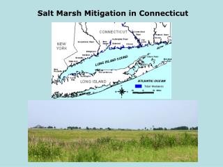
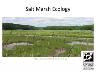
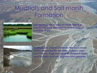
The Marshes Rachel Carson NWR Parker River NWR Boston Harbor Islands NPA Narragansett Bay, RI 14 sites Cape Cod NS Dartmouth, MA sites Sachuest Point NWR Stewart B. McKinney NWR Sagamore Hill NHS Long Island Complex NWR Fire Island NS Gateway NRA Edwin B. Forsythe NWR Prime Hook NWR George Washington Birthplace NM Assateague Island NS Colonial NHS 83 individual marshes in 48 watersheds National Parks US Fish & Wildlife Refuges Other sites • Sites had a range of hydrologic disturbance: • No disturbance (reference sites) • Tidal restriction • Tidal restoration • Open marsh water management (OMWM) for mosquito control ~ 50% of sites were sampled in multiple years (mostly 2001 to 2006) ~ 50% of marshes were reference sites
The Datasets • Vegetation Community Data (70 sites, 156 individual datasets) • Point intercept data from 1-m2 plots • 203 cover types – live vegetation & non-vegetative cover (water, wrack) • Nekton Community Data (81 sites, 185 individual datasets) • Relative abundance data from enclosure gear (throw traps & ditch nets) • 62 species - fish and crustaceans • Landscape metrics (48 sub-watersheds) • 2000 U.S. Census data (human population density of sub-watershed) • 2001 National Land Cover Data (land use within 5 km radius) (not presented) • Multivariate techniques were used to explore patterns in community composition Cape Cod NS, MA Gateway NRA, NY Fire Island NS, NY
Vegetation Community – Common cover types • Reduced dataset to 21 common cover types (present in >20% of datasets) • 76 reference and 80 disturbed marsh datasets: • Principal Component Analyses (PCA), 1st three principal components only accounted for ~40% (1st PC: 20%); • No clear pattern in PCA scores using common cover types; • No clear gradient of land use in PCA scores; • No correlation with watershed human population density. Reference sites Disturbed sites Gradient of Marsh Disturbance Reference sites: reflect desired or target condition. Disturbed sites: reflect degraded or less desired condition. 2nd Principal Component 1st Principal Component
Vegetation Groups-Wetland status & salinity tolerance • Grouped vegetation by wetland status & salinity tolerance using USDA definitions (e.g., obligate wetland species, high salinity tolerance); • Invasive and state-listed status (e.g., endangered, threatened) • Disturbed sites 1st three PC’s accounted for 68% variation; • No correlation with watershed population density; • Pattern in vegetation groups with degree marsh disturbance; • Shift from obligate wetland plants with high salinity tolerance to less salinity tolerant species at disturbed sites; • Invasive species more prevalent at disturbed sites. Salinity tolerance of obligate wetland plants Increasing marsh disturbance High Percent cover Medium Low None Invasive plants Hydrologically Altered (OMWM) ~ 11 species Reference sites ~13 species Restricted sites ~26 species Restoring sites ~35 species
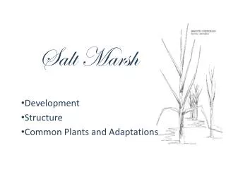
Vegetation– Possible metrics to detect change • Vegetation groups: • Wetland status (e.g., obligate, facultative); • Salinity tolerance; • Invasive species; • Pattern with degree of marsh disturbance. John H. Chafee National Wildlife Refuge, RI
Nekton Community – all species vs common species • All species • Only 16% of the variability explained by 1st three principal components; • PC’s loaded primarily on rare species; • 17 Common species, species present at >10% of marshes • Accounted for 34% of total variability; • No separation of sites; • Conclusion: Individual species would not be a good indicator to detect change in nekton communities. Common Nekton Species Reference sites Disturbed sites 2nd Principal Component 1st Principal Component
Nekton Groups – based on life history characteristics • Nekton Groups: Fish and crustaceans grouped by resident or transient species; • 85% of variation explained by 1st three PCs; • PC1 showed negative correlation between resident fish & shrimp; • PC3 loaded on transient fish; • Can use PC1 & PC3 to distinguish between sites with high proportions of resident fish, resident shrimp, & transient fish. Reference sites Disturbed sites Transient Fish presence 3RD Principal Component Grass Shrimp Dominated (Palaemonetes spp.) Resident Fish Dominated 1st Principal Component
Watershed Population Density • First PC correlated with watershed population density for reference sites • First PC correlated with watershed population density; • Sites in watersheds with higher population densities tended to be dominated by grass shrimp & sites in less dense watershed tended to be fish dominated. Shrimp dominated communities Natural log of total population Fish dominated communities • Pearson correlation coefficient: -0.64, • p<0.0001, adj. r2: 0.40 1st Principal Component
Nekton Groups & PopulationDensity • Sites in watersheds with high population densities were dominated by Palaemonidae grass shrimp; • As population density decreases, resident fish increase in abundance; • Transient fish are associated with lower population density watersheds sites. Population of Surrounding watershed 1,000 to 4,999 5,000 to 9,999 10,000 to 19,999 20,000 & above Small watersheds surrounded by dense populations in Narragansett Bay, RI 3rd Principal Component Transient fish (e.g., flounder, eel) Resident fish (killifish spp.) Resident Shrimp (Palaemonidae spp.) 1st Principal Component
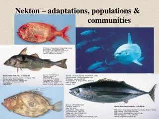
Nekton– Possible metrics to detect change • Nekton groups life history characteristics: • Resident fish; • Resident shrimp (Palaemonidae species); • Transient fish; • Pattern with watershed population density. • Although not strongly correlated in our analyses, these parameters are important: • Exotic species presence (exotic species can threaten native species); • Total species richness (generally, low richness is a sign of a degraded community). Grass shrimp Palaemonetes spp. (resident shrimp) Young-of-the-year winter flounder (transient fish) Striped killifish (resident fish)
Estimate of Condition–Salt Marsh Vegetation • Data graphed are: • 50thpercentile (point) • 75th & 25% percentiles (box) • 90th & 10th percentiles (bars)
Estimate of Condition–Salt Marsh Nekton Breakpoints based on quartile values for reference marshes in watersheds with differing population densities. • Data graphed are: • 50thpercentile (point) • 75th & 25% percentiles (box) • 90th & 10th percentiles (bars)
Application to Resource Management • Assign scores to each condition estimator, with high scores for better or more desired condition • Good = 5, Moderate = 3, Poor = 1; • Presence / absence: absent=5; present = 1; • Sum the scores to obtain an overall value. • Set a range based on number of metrics,example for 3 metrics: • Good: 12-15 • Moderate: 7-11 • Poor: 3-6 Assateague NS
Application to Resource Management Condition criteria applied to vegetation data from Sachuest Point NWR, RI A tidally restricted, degraded marsh that was tidally restored in 1997 Condition criteria applied to nekton data from Jamaica Bay, GATE
Conclusions • Estimates were derived from a large regional multi-year database with a gradient of marsh disturbance from reference to severely degraded condition. • Able to estimate condition criteria for salt marsh vegetation and nekton using key indicator metrics. • Metrics were able to detect change in both vegetation and nekton communities when applied to new data. Cape Cod NS, MA
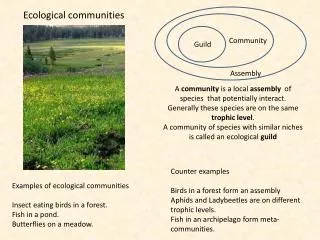
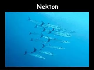
Nekton Guilds Guilds based on life history characteristics associated with salt marshes Residents: salt marshes are critical to their life history Transients: found in marshes, but not critical to their life history Salt Marsh Residents Salt Marsh Transients Fish Crabs Fish Crustaceans Killifish Minnows Green crabs Fiddler crabs Eel Flounder Silversides Blue crabs Bay shrimp Shrimp Grass shrimp
Vegetation Groups - Surrounding Land use (5 km radius • Canonical Correspondence Analyses (CCA); • Relationship among vegetation guilds and surrounding land use; • Vegetation groups from disturbed marshes were correlated with land use; • Disturbed sites: 1st three CCA axes accounted for 67% of the variation (reference sites: 47% of variation); • Higher proportions of invasive plants and low salinity tolerant species associated with developed lands. Wetlands & deciduous forest Salinity tolerance of wetland obligate plants Developed land (high, medium, low intensity) & open developed land High salinity Medium salinity Low salinity Invasive plants Disturbed sites Mixed forest & shrub Water & barren land
Nekton Groups – Surrounding Land use (5 km radius) • Canonical Correspondence Analyses (CCA). • Nekton guilds from reference marshes were correlated with land use; • 1st two CCA axes accounted for 43% of the variation; • Higher proportions of resident shrimp (grass shrimp) were associated with developed lands; • Higher proportions resident & transient fish were associated undeveloped lands. Water & barren land, herbaceous vegetation Developed land (high, medium, low intensity & open) Nekton guilds Resident fish Transient fish Resident shrimp Resident crabs sites Crop land, shrub, deciduous forest Wetlands & mixed forest
Can we estimate thresholds of change? Maybe for nekton…. If low population sites represent a more “natural” or “desired target” condition: >60% resident fish ~15% transient fish ~15% resident shrimp If high population sites represent a more “stressed” condition : 10% resident fish 4% transient fish 85% resident shrimp Proportion of catch Watershed Population Transient fish Resident fish Resident shrimp (Palaemonetes spp.)
What is happening at impacted sites? At lower population watersheds (<15,000 people) shrimp are replacing the fish at the impacted marshes Impacted sites, n=75 Resident fish reference line: 68% Proportion of catch Shrimp & transient fish reference line: ~15% Watershed Population size