Download
1 / 33
420 likes | 798 Vues
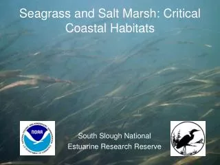
Seagrass and Salt Marsh: Critical Coastal Habitats. South Slough National Estuarine Research Reserve. What is a Salt Marsh?.

E N D
Seagrass and Salt Marsh: Critical Coastal Habitats South Slough National Estuarine Research Reserve
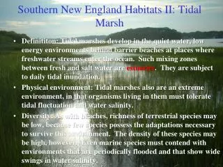
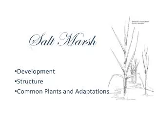
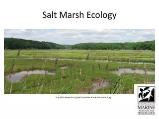
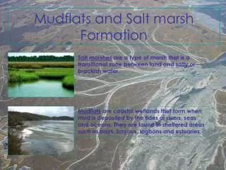
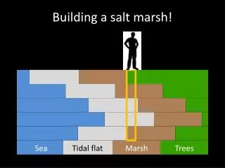
What is a Salt Marsh? Salt marshes are transitional areas between land and water, occurring along the intertidal shore of estuaries and sounds where salinity (salt content) ranges from near ocean strength to near fresh in upriver marshes.
What is a Seagrass Bed? Seagrasses are flowering plants that have adapted to living in salt water. Seagrasses are found mostly on soft sediment in estuaries and shallow coastal waters and are frequently found growing in dense beds. In Pacific Northwest estuaries, the common species of seagrass is called eelgrass (Zostera marina), which grows in soft sediments of intertidal and subtidal zones.
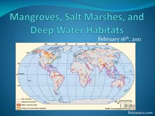
Where are seagrass and salt marsh communities located? Salt marshes
Estuarine Habitats: Salt marshes Tidal channels:
1. Open Water- Subtidal Estuarine Habitats: Salt marshes Tidal channels: Eelgrass beds
1. Open Water- Subtidal Estuarine Habitats: 2. Intertidal mudflat Salt marshes Tidal channels: Intertidal mudflat Eelgrass beds
Extreme High Tide Low Tide MLLW High Tide MHHW Elevation is a primary determinant of seagrass and salt marsh location Transitional Zone Mudflat and/or Seagrass Low and Mid Salt Marsh High Salt Marsh Mainstem Tidal Channel Tidal Inundation Period: High Marsh- Short Low Marsh- Long
Why are seagrass and salt marsh communities important? What roles do they play in the coastal ecosystem?
In ecological and economic value, they rival tropical rainforests and the world’s richest farmlands!
Seagrass and Salt Marsh Functions • Primary Production • Fish and Wildlife Habitat (including “nursery” role) • Sediment sink • Shoreline protection • Water Quality
Primary Production • Eelgrass and Salt Marsh provide the critical foundation to the “detrital food web” • Production • Shredding • Colonization/decomposition • Consumption by small organisms (“grazers”) • Consumption by larger organisms (“predators”) • Defecation/Nutrient transformation
Fish and Wildlife Habitat Example • Juvenile Salmon rearing habitat • Foraging • Physiological transitions • Refuge from predators
Fish and Wildlife Habitat Example • Resident and migratory bird habitat • Shorebirds – feed on insects, fish, invertebrates • Ducks and geese graze on vegetation – Ex. Black Brant / eelgrass
Water Quality • Nutrient uptake • Sediment trapping and baffling of wave energy • Oxygen production
Natural Variability of Salt Marsh and Seagrass Habitats Plant distribution, species diversity, and density can vary substantially over seasons and years in response to: • Precipitation, water table • Light availability • Temperature • Nutrient availability • Plant competition/succession • Sediment characteristics • Oceanic cycles (El NIÑO, PDO) • Sea level rise
Human Impacts on Salt Marsh and Seagrass • Direct Impacts: • Dredging • Diking • Draining • Filling • Indirect Impacts: • Pollution – toxics, • nutrients, sediments • Water diversions • Shading – i.e. docks, • piers, bridges, boats, • high water turbidity • Invasive species
HISTORIC CHANGES OF COOS BAY TIDAL WETLANDS, FILLED AGRICULTURAL LANDS, AND RESIDENTIAL COMMUNITIES (1892-1995) ACRES YEAR
Why Monitor Salt Marsh and Seagrass Habitat? • To further our understanding of coastal ecology • To document changes over time as an indicator of estuarine health • To assess changes in sensitive estuarine habitats from long term trends in sea level rise and climate change • To alert us to declines in key habitats and guide corrective action • To motivate the public to protect existing habitat, restore degraded habitat, and improve upstream land use practices
South Slough’s Monitoring Strategy South Slough National Estuarine Research Reserve (SSNERR) currently monitors a variety of physicaland chemical measures as part of a nationwide effort to track the status and trends of estuarine resources in the United States. Monitoring of eelgrass and salt marsh serve as biological indicators of ecosystem health.
A key advantage of biological indicators of estuary health is that they respond to a broad variety of environmental variables (temperature, salinity, light, pollution, etc), and therefore provide an integrated measure of how the ecosystem is functioning.
The “Big Picture” Questions: • Within salt marshes and eelgrass beds, how are species composition, abundance, and distribution changing over time? • What might be causing these changes?
Questions about short-term variability in these habitats: • How closely linked are the seasonal ecological characteristics of these habitats along the estuarine gradient? • How does the location of a habitat along the estuarine gradient affect species diversity, spatial cover, and biomass?
Questions about long-term variability in these habitats: • How are changes in eelgrass and salt marsh habitats related to longer-term changes in the nearshore Pacific Ocean and/or freshwater inputs from the local watershed?
Guiding Concepts of Our Monitoring Approach: • Establish monitoring sites along estuarine gradient (marine freshwater) • Conduct representative sampling using transects and plots • Repeatable measures • Measure both plant community attributes and environmental variables • Testing both national (NERRS) and International (SeagrassNet) protocols • Sample quarterly (4x per year) to assess seasonal variability
What do we measure at each site? • Water depth • Water salinity (salt content) • Water Table Height • Sediment elevation changes • Sediment grain size • Light using loggers • Water temperature using loggers
What do we measure at each quadrat plot? • Canopy height / Blade width • Shoot density • Flowers & fruits • Sediment description • Biomass core (0.0035m2) • Seagrass % cover • Species composition • Photograph
Current project status? • First year of project – 3 seasons of data collected • Data analysis this Fall • Ongoing long term monitoring to reveal trends