Download
1 / 32
320 likes | 647 Vues
Reducing Risk!. Managing Time and Space Vehicle Positioning. Use any of these visual techniques. IPDE The Smith System Zone Control. 1. “IPDE”. Identify – use a visual search pattern to gather information about the roadway ahead.

E N D
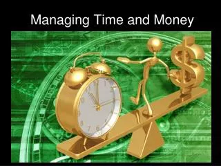
Reducing Risk! Managing Time and SpaceVehicle Positioning
Use any of these visual techniques • IPDE • The Smith System • Zone Control
1. “IPDE” • Identify – use a visual search pattern to gather information about the roadway ahead. • Predict – Use your knowledge and experience to predict the actions of others and the environment. • Decide – If you need to change or maintain direction and speed, or communicate. • Execute – Your chosen actions.
Visual Search Patterns THE THREE VISUAL FIELDS Peripheral Vision Focus Vision Central Vision
Urban Driving Search Patterns 15-20 seconds 4-8 seconds
Rural or High Speed Search Patterns • Search far ahead to identify potential conflicts • Objects in Path and Areas of Limited Visibility • Limitations to Path of Travel and Line of Sight 12 to 15 Second 20 to 30 Second Search Area Control Area
2. SMITH SYSTEM Aim High in steering to allow more time for driver response Keep your eyes moving to search for hazards and vehicle movement around the vehicle Get the big picture of where your vehicle is located in time and space Make sure others see you by using appropriate communication, lane position, and visibility Leave yourself an out to reduce risk of collision from the front, sides or rear
Aim High : Targeting What is the target in the driver’s path of travel? A “Target” is a fixed object in the center of the path you intend to drive
Target Area The Target area is the area to the left and right of your target
Determining Following Intervals A3 secondfollowing interval should provide enough time to avoid a problem if you are monitoring the actions of drivers 8 to 12 seconds ahead in your path of travel. In most cases, you’d still have to steer towards an “escape path”, so 3 seconds is MINIMUM! 3 second interval 8 – 12 second interval
Control Space to the Rear • Check rear view mirror: • After seeing a zone change • Before and after braking • While stopped • Before and after making turns • Before and after a lane change Check blind spots
Visual Search Categories • Traffic Controls • Motor Vehicles • Non-Motorized Users • Highway
Road Conditions Width Curbing Curves Slopes Roadway Structure Intersection? Roadway Sensory Input to the Brain Roughness Slick Wet Leaves Mud Sand Roadway Surface Atmosphere Roadway Features Illumination Glare Precipitation Wind/Noise Shoulders Solid Objects Adjacent Buildings
Identifying Vehicles Types CAMPER, PICK-UP, MOTOR HOMES, MOTORCYCLES, FARM MACHINES, OFF-ROAD SNOWMOBILES Type Motor Vehicles Sensory Input to the Brain Road Handling Characteristics
Identifying Non-Motorized Users • KIND AND SIZE • NUMBERS • AGE OF RIDER • ACTIVITY • RIDER ABILITY NON-MOTORIZED USERS Sensory Input to the Brain Pedestrians In-Line Skates, Skateboards Bicycles Animals
Traffic Controls Sensory Input to the Brain RegulatoryWarning Guide Unmarked Intersections Signs Signals TRAFFIC CONTROLS Stop/Go Lane Turning Flashes Sensory Input to the Brain Passing Crosswalk Stop line Interchanges Roadway Markings
Intersection Search Patterns • Intersection Approach • Check open areas, thenclosed areas to front • Check to the rear • Communicate as necessary • Check areas adjacent to path of travel • Check sightlines left and right • Adjust speed and/or position as appropriate Open Closed Closed Open Open Open
Line of Sight Through Left Curve • Establish Line of Sight and Projected Path of Travel • Check to the Rear • Adjust Position for Maximum View of Oncoming Traffic • Establish Target Area for Path of Travel • Adjust Speed and Position to Conditions
Line of Sight Through Right Curves T – 5.20
Line of Sight Over Hill • Sightline limitations are similar to a curve • Adjust speed and vehicle position to the right or outside of lane What’s this car NOT doing correctly?
3. ZONE CONTROL Front Right Rear Right Rear Center Front Center Front Left Rear Left Be aware of these six “zones” around your vehicle and make note if they are “open” (nothing is there) or “closed” (something is there). Identify closed zones first.
1 3 2 4 5 Vehicle Positioning MAXIMIZE LANE USE Use the lane position that gives you the best line of sight and path of travel. This diagram is based upon an average 12 foot wide lane.
Lane Position # 1 2-3 Feet 1 2-3 Feet
Lane Position # 2 3-6 Inches 2
Lane Position # 3 3 3-6 Inches
4 5 Lane Positions #4 and 5 Lane positions 4 and 5 – straddling the line to avoid a problem
How Do You Know How Far Your Vehicle is From the Curb or Edge of the Road? Driver
Answer: Reference Points This driver is using her left side mirror, lined up with the first crosswalk line, to help her know that the front of her car is stopped just before the crosswalk!
More Reference Points This driver can use the right strap holding his canoe on as a reference point. As long as it lined up with the solid white line, his car is in the middle of his lane. What could he use if the canoe strap wasn't there?
You could use the windshield sticker to help keep the car about 3’ from the left edge of this lane. You could also use the little bump in between the wipers to keep the car about 3’ from the right edge of the lane. Another example
Reference points can be very useful when parking in tight parking spaces!
Summary • Use IPDE to reduce risk. • Use the Smith System to be aware of your surroundings. • Use Zone Control to manage the immediate area around your vehicle. • Use reference points to help know your vehicle’s position in the road.