Time and Space
450 likes | 666 Vues
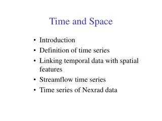
Time and Space. Introduction Definition of time series Linking temporal data with spatial features Streamflow time series Time series of Nexrad data. Hydrologic Information System. Analysis, Modeling, Decision Making. Arc Hydro Geodatabase. Space-Time Scales and Hydrologic Processes.

Time and Space
E N D
Presentation Transcript
Time and Space • Introduction • Definition of time series • Linking temporal data with spatial features • Streamflow time series • Time series of Nexrad data
Hydrologic Information System Analysis, Modeling, Decision Making Arc Hydro Geodatabase
Space-Time Scales and Hydrologic Processes Subsurface water Surface water Time Atmospheric water Space Figure adapted from Sivapalan and Bloschl (2000).
Water Watch – Real Time Streamflow Data (~ 5000 gages) http://waterdata.usgs.gov/nwis/rt Updated every 4 hours
Spring and Fall 2002 October 2002 March 2002 Drought in Northwest Drought in Northeast
USGS NWISWebhttp://water.usgs.gov • Real-time and Historic Data • Streamflow and stage • Groundwater levels • Water Quality • Site information • Tabular or Graphical Format
Streamstats A program for finding streamflow statistics at any location on a stream http://ststdmamrl.er.usgs.gov/streamstats/
Streamflow Information in Space and Time Current Future Possibilities Time Real Time data Historical daily mean discharge Streamstats Streamflow statistics At Gages Anywhere on a Stream Space
Hydrologic Data in Space and Time Time Hydrologic Information Continuum Future Present Past Space Point Line Area Continuous Surface
Coupling Spatial and Temporal Data 1 hour Nexard Rainfall on the Guadalupe Basin October 13, 2001
Time and Space • Introduction • Definition of time series • Linking temporal data with spatial features • Streamflow time series • Time series of Nexrad data
Arc Hydro Time Series Object TSDateTime (Time of measurement) (Data value) TSValue FeatureID (Spatial Feature) TSType (Type of Data)
Arc Hydro Time Series Object TSDateTime TSValue FeatureID TSType
View 1:Time Series for a Spatial Feature TSDateTime 101 FeatureID TSType
View 2:Time Series of a Particular Type TSDateTime FeatureID Evaporation TSType
View 3:Time Series of a ParticularType for a Single Feature TSDateTime FeatureID Evaporation TSType
View 4:A Time “Snapshot” of Spatial Attributes TSDateTime 1989-03-30 01:00:00 FeatureID TSType
Time Series Type Unified Modeling Language Representation in Visio 2000
Time series class properties • TSTypeID – integer which indexes type of time series • Variable – Name of the variable (text) • Units – Units of measurement (text) • IsRegular – True/False to indicate whether measured at regular time intervals or irregularly (boolean) • TSInterval – Time interval for regular data (Coded Value Domain of acceptable intervals) • DataType – Type of time series data (Coded Value Domain of specified types) • Origin – Recorded or Generated (Coded Value Domain)
Coded Value Domains
Time and Space • Introduction • Definition of time series • Linking temporal data with spatial features • Streamflow time series • Time series of Nexrad data
Junction DrainagePoint Connecting to Time Series Flow HydroID FeatureID Time TimeSeries HydroPoint CrossSection FeatureID of time series is HydroID of feature the time series describes
Time and Space • Introduction • Definition of time series • Linking temporal data with spatial features • Streamflow time series • Time series of Nexrad data
National Water Information System Arc Hydro NWIS data retrieval tool Web access to USGS water resources data
NWIS Data • Metadata • Tabular Output • Year.Month.Day • Discharge (cfs)
Retrieving NWIS Data • Select Gage Layer • Enter Period of Record
Streamflow Time Series Arc Hydro Time Series Table
Time Series Extracted to Excel(In Excel, use Data/Get External Data to query Geodatabase) Excel view Geodatabase view
Time Series in Arc Hydro USA 1,596 HCDN Stations out of 18,827 gaging Stations (Daily stream flow from Oct, 1988 – Sep, 2000 Source: NWIS website)
Time and Space • Introduction • Definition of time series • Linking temporal data with spatial features • Streamflow time series • Time series of Nexrad data
HRAP Cells for Nexrad Data Average area = 14.5 km2
Coupling Spatial and Temporal Data 1 hour Nexard Rainfall on the Guadalupe Basin October 13, 2001
Water Balance in the Landscape Atmospheric Water Precipitation Evaporation Runoff Soil Water Surface Water Recharge Baseflow Groundwater
EDNA Catchments Average area = 7.5 km2
Modflow Groundwater Cells Modflow Model of the Edwards-Trinity aquifer Average area = 2.6 km2
Intersection of Nexrad and Catchments Surface Water Balance Atmospheric Water Surface Water Soil Water
Intersection of Nexrad and Modflow Cells Atmospheric Water Groundwater Balance Groundwater
Intersection of Nexrad, Catchments and Modflow Atmospheric Water Soil Water Surface Water Groundwater