Download
1 / 11
110 likes | 248 Vues
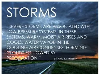
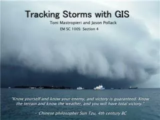
Tracking Storms with GIS. Toni Mastropieri and Jason Pollack. EM SC 100S: Section 4. “Know yourself and know your enemy, and victory is guaranteed. Know the terrain and know the weather, and you will have total victory.” - Chinese philosopher Sun Tzu, 4th century BC. Storm.

E N D
Tracking Storms with GIS Toni Mastropieri and Jason Pollack EM SC 100S: Section 4 “Know yourself and know your enemy, and victory is guaranteed. Know the terrain and know the weather, and you will have total victory.” - Chinese philosopher Sun Tzu, 4th century BC
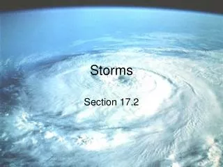
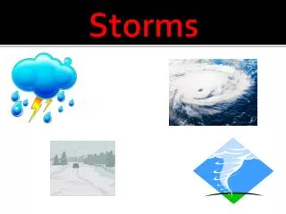
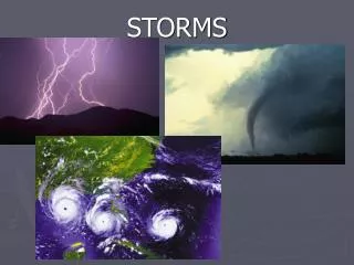
Storm • An atmospheric disturbance involving perturbations of the prevailing pressure and wind fields • Examples include tornadoes, hurricanes, thunder storm, and blizzards • Influences human activity in agriculture, transportation, construction, flood control, and the transmission of electric energy http://producemagazine.com/2011/06/midwest-flooding-corn-prices-double-farm-fields-devastated/ http://www.carrottspc.com/h2o/
Tracking Storms Before GIS • People have been trying to predict the weather since the dawn of civilization • Lack of knowledge of dangerous storms caused the death toll to be larger than it would be in the present • Modern forecasting came about with an increase in mapping and communications technologies http://lifehacker.com/398153/top-10-modern-life-survival-skills
Forecasting Analysis Observation http://www.accuweather.com/us/pa/university-park/16802/city-weather-forecast.asp Initialization Forecast Output http://www.accuweather.com/video/9551451001/northeast-extended-regional-we.asp http://www.personal.psu.edu/stw141/blogs/weatherforecasting/
GIS Technology and Storms • Computer intensive models • Examples include: • Google Earth • Hurricane Tracking • Severe Weather Warnings • NASA World Wind http://www.weather.gov/ http://www.nhc.noaa.gov/
CoCoRaHS • You can help too! • All volunteer based • Over 6,500 observers in 26 states • The only requirements are enthusiasm and a desire to learn more about weather • How it’s accomplished • Overall Goal http://www.crh.noaa.gov/lot/ ?n=cocorahs • http://rainlog.org/usprn/html/ • main/posting-snow.jsp http://www.cocorahs.org/Maps/ViewMap.aspx?state=usa http://www.nasa.gov/mission.pages/shuttle/ behindscenes/hail_monitor.html
Hurricane Dean • Labeled as the worst storm of the 2007 Atlantic season • However, due to advances in meteorology (because of GIS!), Dean’s well-predicted track helped people to prepare for its landfall • http://www.youtube.com/watch?v=2C8IIzFY-oM http://scienceblogs.com/intersection/2008/02/the_new_and_improved_hurricane_1.php http://www.nhc.noaa.gov/pdf/TCR-AL042007_Dean.pdf
GIS Advantages • Meteorology and maps are a natural fit! • Allows forecasters to be able to predict the path of a storm with more accuracy • GIS has made watching the weather a more integral part of everyday life • People can “connect” with the visual proof of the maps • Affects daily activities: • Rushing to go to the market before a huge snowstorm • Evacuations for hurricanes http://ldctstormchaser.blogspot.com/2011/02/chicago-blizzard-more.html http://www.lisisoft.com/tools/radar.html
GIS Disadvantages • What are some disadvantages that you can think of? • Excessive Reliance • Predicted wrong • How to survive without having constant access to weather predictions • Damaged economy www.shutterstock.com 64445158 http://geology.com/news/category/north-carolina.shtml
Summary • Storms • History of forecasting • Forecasting • GIS is an important part of weather tracking • Includes normal layers as well as others • You can get involved • GIS advantages and disadvantages
References • Committee on Observation Earth Satellites. “Weather Forecasting.” The Earth Observation Handbook. European Space Agency, n.d. Web. 3 Oct. 2011. <http://www.eohandbook.com/eohb05/ceos/part2_6.html>. • Franklin, James L. /tropical Cyclone Report - Hurricane Dean. Miami, Florida: National Hurricane Center, 2008. PDF file. • Gerrity, Joseph P., et al. “Weather Forecasting and Prediction.” AccessScience. McGraw-Hill, 2008. Web. 11 Sept. 2011. <http://www.accessscience.com.ezaccess.libraries.psu.edu/content/Weather%20forecasting%20and%20prediction/742600>. • National Weather Service. “Community Collaborative Rain, Hail and Snow Network.” National Weather Service National Forecast Office. National Weather Service, 23 Sept. 2009. Web. 7 Oct. 2011. <http://www.crh.noaa.gov/lot/?n=cocorahs>. • Newton, Chester W, “Storm.” AccessScience. McGraw-Hill, 2008. Web. 11 Sept. 2011. <http://www.accessscience.com.ezaccess.libraries.psu.edu/content.aspx?searchStr=storms&id=657900>. • Vasquez, Tim. Weather Forecasting Red Book. Garland, Texas: Weather Graphics Technologies, 2006. Print. • Walker, Nick. “Weather Proverbs.” The Weather Dude. USA Today, 2006. Web. 5 Oct. 2011. <http://www.wxdude.com/proverb.html>.