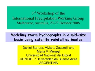
EVALUATING THE PERFORMANCE OF SATELLITE RAINFALL ESTIMATES USING DATA FROM NAME
20 likes | 203 Vues
Network mean with measurable precipitation. Observed Precipitation Intensity. Network mean with precipitation free-records. Elevation (m). Satellite Precipitation Intensity . Observation Satellite. Wet Days (% days of records). Observed Precipitation Frequency.

EVALUATING THE PERFORMANCE OF SATELLITE RAINFALL ESTIMATES USING DATA FROM NAME
E N D
Presentation Transcript
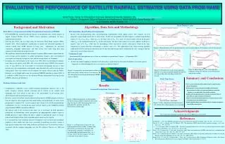
Network mean with measurable precipitation Observed Precipitation Intensity Network mean with precipitation free-records Elevation (m) Satellite Precipitation Intensity • Observation • Satellite Wet Days (% days of records) Observed Precipitation Frequency Satellite Precipitation Frequency Figure 4: Mean diurnal cycles of precipitation for each elevation band (a) for frequency and (b) for intensity. Observed precipitation frequency Precipitation frequency Satellite precipitation frequency TR1=1420 m TR2=1254 m TR3=1593 m TR4=705 m Hour Figure 6: Mean diurnal cycles of precipitation frequency along each transect (a) for observation and (b) for satellite. Figure 5: Network mean cycles of precipitation intensity (a) using measurable rainfall data and (b) for using all day data including rainfall-free records. Observations Satellite estimates EVALUATING THE PERFORMANCE OF SATELLITE RAINFALL ESTIMATES USING DATA FROM NAME Ismail Yucel, Center for Atmospheric Sciences, Hampton University, Hampton, VA, ismail.yucel@hamptonu.edu Robert J. Kuligowski, Office of Research and Applications, NOAA/NESDIS, Camp Springs, MD David Gochis, NCAR, Boulder, CO Mean Diurnal Cycles Background and Motivation Algorithm, Data Sets and Methodology a) b) • Brief History of Operational Satellite Precipitation Estimation at NESDIS • NOAA/NESDIS has routinely produced estimates of precipitation from satellite imagery to support National Weather Service (NWS) forecast operations, particularly for heavy rain/flash flood situations. • Until the late 1990’s, this was done using the Interactive Flash Flood Analyzer (IFFA; Scofield 1987), which employed a combination of manual and automated algorithms to estimate rainfall from GOES infrared (10.7-µm) data. Adjustments for sub-cloud evaporation, orographic enhancement, and other factors were made using data from numerical weather prediction model forecasts. • The significant amount of manual labor required to produce IFFA estimates limited both the areal coverage and the timeliness of satellite precipitation estimates—they were produced over regions covering only a couple of states with an average latency of 30 minutes. • In response, the Auto-Estimator (A-E; Vicente et al. 1998, 2001) was developed to automate many (but not all) aspects of the IFFA The A-E covered the entire CONUS with estimates every 15 min. However, the A-E tended to overestimate precipitation because it often mistook cirrus for cumulonimbus; consequently, radar data had to be used to screen out non-raining pixels. Since this solution was not adequate for regions with no radar, the Hydro-Estimator was developed and became the operational NESDIS algorithm in August 2000. It is available to NWS forecasters via the Advanced Weather Information Processing System (AWIPS) and also on the Internet at http://www.orbit.nesdis.noaa.gov/smcd/emb/ff/. • Problem Statement and Goal • Comprehensive validations of the satellite-estimated precipitation character such as the hourly frequency, intensity, diurnal evaluation and its relation to the complex local topography have been absent to date due to the unavailability of pre-existing dense observation network in mountainous regions. • However, as part of the North American Monsoon Experiment (NAME) program, which has been developed to aim at improving both understanding and predictability of warm season precipitation in southwest US, a recent technical note (Gochis et al. 2003b) documented the establishment of a new event-based rain gauge network, known as the NAME Event Rain gauge Network (NERN), in northwest Mexico. • The primary goal of the research in this study was to investigate the H-E algorithm’s performance in documenting surface precipitation on topographically complex region of NAME and thus to report whether the H-E is capable of capturing the aspects of terrain-induced rainfall and to define where algorithm improvement may be required. • It is envisaged that such evaluation will also be helpful to users of mesoscale atmosphere modelers as these models have the severe uncertainty in predicting convective systems at high spatial resolution due to the strong insolation and the presence of elevated heat sources associated with the complex topography over the US southwest (Yucel et al., 2002 and 2003). • H-E Algorithm--Rain/No Rain Discrimination • Because both non-precipitating cirrus and precipitating cumulonimbus clouds appear cold in T10.7 imagery, the A-E frequently assigned high rainfall rates to cirrus clouds. To alleviate this problem, the H-E computes a standard normalization statistic Z= (T10.7-µT10.7)/σT10.7, where µT10.7 is the mean value of T10.7 for a circle of selected radius centered on the pixel, while σT10.7 is the standard deviation of T10.7 for the same region. The idea is that regions of convective updrafts would have a negative value of Z (T10.7 colder than its surroundings) while convectively inactive cloud pixels would be the same temperature or warmer than their surroundings—a positive value of Z. The application of this cloud-screening algorithm within the H-E led to substantial reductions in the wet bias that had been previously exhibited by the A-E—enough so that the radar screen was no longer necessary. • Validation Period: • Instantaneous H-E precipitation rates at 4-km are validated for a period from 2 August – 14 September 2002. • Data Preparation • To show the rainfall sampling as function of elevation, data is analyzed in six elevational breakdowns. In current analysis, • raingauges are installed along four west-east transects as shown in Figure 1. a) a) b) b) Figure 1: A map of the elevation bands overlain with the 50 rain gauges along each west-east transect. In (b), histogram of elevational distribution of NERN arrays is shown. Summary and Conclusions Daily Time Series Band 1 Results • There is an overestimation with satellite rainfall except elevations • greater than 2500 m. • Overestimation is more noticeable with high rainfall amount. • Up to elevation of 1500 m, the agreement between rainfall and • elevation is also observable from satellite estimates. • Satellite estimates provide the less wet-day records than those of • observation in spite of overall overestimation. • Features caused by elevational differences in diurnal cycles are not • clearly distinctive with satellite values. • Satellite algorithm derives precipitation with less frequent and greater • intensity than observations. Band 2 Seasonal Precipitation Characteristics Band 3 Precipitation [mm day-1] Band 4 Band 5 Band 6 Figure 2: Horizontal patterns of total rainfalls for observed and satellite-estimated values from Aug 2 to Sep 14, 2002. Rain gauge data were interpolated to a grid to generate the observational rainfall map. Day of Year (Aug 2 – Sep14, 2002) Figure 7: Daily comparison between observed and satellite-derived precipitation for each band. Acknowledgments • This work has been supported by funding from the NOAA-CREST grant 219115/219116. References b) a) Scofield, R. A., 1987: The NESDIS operational convective precipitation estimation technique. Mon. Wea. Rev., 115, 1773-1792. Vicente, G. A., R. A. Scofield, and W. P. Menzel, 1998: The operational GOES infrared rainfall estimation technique. Bull. Amer. Meteor. Soc., 79, 1883-1898. -----., J. C. Davenport, and R. A. Scofield, 2002: The role of orographic and parallax corrections on real time high resolution satellite rainfall rate distribution. Int. J. Remote Sens., 23, 221-230. Yucel, I., W. J. Shuttleworth, X. Gao, and S. Sorooshian, 2003: Short-term performance of MM5 with cloud cover assimilation from satellite observations, Mon. Wea. Rev., 131, 1797-1810. Yucel, I., W. J. Shuttleworth, R. T. Pinker, L. Lu, and S. Sorooshian, 2002: Impact of ingesting satellite-derived cloud cover into the Regional Atmospheric Modeling System. Mon. Wea. Rev.,130, 610-628. Gochis, D.G., J.-C. Leal, W. J. Shuttleworth, C. Watts, and J. Garatuza-Payan, 2003: Preliminary Diagnostics from a New Event-Based Precipitation Monitoring System in Support of NAME, J. Hydrometeorology, 4, 974-981. Figure 3: (a) Comparison of mean wet- day return period between satellite estimates and observations as function of elevation. The return period is defined as 1/frequency of any measurable precipitation in a day (i.e. 0.1 mm). In (b), the percentage of wet-days as function of elevation is shown.
