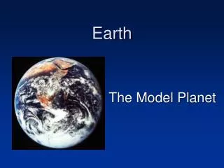
Chapter 1: Earth as a Planet
Chapter 1: Earth as a Planet. What is Geology?. Geology Scientific study of Earth Physical geology Understand processes & materials Historical geology Sequence of geologic events. Using the scientific method. Scientific method How scientists approach problems

Chapter 1: Earth as a Planet
E N D
Presentation Transcript
What is Geology? Geology Scientific study of Earth Physical geology Understand processes & materials Historical geology Sequence of geologic events
Using the scientific method Scientific method How scientists approach problems Observations & data gathering Formulating hypothesis Hypothesis: plausible, but not proven, explanation for how something happens Testing hypothesis Formulating theory Theory: hypothesis tested & supported by observation & experimentation Formulating law/ theory
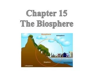
The Earth system System concept Break large complex items into smaller pieces without losing sight of big picture Geosphere Solid Earth Biosphere All living & once living organisms Atmosphere Gasses surrounding Earth Hydrosphere All water on Earth All locations & all states
Cycles and interactions Hydrologic cycle Describes movement of water Rock cycle Processes that form, modify, transport or break down rock Tectonic cycle Processes that drive movement &interactions in lithosphere Lithosphere
Earth in space The solar system Earth is about 4.56 billion years old Earth is 1of 8 planets orbiting Sun Also includes moons, asteroids, comets, meteoroids Terrestrial planets Jovian planets
Earth in space Differentiation: layering of terrestrial planets based on chemical composition (i.e. density) Crust: outermost compositional layer Thin, low-density & rocky Mantle: middle layer Rocky, intermediate density Core: innermost layer High density & metallic Silicates Solid Fe/Ni Liquid Fe/Ni Mg; some silicates & Fe/Ni mixed in
What makes Earth unique? Atmosphere Rich in oxygen Hydrosphere Water as solid, liquid &/or vapor Biosphere Full of living organisms Regolith Blanket of loose debris covering Earth Soil
What makes Earth unique? Plate tectonics Movement &interactions of large fragments of Earth’s lithosphere (plates) Distribution of volcanoes & earthquakes Oceanic crust (basalt) Thinner, denser, younger Basalt Continental crust (granite) Older, thicker, less dense Uniformitarianism Earth processes today operated similarly throughout geologic history “the present is the key to the past”
Why study geology? Earth is our home Depend on Earth for resources Limited resources require management Earth’s physical &chemical processes affect us Need to appreciate our own role in geologic change
Chapter 3:HOW OLD IS OLD?The Rock Record &Deep Geologic Times
Relative Age Sequence of past geologic events Age of rock, fossils, or other geologic feature relative to another feature Stratigraphy Study of rock layers & processes that form them Strata Rock layers
Relative Age Principal of original horizontality: water-laid sediments are deposited in horizontal layers
Relative Age Principle of stratigraphic superposition: each layer is younger than the layer below it
Relative Age Principle of lateral continuity: sediments deposited in continuous layers
Relative Age Principle of cross-cutting relationship: layer must be older than any feature that cuts or disrupts it
Gaps in the record Numerical age Age of rock or geological feature in years before present Unconformity Substantial gap in rock sequence; shows absence of part of rock record
Fossils and Correlation Paleontology Study of fossils & record of ancient life on Earth Use fossils to determine relative rock ages Principle of faunal & floral succession Stratigraphicordering of fossil assemblages Correlation Equate ages of strata from 2 or more different places
The Geologic Column • Geologic time in1 year
Numerical Age & rates of decay Radioactivity Process where element spontaneously transforms Radioactive decay Parent atoms Daughter atoms Half life Time needed for 50% of parent atoms to decay into daughter atoms Radiometric dating Use radioactive isotopes to determine numerical age of minerals, rocks & fossils
Rates of decay Examine Figure 3.15 and determine the relative age of rock layer 4
The Age of Earth Oldest rock: about 4 billion years old Oldest mineral grain : 4.4 billion years old Meteorites Carbonaceous chondrites Thought to contain unaltered material from solar system formation Around 4.56 billion years old
Global Positioning System • Global navigation satellite system for determining location on Earth’s surface • Need minimum of 3 satellites “visible” to determine position on Earth’s surface
Map Scale: relates map distance to Earth distance Verbal Scale: uses words for relationship 1 inch equals 16 miles Graphic or Bar Scale: line or bar marked off in graduated distances 0 is not at far left to allow for more precise measurements Fractional Scale: expressed as fraction or ratio Example: 1/50,000 or 1:50,000 1 unit of measurement on map is equal to 50,000 units of same measurement on Earth 1 foot = 50,000 feet or 1 cm = 50,000 cm Map Scale
Measure distance on map to get “measured distance” Multiply measured distance by fractional scale denominator to get “ground distance” Convert “ground distance” to other units Example: If you have a map scale of 1:10,000 and a measured distance of 3.5 inches; complete the following: _______ feet, _______ miles How? 3.5 (10000) = 35000 inches 35000 / 12 (1 foot) = 2916.67 feet 2916.67 / 5280 (feet in a mile) = 0.55 miles Calculating Distance with Fractional Scales
Common scale = 1:24,000 Called “7.5 minute” quadrangle map because map covers 7.5 minutes of both latitude & longitude Marginal map data gives important info: Map title Map location Latitude & longitude Map scales Declination arrows True North (N or *) Magnetic North (MN) Grid North (GN) Map Symbols USGS Topographic Maps
Connect points of equal elevation Contour line rules pg. 41 of your lab manual Steep slope – contour lines close together Gentle slope – contour lines farther apart Contour interval – interval of change between 2 contour lines Index contour – usually every 5thline is bolder & labeled with value Helps to calculate contour interval Contour Lines
Contour Map Basics • Find the elevations of 2 index contours • Subtract to find elevation change between 2index contours • Count the number of lines you cross when going from 1 index contour to the other • Divide difference in elevation between 2 index contours by # of lines to find contour interval • Example: • What is the contour interval on this map? _____ • What is the elevation of Point A? _____ • What is the elevation of Point B? _____ A B 20 ft 780 ft 725 ft
Shown in “plan view” Viewed from above Shows elevation change along a transect (A to B) Creates “side view” of the landscape Topographic Profiles
Index fossil: short-lived species tied to specific time period ID’ing specific fossils can date rock layers to specific time period Can be used to point out missing rock layers Index Fossils
Tree rings Used to find tree age & ID conditions tree experienced in its lifetime Count tree rings to find tree age Wide rings = good conditions Narrow rings = poor conditions Varves Sediment layers that accumulate annually due to seasonal fluctuations Not frozen = sediment accumulation Frozen = no sediment accumulation Coral Correlation between # of daily growth increments & # of days in year Used to determine time period that coral grew Tree Rings, Varves, & Coral