Download
1 / 29
290 likes | 307 Vues
Explore how climate change impacts river restoration efforts and learn how restoring rivers can mitigate climate change effects. Discover insights on adapting restoration strategies to changing climates and fostering biodiversity, such as re-populating salmon streams and enhancing biodiversity for resilience. Uncover the link between anthropic changes and restoration, aiming for long-term ecosystem health. Dive into case studies like Butte Creek in California and Torrens River in South Australia for restoration and flood control methods. A comprehensive review by Kondolf et al. sheds light on future challenges and opportunities for sustainable river restoration practices.

E N D
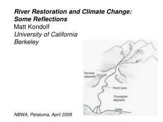
River Restoration and Climate Change: Some Reflections Matt Kondolf University of California Berkeley NBWA, Petaluma, April 2008
We can consider both • How climate change will affect our efforts to • restore rivers • -How river restoration could be used to mitigate • effects of climate change • Consider our favorite charismatic megafauna, • anadromous Pacific salmon • First: Northern California will become more like • southern Calif: more episodic
This means our attempts to mimic humid climate forms, such as undertaken on Uvas Ck in Gilroy, are even less likely to succeed than they have to date Uvas Creek, California Jan 1996, 2 mo post-construction (Are we in Denmark?)
Uvas Ck (same view as last photo) July 1997 Channel failed Feb 1996, 3 months after construction
Design for the Climate/hydrology • Cultural preference for single-thread meandering channels – like green lawns – probably inherited from Atlantic climates • 18th-19thC English landscape theory, more recent research
Anticipating higher Temps: Using Butte Creek spring run to re-populate a restored San Joaquin
Using river restoration to (partially) mitigate effects of climate change: Deer Creek Deer Creek
Restoration planning documents for salmon in the Sacramento River system identified the need for smaller gravels and more riparian trees in Lower Deer Ck. Recommended: add spawning gravel, plant trees
But a geomorphic analysis showed that the conditions of large gravel and lack of vegetation along low-flow channel were consequences of a 1949 flood control project
Pre-1949 channel: multi-threaded, complex, shaded, frequent pool-riffle alternations, hydraulically rough Post-1949 channel: simplified, wider, hydraulically smooth High shear stress in floods, gravels and trees would scour
Confinement by levees increases bed shear stress during high flows
Deer Ck Strategy: Allow overbank flow to relieve excess shear stress in channel No channel maintenance Because watershed is largely unaltered, flow and sediment load should lead to re-establishing channel complexity Complex channel induces more hyporheic exchange, buffering water temperatures
Figure 3.2‑2: Longitudinal profile of thalweg in a geomorphically complex reach of lower Deer Creek near RM 9.
Figure 3.2‑1: Longitudinal profile of thalweg in a geomorphically simple reach of lower Deer near RM 1.
Q main channel (low elevation) Q side channel (high elevation) Q cobble bar or island downwelling “source” water upwelling hyporheic water Figure 3.3‑6: Schematic of typical hyporheic exchange temperature study site in lower Deer Creek.
Figure 3.3‑5: Upwelling hyporheic water identified by tracer dye test.
Downwelling source water “pod” Upwelling hyporheic water piezometers Figure 3.3‑7: Picture of typical hyporheic exchange study site in lower Deer Creek near RM 5.0. Flow direction is from top to bottom of picture.
Figure 3.4‑4: Comparison of mean daily streamflow at USGS gage (approximately RM 10.5), streamflow downstream of the SVID dam (approximately RM 2.4), and water temperature at the USGS gage.
Figure 3.3‑9: Typical downwelling (left) and upwelling (right) temperature sensor installations in lower Deer Creek.
Figure 3.4‑10: Illustration of peak water temperature reduction, water temperature amplitude fluctuation reduction, and lag time between peaks measured at downwelling and upwelling hyporheic exchange sites. Data from hyporheic exchange site at RM 5.0 for August 1, 2005.
Figure 3.4‑16: Hyporheic exchange sensors near RM 5.0 for a 6 day period in August, 2005.
Figure 3.4‑22: Hyporheic exchange sensors near RM 6.9 for a 6 day period in August, 2005.
Salmonid juvenile at upwelling site in July when surrounding water temps reach 30+ C!
Often: irrevocable changes to the system, restoration of only some functions possible Viewing directions of anthropic change/restoration in terms of connectivity and flow variability We see restoration trajectories rarely parallel degradation trajectories
high Deschutes River, Oregon Crow Creek, Tennessee Isar River, Germany Butte Ck California channelization Condamine-Balanne, Queensland rehabilitation rehabilitation divert base flow Clear Creek, California flow regulation (dam) off-stream storages Longitudinal connectivity flow regulation (dam) perennialization by urbanization, weirs, and wastewater rehabilitation Torrens River, South Australia low spring fed snowmelt rainfall ephemeral/ intermittent Streamflow variability low high Kondolf et al. in review
The road ahead for river restoration: Let’s avoid building SUVs!