Download
1 / 57
580 likes | 688 Vues
Learn about Electronic Chart Display and Information Systems (ECDIS), GIS, navigational sensors, and more in this comprehensive course by the Italian Maritime Academy. Enhance your knowledge on legal aspects, numeric cartography, and official charts for safe navigation.

E N D
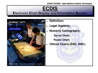
ECDIS COURSE - Italian Maritime Academy Technologies ECDISElectronic Chart Display and Information System • Definition; • Legal Aspects; • Numeric Cartography: • Vector Chart; • Raster Chart; • Official Charts (ENC, RNC).
ECDIS COURSE - Italian Maritime Academy Technologies ECDISElectronic Chart Display and Information System ECDIS: An Electronic Chart Display and Information Systemis a Geographic Information System (GIS) that complies with International Maritime Organization (IMO) regulations and can be used in replacement of paper navigation charts. GIS:Computer-based technologies for storage, manipulation, and analysis of geographically referenced information. A Geographic Information System differs from other computerized information systems for the following reasons: 1. the information is geographically referenced (geo-coded); 2. higher capabilities for data analysis and scientific modelling, in addition to the usual data input, storage, retrieval, and output functions.
ECDIS COURSE - Italian Maritime Academy Technologies ECDISElectronic Chart Display and Information System The system displays information from electronic navigational charts and integrates position information from the Global Positioning System (GPS) and other navigational sensors, such as: 1. Radar (Target and display on top); 2. Echo-sounder; 3. Gyro-compass; 4. Wind sensors; 5. Speed-Log; 6. Automatic Identification Systems (AIS). For these reasons ECDIS represents a real time Geographical Information System.
Allarms Software for “Route Planning” Software for “Route Monitoring” Autopilot GPS/DGPS Speed-Log Gyro-Compass Navigation System Chart Database (vector) Data Logger Radar AIS Echo-sounder Wind-sensors Real time information Keyboard Manual Data Input Display Print Trackball Mouse ECDIS COURSE - Italian Maritime Academy Technologies ECDISElectronic Chart Display and Information System C.P.U.
ECDIS COURSE - Italian Maritime Academy Technologies ECDISElectronic Chart Display and Information System The primary function of an ECDIS is to contribute to safe navigation. IMPORTANT:ECDIS IS AN INSTRUMENT FOR “SUPPORTING” DECISION PROCESS. There is a tendency to put too much trust in computer based systems and believe whatever is on the display (Over reliance on ECDIS). It is essential that officers remember to cross check the information displayed by all other means available, especially by looking out the window and watching the display. At the same time the officer has to take care of the accuracy of the integrated navigational sensors.
ECDIS COURSE - Italian Maritime Academy Technologies ECDISInternational Organizations To ensure that ECDIS equipment intended for onboard use is seaworthy, it must pass type approval and test procedures developed by the IEC (International Electrotechnical Commission) based on the ECDIS Performance Standards of IMO (International Maritime Organization) and applying the IHO (International Hydrographic Organization) technical standards related to the digital data format. Type approval is a method to show conformance with IMO requirements on a legal basis. It is initiated and required by all Flag States which are Member States of the European Union and by many others including United States, Japan and Australia. ECDIS type approval is the certification process that ECDIS equipment must undergo before it will be considered to comply with the IMO Performance Standards for ECDIS by the international shipping community.
ECDIS COURSE - Italian Maritime Academy Technologies ECDISInternational Organizations IHO IMO Performance Standards for ECDIS IMO Model Course 1.27 SOLAS Convention STCW S-57 Transfer Standard for Digital Hydrographic Data S-52 Specifications for ECDIS App.1 Guidance on Updating App.2 Colour and Symbol App.3 Glossary of ECDIS-related Terms S-52 Specifications for ECDIS App.1 Guidance on Updating App.2 Colour and Symbol App.3 Glossary of ECDIS-related Terms S-57 Transfer Standard for Digital Hydrographic Data IEC IEC Publication 61174 Maritime Navigation and Radiocommunication Equipment and Systems - Electronic Chart Display and Information System (ECDIS) – Operational and performance requirements, methods of testing and required test results. Publication 61174 Maritime Navigation and Radiocommunication Equipment and Systems - Electronic Chart Display and Information System (ECDIS) – Operational and performance requirements, methods of testing and required test results.
ECDIS COURSE - Italian Maritime Academy Technologies ECDISLegacy Aspects – “IMO Performance Standards” There are two classes of navigational electronic chart system: 1.ECDIS, which meets the IMO/SOLAS chart carriage requirements; 2.ECS (Electronic Chart System), which can be used to assist navigation, but does not meet IMO/SOLAS chart carriage requirements. ECDIS equipment is specified in the IMO “ECDIS PERFORMANCE STANDARDS” IMO Resolution A817(19) & IMO Resolution 232(82):”Adoption of the revised Performance Standards for ECDIS"; as follows: “Electronic Chart Display and Information System (ECDIS) means a navigation information system which, with adequate back up arrangements, can be accepted as complying with the up-to-date chart required by regulation V/19 & V/27 of the 1974 SOLAS Convention”
ECDIS COURSE - Italian Maritime Academy Technologies ECDISLegacy Aspects – “IMO Performance Standards” IMO SOLAS V/19: 2.1 All ships irrespective of size shall have: (…) 2.1.4 nautical charts and nautical publications to plan and display the ship’s route for the intended voyage and to plot and monitor positions throughout the voyage; an Electronic Chart Display and Information System (ECDIS) may be accepted as meeting the chart carriage requirements of this subparagraph; 2.1.5 back-up arrangements to meet the functional requirements of subparagraph 2.1.4, if this function is partly or fully fulfilled by electronic means;* *An appropriate folio of paper nautical charts may be used as a back-up arrangement for ECDIS. Other back-up arrangements for ECDIS are acceptable (see appendix 6 to resolution A.817(19), as amended). IMO SOLAS V/27: Nautical charts and nautical publications, such as sailing directions, lists of lights, notices to mariners, tide tables and all other nautical publications necessary for the intended voyage, shall be adequate and up to date.
ECDIS COURSE - Italian Maritime Academy Technologies ECDISLegacy Aspects – “Back Up Requirements” No electronic system is completely failsafe! IMO Performance Standards therefore require that the ”overall system” include both a primary ECDIS and an adequate independent back up arrangement. IMO added Appendix 6 to the performance standards for ECDIS back up requirements, lists the required functions and availability requirements of back up arrangements, including: • Chart information using the latest official edition that are kept up-to-date for the entire voyage; • Route planning capable of performing route planning functions, including taking over the route plan of the primary system, and adjusting a planned route; • Route monitoring enabling take-over of the route monitoring function originally performed by the primary system, including plotting own ship’s position and displaying the planned route;
ECDIS COURSE - Italian Maritime Academy Technologies ECDISLegacy Aspects – “Back Up Requirements” • Voyage recording that keeps a record of the ship’s actual track, including positions and corresponding times. The definition of these key functional requirements still leaves open technical solutions representing adequate back up arrangements. Finally: A second ECDIS connected to an independent power supply and a separate GPS position input; An appropriate up-to-date folio of official paper charts for the intended voyage; An ECDIS operating in the RCDS mode of operation; Back Up Systems A radar-based system called ”Chart-Radar” according to IMO Performance Standards for Chart Radar;
ECDIS COURSE - Italian Maritime Academy Technologies ECDISLegacy Aspects – “Back Up Requirements” France Acceptance of ECDIS: Applies to all vessels; Maritime Authority provides certification; Backup Arrangements for ECDIS: At present the French Administration only authorises paper charts to be used as a backup to ECDIS; Acceptance of RCDS: Applies to all vessels; Maritime Authority provides certification; IMO or Flag State Notifications: Règlement annexé à l’arrêté du 23/11/1987, division 221; Website: www.mer.gouv.fr • IMO Circular Letter 2666- Compendium of Flag State ECDIS requirements
ECDIS COURSE - Italian Maritime Academy Technologies ECDISLegacy Aspects – “ENC” Electronic Navigational Chart (ENC)means the database standardised as to content, structure and format issued for use with ECDISon the authority of government-authorized hydrographic offices. The ENC contains all the chart information necessary for safe navigation, and may contain supplementary information in addition to that contained in the paper chart (e.g. sailing directions),which may be considered necessary for safe navigation.
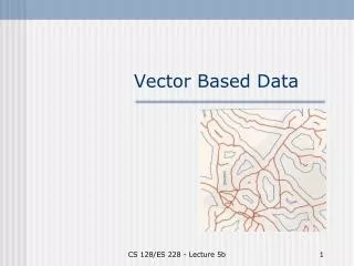
ECDIS COURSE - Italian Maritime Academy Technologies ECDIS “Numeric Cartography” There are two types of Numeric Chart: 1. Vector 2. Raster The difference between them is the data archiving modality.
(x4,y4) (x3,y3) (x2,y2) (x2,y2) (x1,y1) (x2,y2) (x3,y3) (x1,y1) (x1,y1) (x1,y1) Point Line Polyline Poligon ECDIS COURSE - Italian Maritime Academy Technologies ECDISNumeric Cartography – “Vector Charts” • ENTITY: • Points are spatially stored using the coordinates. For example, a two-dimensional point is stored as (x1,y1); • Linesare stored as a series of point pairs, where each pair represents a straight line segment, for example, (x1, y1) and (x2, y2) indicating a line from (x1, y1) to (x2, y2); • Polylines are a connected sequence of lines; • Polygons are a connected sequence of lines where the first and the last points are coincident.
ECDIS COURSE - Italian Maritime Academy Technologies ECDISNumeric Cartography – “Vector Charts” Y P1 Numeric Database X • Each entity type may have one or more attribute. Attributes may describes quantitative data ranked in 3 level of accuracy: • Ordinal (Ranks: Good, Better, Best); • Interval (Numeric: Age, Income); • Ratio (Scale: Length, Area); • Attributes may describes, also, qualitative data.
ECDIS COURSE - Italian Maritime Academy Technologies ECDISNumeric Cartography – “Vector Charts” VECTOR DATA ENTITY ATTRIBUTE Qualitative Point Line Quantitative Poligon Polyline Ordinal Ratio Interval
ECDIS COURSE - Italian Maritime Academy Technologies ECDISNumeric Cartography – “Vector Charts” For a building… ID (unique) Attribute (qualitative) Attribute (quantitative - Interval) Attribute (quantitative - Ratio) Coordinates
ECDIS COURSE - Italian Maritime Academy Technologies ECDISNumeric Cartography – “Vector Charts” Y P1 Numeric Database X Vector charts are generally manufactured from scanned hydrographic office paper charts. The scanned image is then digitised by tracing the lines and features on the chart. 1. this vectorisation process stores chart features in “layers”(“themes”) which can be redrawn automatically at an appropriate size as you zoom into the chart. You can add or remove categories of data such as spot depths, depth contours, navigation marks, etc.
ECDIS COURSE - Italian Maritime Academy Technologies ECDISNumeric Cartography – “Vector Charts” 2. you can “query” specific chart items (e.g. to get more information on a navigation light); 3. you can display the chart at a larger scale than the source paper chart (without image degradation). So it is very important to point out the concept of Nominal Scale for Numeric Chart. Remembering thatVector charts are generally manufactured from scanned hydrographic office paper charts, Nominal Scale is the scale of the source paper chart. Pay attention: we can sail, for example, on a chart at 1:5000 with a Nominal Scale of 1:50000. The metric information and the chart data are from a 1:50000 scale chart 4. systems automatically decide on the information to be displayed, depending on the level of zoom.
ECDIS COURSE - Italian Maritime Academy Technologies ECDISNumeric Cartography – “Vector Charts” • VANTAGE: • Adding or removing layers of data; • Zooming and seeing more or less data appear according to the level of zoom; • Displaying the chart at a larger scale than the source paper chart; • Not large data volumes - Compact data structure. • DISADVANTAGE: • The nature of the vector display is such that the chart data is not displayed electronically as it was compiled (as a paper document) and the original cartographic design of the paper chart is lost.
ECDIS COURSE - Italian Maritime Academy Technologies ECDISIHO S57 To ensure that ECDIS function uniformly anywhere in the world, the information elements contained in the database must be consistent. It would make non sense for each Hydrographic Office to develop different types of chart “objects”. For this reason the IHO (International Hydrographic Organization) develop an Object Catalogue that described the range of attributes to be assigned to each object (www.S-57.com). As the key component of the “IHO Transfer Standard for Digital Hydrographic Data” (IHO S-57), the object catalogue ensures that the database for ECDIS, the “Electronic Navigational Chart (ENC)”, is properly constructed and organized. So…
ECDIS COURSE - Italian Maritime Academy Technologies ECDISIHO S57 …the “IHO Transfer Data for Digital Hydrographic Data” (usually abbreviated as IHO S-57) establishes the requirements for producing an ENC to be used with an ECDIS satisfying the ECDIS Performance Standard A817(19). It was completed in November 1996 and published in March 1997 (a new version has been published in 2000).
ECDIS COURSE - Italian Maritime Academy Technologies ECDISWEND (World-wide Electronic Navigational Chart Data Base) The Electronic Chart are produced under the authority of a government organisation (Hydrographic Organization). The user, then, can obtain the ENC’s from the various HOs directly. This becomes prohibitively cumbersome if the user engaged on international voyage. Therefore service providers have been established which collect the ENCs from different HOs and maybe other sources, to deliver to the end user all data he needs for his voyage. A particular problem is to ensure that all official ENCs produced by a large number of different HOs are of the same quality. Without an additional intervening mechanism ensuring uniform data quality, Mariners would be left with inconsistencies between ENCs from different HOs. This the background why IHO has developed a concept for a worldwide official ENC service.
ECDIS COURSE - Italian Maritime Academy Technologies ECDISWEND – ECDIS Data Service • The concept of an official data Service was developed in conjunction with the IMO requirements to establish a worldwide uniform updating service. • An official ECDIS data service include: • Global Uniformity of data: All participants must work in accordance with the same standard, i.e. S-57 data transfer standard. It must ensured that ENCs from all producing HOs worldwide exhibit consistent contents and display. • Quickest way from the source to ECDIS: This excludes any additional levels of processing. That is why the data must come directly from the originators. The Hydrographic Offices must have strict sharing of work in close co-operation. This ensures at the same time the global uniformity of data.
ECDIS COURSE - Italian Maritime Academy Technologies ECDISWEND – ECDIS Data Service A reasonable solution is to have an arrangement for sharing the work of setting up and facilitating the provision of a world-wide ECDIS data service based upon agreed upon standard. This arrangement was established by the IHO as the World-wide Electronic Navigational Chart Data Base (WEND). The purpose of WEND is “to ensure a world-wide consistent level of high quality, updated official ENCs trough integrated services that support chart carriage requirements of SOLAS Chapter V and requirements of the IMO Performance Standards for ECDIS”.
ECDIS COURSE - Italian Maritime Academy Technologies ECDISWEND – ECDIS Data Service - RENC • WEND consists of two components to achieve its purpose: • A charter describes the principles governing the co-operation. This includes the following provisions: • By definition, the organization responsible for hydrographic survey of an area is also responsible for the ECDIS data; • The relevant ECDIS standards, especially S-57 Edition 3 must be observed; • The rules and responsibilities for producing and validating the data. • So called Regional Electronic Chart Co-ordinating Centres (RENC) which “are organisational entities where IHO members have established co-operation amongst each other to guarantee a world-wide consistent level of high quality data, and for bringing about co-coordinated service with official ENCs and updates to them”.
ECDIS COURSE - Italian Maritime Academy Technologies ECDISNumeric Cartography – “Raster Charts” An exact replica of the paper chart (scanner). The Raster Image is subdivided in pixels, in a matrix of n lines and m columns. Each pixel has a homogeneous and not sub divisible contents. • RADIOMETRIC RISOLUTION • CROMATIC RISOLUTION (BPP) • GEOMETRIC RISOLUTION (DPI) Pixel
ECDIS COURSE - Italian Maritime Academy Technologies ECDISNumeric Cartography – “Vector and Raster Charts” Raster Vector
ECDIS COURSE - Italian Maritime Academy Technologies ECDISNumeric Cartography – “Official Charts” • Official electronic chart data and private chart data • Official electronic chart data are of two general types: • Electronic Navigational Charts (ENC); • Raster Navigational Charts (RNC). The inner construction of ENCs and RNCs is fundamentally different: • ENCs are vector charts; • RNCs are raster charts. • The term “Official”, indicates that those chart data have been produced under the authority of a government organisation – in contrast to private.
ECDIS COURSE - Italian Maritime Academy Technologies ECDISNumeric Cartography – “ENC” • ENC means the database, standardized in the content, structure and format, issued for use with ECDIS on the authority of government-authorized Hydrographic Offices. • ENCs are vector charts compiled from a database of individual geo-referenced objects from Hydrographic Office’s archives including existing paper charts. • ENCs have the following attributes: • ENC content is based on source data or official charts of the responsible Hydrographic Office; • ENCs are compiled and coded according to international standards; • ENCs are referred to World Geodetic System 1984 Datum (WGS84); • ENC content is the responsibility and liability of the issuing Hydrographic Office; • ENCs are issued only by the responsible Hydrographic Office; • ENCs are regularly updated with official update information distributed digitally.
ECDIS COURSE - Italian Maritime Academy Technologies ECDISNumeric Cartography – “ENC – S52/S57” • In conjunction with the development of IMO Performance Standards for ECDIS, the International Hydrographic Organization has developed technical standards related to the digital data format, specifications for ECDIS content and display, and data protection. • IHO Special Publication 52 (S-52): includes appendices describing the means/process for updating, colour and symbol specifications, and a glossary of ECDIS-related terms. • IHO Special Publication 57 (S-57): includes a description of the data format, product specification for the production of ENC data, and an updating profile. • Both IHO S-57 and S-52 are specified in the IMO Performance Standards for ECDIS.
ECDIS COURSE - Italian Maritime Academy Technologies ECDISDisplaying ENCs by means of the Presentation Library ENCs don’t contain any explicit visualisation items. An ENC contains an abstract description of geographic entities but does not contain any presentation rules. All presentation rules to get ENC’s content displayed are contained in a separate software module – the so called “Presentation Library”. Both the Geo-referenced object contained in the ENC and the fitting symbolization contained in the Presentation Library are linked to each other only in the very moment of their call up for display. The definition of the Presentation Library for ENCs is contained in Annex A of the IHO Special Publication S52, Appendix 2 “Colours & Symbols specifications for ECDIS”.
ECDIS COURSE - Italian Maritime Academy Technologies ECDISDisplaying ENCs by means of the Presentation Library PRESENTATION LIBRARY Contains all presentation rules (S52) ENC Description of Geographic Entities (S57)
ECDIS COURSE - Italian Maritime Academy Technologies ECDISNumeric Cartography – “ENC/S63” A majority of all ENCs are only made available to the end-users in a protected form compliant with the IHO S-63 Data Protection scheme. The S-63 protection scheme defines a mechanism for encrypting ENC information and applying a digital signature to enable authentication of the chart data by the end-user. The end-user will require a decryption key to access and view the ENC data protected by the scheme. Each ENC chart is encrypted with a different key, and the decryption keys are issued to specific end-user systems and can consequently not be exchanged or shared by different systems. A majority of all ECDIS and ECS suppliers have developed support for IHO S-63 and can read protected ENCs. A few nations distribute their ENCs without using encryption; all ECDIS systems are able to access and display these ENCs.
ECDIS COURSE - Italian Maritime Academy Technologies ECDISNumeric Cartography – “SENC” • An ECDIS does not process the ENC content directly for the matter of display. ENCs in S-57 format are optimised to absorb the Hydrographic object information but this structure is not adequate for the fast generation of the resulting computer image on the screen. • In order to get efficient data structures that facilitate the rapid display of ENC data, ECDIS firstly converts each ENC from S-57 ENC format into an internal format called SENC (System ENC) which is optimised for chart image creating routines. • Such routines are not standardised; they are part of the individual software know-how of the ECDIS manufacturers. Consequently the SENC format differs between the ECDIS of different manufacturers. In contrast to the common uniform ENC format the SENC format is proprietary for each ECDIS manufacturer.
ECDIS COURSE - Italian Maritime Academy Technologies ECDISNumeric Cartography – “SENC” • ENCs in S-57 format have to be translated into the internal data format or SENC (System Electronic Navigational Chart) used by the ECDIS before they can be displayed. • The main SENC formats are C-Map's CM-ENC (CM-93/3) format supported by over 20 ECDIS manufacturers. • The most noticeable effect is the difference in installation and updating time. Here are the results of tests from “10 Things They Should Have Told You About ECDIS”:
ECDIS COURSE - Italian Maritime Academy Technologies ECDISNumeric Cartography – “SENC” • Comparison between S-57 ENC and SENC installation times • (all available cells, Sept 06) • S-57 ENC format: • Disk copying (5 base CDs) 1.5 hours • Decryption, verification and installation 11.2 hours • Total 12.7 hours • Apply Update CD 4.03 hours • CM-ENC SENC format: • Disk copying (1 DVD) 13 mins • Apply licence 5 mins • Total 18 mins • On line update A few minutes
ECDIS COURSE - Italian Maritime Academy Technologies ECDISNumeric Cartography – “ENC/N.P.N.S.R.” • During production, ENCs are assigned a compilation scale based upon the nature of the source data they are based on, and are allocated to a navigational purpose band related to this. As shown in the table below there are 6 navigational purpose bands (scale ranges are indicative only). • Navigational Purpose Name Scale Range : • 1 Overview • 2 General • 3 Coastal • 4 Approach • 5 Harbour • 6 Berthing • >1:1 499 999 • 1:350 000 – 1:1 499 999 • 1:90 000 – 1:349 999 • 1:22 000 – 1:89 999 • 1:4 000 – 1:21 999 • < 1:4 000
ECDIS COURSE - Italian Maritime Academy Technologies ECDISNumeric Cartography – “ENC Code” • Each ENC is identified by an 8 character identifier e.g. FR501050: • The first two characters indicate the producer e.g FR for France, IT for Italy (a complete list of producer codes is included in the IHO standard S-62). • The third character (a number from 1 to 6) indicates the navigational purpose band. • The last 5 characters are alpha- numeric and provide a unique identifier. A Chart with a different code is an unofficial chart.
ECDIS COURSE - Italian Maritime Academy Technologies ECDISNumeric Cartography – “ENC Code” • ECDIS distinguishes an ENC from unofficial data. When unofficial data is used, ECDIS informs mariners that they must navigate by means of an official, up to date, paper chart by a continuous warning on the screen. • If unofficial data is shown on the ECDIS display, its boundary is to be identified by a special line style. This boundary is visualized as a “one-sided” RED line with the diagonal stroke on the unofficial side of the line. ENC Unofficial data chart
ECDIS COURSE - Italian Maritime Academy Technologies ECDISNumeric Cartography – “Updating ENCs” • In principle the generation and distribution of regular updates uses identical organisational structures as for the production and distribution of ENCs described above. Their frequency is usually synchronised with the chart corrections promulgated with national Notice to Mariners for the affected sea areas. • Updates may reach the ship via different ways depending from the capabilities of the service provider and the communication facilities onboard: • On data distribution media, e.g. CD; • As e-mail attachment via SATCOM; and • As broadcast message via SATCOM plus additional communication hardware. A number of ENC service providers already have updating services using e-mail and web and other means; details may be obtained from ENC distributors.
ECDIS COURSE - Italian Maritime Academy Technologies ECDISNumeric Cartography – “Updating ENCs” • Updates to ENCs are sequential, and the sequence is unique to each ENC. During the updating process ECDIS always checks that all updates in the sequence have been applied. If an update is missing then the ECDIS will indicate this; it is not possible to load later updates until the missing update is applied. • The ECDIS maintains a list of updates applied and the date of application. • Port State Control officers may use the ECDIS listing to ensure that ENCs are being kept up to date in accordance with SOLAS V Regulation 27.
ECDIS COURSE - Italian Maritime Academy Technologies ECDISNumeric Cartography – “ENCs Coverage” The International Hydrographic Organisation (IHO) provides an interactive web catalogue (http://services.ecc.as/ihocc/public) displaying the status of worldwide ENC production. This system has pointers for guiding users to ENC suppliers and distributors. It is also possible to download the ENC catalogue information from here as a comma separated file.
ECDIS COURSE - Italian Maritime Academy Technologies ECDISNumeric Cartography – “ENC” • In order to replace paper charts: • The chart data in use must be official - ENCs where these are available. • What to do in areas without ENC coverage?
ECDIS COURSE - Italian Maritime Academy Technologies ECDISNumeric Cartography – “RNC/RCDS” • RNC means “Raster Navigational Chart”. RNCs are digital raster copies of official paper charts conforming to IHO Product Specifications RNC (S-61). By definition RNCs can only be issued by, or on the authority of, a national Hydrographic Office. • RNCs have the following attributes: • RNCs are a facsimile of official paper charts; • RNCs are produced according to international standards; • RNC content is the responsibility of the issuing Hydrographic Office; and • RNCs are regularly updated with official update information distributed digitally.
ECDIS COURSE - Italian Maritime Academy Technologies ECDISNumeric Cartography – “RNC/RCDS” In 1998 the IMO recognised that it would take some years to complete the world’s coverage of ENCs. As a consequence IMO ECDIS Performance Standards were amended adding a new optional mode of operation of ECDIS, the Raster Chart Display System (RCDS) mode. In this mode RNCs can be used in ECDIS to meet SOLAS carriage requirements for nautical charts. However, this is only allowed if approved by the Flag State. The intention of those changes was to allow the ECDIS to operate as far as possible on official chart data; ENCs where they were available and RNCs to fill in the gaps. IMO took note of the limitations of RNCs as compared to ENCs (see IMO SN Circular 207 at Annex), and the revised ECDIS Performance Standards require that the ECDIS must be used together with “an appropriate folio of up to date paper charts” for the areas where RCDS mode is employed.