Download
1 / 37
390 likes | 633 Vues
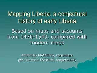
Mapping Liberia: a conjectural history of early Liberia. Based on maps and accounts from 1470-1540, compared with modern maps ANDREAS MASSING, consultant gtz (German technical cooperation). Purpose of the paper.

E N D
Mapping Liberia: a conjectural history of early Liberia Based on maps and accounts from 1470-1540, compared with modern maps ANDREAS MASSING, consultant gtz (German technical cooperation)
Purpose of the paper • Better inform Liberians about their almost unknown early history (1470 – c.1600) ; • Identify Portuguese geographical names; • Draw conclusions on trade and settlement from maps, sailing instructions, and voyager’s reports and infer on the nature of contacts and socio-economic activities.
The 15th Century Coast • In the 15th century, the coast from Cape Mount to Cape Palmas was named costa de malagueta, named after a spice traded here. (afromomumparadisi) used as a substitute for pepper. • The maps shown here give only features recurrent in most maps or accounts, not variants between individual maps • Note that most Portuguese names (symbols) have endured 5 centuries
Coastal features in the 15/16th Cabo monte Cabo mesurado Rio de sam paulo Rio do junco Aldea da lagoa Resgate do Soeyro Rio dos Cestos Cabo das Baixas Ilha da Palma Resgate do Genoes Rio de San Vicente Praia dos escravos Rio da Lagea Os curraos Cabo de San Cremente Cabo das Palmas Aldea de Portugal
MAPPING THE LIBERIAN COASTearly period • Cadamosto (Venice) 1463 • Anonimous (Joao de Santarem ?) 1471 • Jorge Reinel 1485 • Duarte Pacheco Pereira, Esmeraldo 1510 • Fernandes Valentim, Manuscrito 1506 DiogoRibeiro 1530 • Joao Freire, Atlas de setecartas, Huntington Library, • Carta de Marinharia, 1560 • Costa de Ginea, anonymous • João de Lisboa , Roteiro ? • For reference see Portugalliae Monumenta Cartograohica 5 vols. • Sanuto, Geografia, Venezia 1588 • John Wolfe R.E. 1587 • J. Ortelius ? Africa tabula nova, ed. Antverpia, 1570 • Thomas Cavendish 1587
“Exploration” • In 1462 already Pero de Sintra had reached Cape Montserado. But exploration halted till 1469 when the Portuguese crown needed money and subcontracted the Guinea trade to Fernao Gomes, a merchant, for 200,000 yearly reals, and linked it to discovery of 100 leagues p.a. He sent out 2 ships with Joao de Santarem and Pedro de Escobar who discovered Sao Tome on dec.21 1470, and Principe on january 1,1471, and later in january Elmina. They apparently then backtracked along the coast. Till 1477 when his contract ended, he traded mostly in slaves, malagueta pepper, ivory and gold, but the proceeds of the latter were reserved to the crown.
Commercial exploitation • War with Castile hads the crown take care of the trade, as Spanish and Flemish ships came to the coast to trade gold (1475-79) but a coastal fleet under Diego Cão patrolled the coast till the treaty which gave Portugal absolute rights in Guinea. • In January 1483 Elmina became a fortified place & thence on controlled the trade along the Guinea Coast . W and E of Elmina the fleet to bought slaves to send them to Elmina. They were employed for carrying loads between the coast and the gold mines.
The Jorge Reinel map of 1540 • As a practical example of map-making of that period – the first printing press in Lisbon was established by Eleazar of Toledo, a Spanish jew, - I show the 1540 map of Jorge Reinel (Florence at Baron Firidolfi), even though the first map of Guinea is of 1485 by Pedro Reinel (but most names are illegible due to drawings e.g. Lion of SL • notice the quina (5 silver coins) surrounded by ‘castles”, the royal standard, at C.Palmas, El Mina and at Cameroon. The banner with red cross is the flag of St. George at S. Jorge da Mina. • I ignore the meaning of the two other crosses, I guess they represent the kingdoms of Benin and Congo, based on their position.
The coast of today • The following slides show views of the coastline today: • a) a satellite view from Google Earth (resolution sub-optimal) • b)a map from MS Encarta 2000 • (with toponyms but not very accurate, Google Earth, which contains mistakes, however)
From Cabo Monte to Rio Cestos • Fortunately, the corner stones of the coast, cabomonte, cabomesurado , rio dos Cestosand Cabo das Palmas are easy to identify and have been kept throughout five centuries • Cabo Mesurado • probably from “Mont serrado”, “sawtooth”, (or cerrado = closed, dark) . Duarte explains that viewed from close, the mountain was cut into two halves by a valley and had the appearance of 2 breasts. • 2 miles from there, at Mata Sta. Maria “began the malagueta trade “e dura este para 40 leguoas no longo desta costa”, (i.e. 240 km).
St Paul’s • Rio de san paulo is NOT the St. Paul’s of today, since located AFTER C. Mesurado, and BEFORE rio Junco • The first could therefore be the Junk or Schieffelin river and the second the St. John’s of today.
Rio dos cestos (River Cess) • “So named after the baskets in which the inhabitants bring the malagueta to the ships which they do only at this place”. Duarte Pacheco • Thus there had been a sizeable trade in malagueta pepper and an industry of basket-weaving.
Ilha da Palma, a trading point • .” 3 miles from the Cestos was the ilhada Palma 1½ km from the coast, a place for trading slaves and malagueta” “Today”, Pacheco said, “the commerce is spoiled, because previously one traded one bushel of malagueta for 1 brass bracelet of half a pound, and 1 slave for 1 barber’s basin, (confirmed for 1479 by DelaFosse) but today one needs 5-6 bracelets for 1 bushel of malagueta, and 4-5 basins for 1 slave”. “Slaves were called here guey, the other nhunho”. The latter, pronounced in Portuguese nyonyo, is the Kru term for “woman” (nyn), the other could be (ny), the word for “man”. The terms would refer to a male and a female slave. • From there onwards, the coast was full of rocks and 2 leagues further, a few islands, called on some charts osIlheos – seem to correspond to the IlheoCagado – ‘covered with birds excrements’ - of Fernandes
Liberian islands ?? • Most modern maps are inadequate to identify the numerous rocks off the coast, usually continuations of rocky ridges. • Theerefore I have taken an ACS map of 1871 based on British Admiralty Survey of the 40’ which mapped them adequately • Pacheco’s ‘ilhadapalma’ 3 leagues E from Cestos and 1½ league off the coast appear to be the islands near Rock Cess, perhaps BailouRck. • The others, 2 leagues further (osilheos, or tresilheos) appear to be the rocks of Baffu bay
Resgate dos Genoes(es) • Located, according to Pacheco, 3 leagues from CaboFormoso, which was itself 5 leagues from the islands. These 8 l = 50 km bring us to Baffu point and L. Butaw • We know that capital from Genoa was involved in the Cape Verde trade (Anton daNoli), but this seems to be the only hint that it also participated in the Guinea trade. • However, Pacheco says that it was named after a man from Genoa who first stepped on shore. • But 2 miles from there he inserts a Resgate dos Portugueses, in contrast to that of the Genoese
Cabo de San Vicente • “a sharp rock projecting into the sea followed by a riopequeño 15 leagues (90 km) from rioCestos. • This distance lets us identify this with Blubara point and Sinoe river.
Praia dos Escravos • This is difficult to determine but should be an area of high population density, typically the area between Little Kru and King Willis Town, the so-called 5 towns. • Fernandes inserts another Resgate dos Genoes and a Resgate dos Portugues, after the praia.(probably a mistake) • However, the 1871 ACS map shows a R. Esereos at Betu. Could this be a relic from Portuguese time?
Lajeaaoscurraos • ‘Lajea’ (also lagea, allaia) means large slab of rock as opposed to lagoa (lagoon). ‘aoscurraos’ – which on some maps occurs alone, might mean ‘coral’, so that we would have coral reefs here, which might later – via Dutch transcriptions - have become Craw or Krou. • such large outcroppings are at Nuon Point or SettraKru
Cabo de San Clemente • according to Pacheco 12 leagues (72 km = 45 ml) from Cape Palmas. Here the malaguetawas almost unavailable. • The distance places that Cape near Wayako projecting far enough into the sea to be perceived as a Cape
Cabo das Palmas • The most remarkable point, as after it, the coast turns from a SE direction into a NE direction. • Some maps also mentions ilha dos matos (dead island) • The Aldea de Portuguall is the only reference to a Portuguese settlement( perhaps indicated by the quina on Reinel’s map).
Conclusions • On the basis of the indications and approximate distances given by Pacheco and Fernandes it is possible to identify the landmarks of the early period with relative certainty. • Early places of trading seem to have been at Cestos, Rock Cess, Butaw, Sino, the Craw towns and Betu, many of those abandoned in later times. Major trade activities were in malagueta and slaves bound for Elmina • A settlement and site for a fortress seems to have been identified near Cape Palmas • but never materialized
History precedes that of the foundation of the 19th century nation state; Liberian peoples have various histories and identifications Archaeology may give further clues
Annex: Later maps • Peter de Marees, 1602 • Pieter Hinke, De Kuste van Madre Bombe 1716 • Sieur d’Anville Côte de la Guinée 1729 • Homann Erben, Guinea, Nürnberg 1743 • Bonne, Carte de la Guinée, Paris 1771 • British Admiralty Survey: African Pilot 1845 • French Admiralty Survey: Bouet-Willaumez 1846 • American Colonization Society, Rev. McLain, Sectry. 1845 • American Colonization Society, Map of Liberia 1871 • American Colonization Society, Map of Liberia 1892 • Dep.of Interior, US Geological Survey, Min.of Lands & Mines 1972 /1953/1966 • UNHumanitarian Info 2002 • MS Encarta 2000 • Google Earth 2006