Download
1 / 17
170 likes | 358 Vues
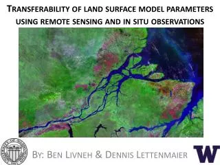
Transferability of land surface model parameters using remote sensing and in situ observations. By: Ben Livneh & Dennis Lettenmaier. Overview. Unified Land Model (ULM) was developed 1 Rigorous calibrations performed at 220 basins 2 Regionalize/transfer calibrated parameters

E N D
Transferability of land surface model parameters using remote sensing and in situ observations By: Ben Livneh & Dennis Lettenmaier
Overview • Unified Land Model (ULM) was developed1 • Rigorous calibrations performed at 220 basins2 • Regionalize/transfer calibrated parameters • Domain and catchment attribute data sets • Experimental set-up • Results • Conclusions 1. Livneh et al. 2011; 2. Livneh et al., 2012
Unified Land Model (ULM) Regionalization • Goal: establish a predictive relationship between ULM parameters, Θ, andobservable catchment features, η (e.g. θ= a + bη) for a new model, ULM. • Motivation:extend recent model calibrations to new domains; calibration is often impractical/impossible. η θ ULM field capacity parameter Greenness Fraction (satellite)
Experimental domain and predictands, Θ • 220 MOPEX1 basins, spanning a wide range of hydro-climatology • Calibrated model parameters, Θ, for each basin were obtained from a recent study2 as inputs to the regionalization procedure (predictands). 1. Schaake et al., 2006; 2. Livneh et al., 2012
Summary of candidate catchment attributes, η Total: 388 1. Livneh et al. 2012b; 2. Seaber et al. 1987; 2. Gutman and Ivanov, 1998; 4. Koren et al. 2003; 5. Tang et al. 2009; 6. Swenson and Wahr, 2006, Falcone et al. 2010
Regionalization methodology • Step-wise principal components regression (PCR) procedure1,2 was selected to maximize explanatory skill and minimize potential redundancy/inter-correlation. Jack-knifing validation chosen. θ1=a+b1η1+b2η2+…+bnηn • Additional experiment: resample calibrated model parametersprior to developing the equation, based on their zonal representativeness, i.e. Zonalization θ’1=c+d1η1+d2η2+…+dnηn θ1-LOCAL= “classic” regionalization θ1-ZONAL= 1. Garen, 1992; 2. Rosenberg et al. 2011
Zonalization procedure • 10 calibrated parameter sets per basin1 that are Pareto-optimal, ΘP, i.e. non-dominant multiple-objective functions: streamflow correlation, R, diff. in means, α, diff in std. deviations, β. • Compute an additional objective function Nash-Sutcliffe Efficiency2, NSE (-∞,1) Exp 1: Select local optimum: based on highest NSE θi-LOCAL=a+b1η1+b2η2+…+bnηn Local performance ranking local optimum ΘP,LOCAL = ΘP1 Highest NSE Lowest NSE 1. Livneh et al. 2012a; Nash and Sutcliffe, 1970
Zonalization procedure • 10 calibrated parameter sets per basin1 that are Pareto-optimal, ΘP, i.e. non-dominant multiple-objective functions: streamflow correlation, R, diff. in means, α, diff in std. deviations, β. • Compute an additional objective function Nash-Sutcliffe Efficiency (NSE) Exp 1: Select local optimum: based on highest NSE Exp 2: Select zonal optimum, based on highest zonal θi-LOCAL=a+b1η1+b2η2+…+bnηn θi-ZONAL=c+d1η1+d2η2+…+dnηn Local performance ranking Zonal performance ranking Re-run ULM with each ΘP, at neighboring basins within a zoning radius (5°). Compute and rank the a mean statistic for each parameter set zonal optimum ΘP,ZONAL = Exp2 Highest NSE local optimum ΘP,LOCAL = ΘP1 Exp 1 Highest NSE 5° Lowest NSE Lowest NSE 1. Livneh et al. 2012a; Nash and Sutcliffe, 1970
Zonalization increases spatial coherence • Spatial coherence increased. Verified visually and by variograms (not shown) PCR derived relationships zonal predictand θi-ZONAL=c+d1η1+d2η2+…+dnηn θZONAL local predictand θi-LOCAL=a+b1η1+b2η2+…+bnηn θLOCAL ULM field capacity parameter, θ
ULM skill (NSE) using zonal versus local parameters local optima Local NSE zonal optima Penalty in streamflow prediction skill for using zonal parameters at a given basin (i.e. locally) is comparatively smaller than the penalty for using local parameters zonally 220 basins ranked by NSE zonal optima Zonal NSE Mean (5° radius) local optima Example of zoning radius
PCR regionalization results • Jack-knifing method to test regionalization. local optima ΘZONAL LOCAL-ZONAL Local basin NSE ULM Rank local optima ΘLOCAL Local basin NSE
PCR regionalization results • Zonal predictands leads to best performance; exceeding local calibrations in a few places. • Jack-knifing method to test regionalization. local optima ΘZONAL LOCAL-ZONAL Local basin NSE ULM ULM regionalized Rank local optima ΘLOCAL Local basin NSE ULM regionalized
PCR regionalization results • Jack-knifing method to test regionalization. • Zonal predictands leads to best performance; exceeding local calibrations in a few places. local optima ΘZONAL LOCAL-ZONAL Local basin NSE ULM ULM regionalized Rank local optima • Repeated the experiment, using only those attributes available globally (i.e. remove GAGES-II variables). • Approach worked surprisingly well, when only globally-available data were used. LOCAL Θ Local basin NSE ULM regionalized
PCR regionalization results • Jack-knifing method to test regionalization. • Zonal predictands leads to best performance; exceeding local calibrations in a few places. Nash-Sutcliffe Efficiency (NSE) over 220 basins local optima ΘZONAL LOCAL-ZONAL Local basin NSE ULM ULM regionalized ULM regionalized-Global Rank local optima • Repeated the experiment, using only those attributes available globally (i.e. remove GAGES-II variables). • Approach worked surprisingly well, when only globally-available data were used. LOCAL Θ Local basin NSE ULM regionalized
Conclusions/Recommendations • New data sets were incorporated into regionalization • Searching for zonally representative parameters proved to be the most effective regionalization. • Future work should continue searching for ways to re-sample model parameters prior to regionalization, as this was shown effective. • Modest loss in skill for the global experiment are a testament to the robustness of the step-wise PCR method. • Future work is underway looking at alternate domains, models, and catchment attributes.
Acknowledgements • Dennis Lettenmaier (co-author) • Dr Bart Nijssen, Eric Rosenberg for their advise and assistance • The work on which this paper is based was supported by NOAA Grant No. NA070AR4310210 to the University of Washington • This work has been submitted to Water Resources Research as: Livneh.B, and D.P. Lettenmaier, 2012: Regional parameter estimation for the Unified Land Model, Water Resources Research (submitted). • Draft available on website: www.hydro.washington.edu/~blivneh
Thank you • Contact: Ben Livneh: blivneh@hydro.washington.edu