Download
1 / 25
250 likes | 360 Vues
This proposal outlines a comprehensive study aimed at assessing groundwater vulnerability in Maryland. It highlights the urgent need to address groundwater pollution, presenting the DRASTIC method as a key tool for evaluation. The study will utilize data from over 1,000 groundwater wells, examining factors such as depth to groundwater, net recharge, aquifer media, soil media, topography, vadose zone impact, and hydraulic conductivity. The ultimate goal is to create a statewide vulnerability map, ranking areas by pollution risk, and informing targeted protection measures.

E N D
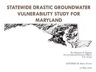
PROPOSAL FOR STATEWIDE GROUNDWATER VULNERABILITY STUDY FOR MARYLAND By Olufunso S. Ogidan GEOG 596A 05 January 2010 Adviser: Dr. Barry Evans
Outline • Background & Scope • Project Goals • Data and Data Sources • Proposed Methodology • Limitations • Questions
Background & Scope • Multiple cases of groundwater pollution in Maryland • Current groundwater protection programs in Maryland • Brief description of DRASTIC
Groundwater pollution in Maryland • Methyl Tertiary Butyl Ether (MTBE) leakages into groundwater • Currently there are 8,500 Underground Storage Tanks (UST) and 11,109 confirmed releases • Pesticide presence in groundwater system • Other potential sources of groundwater contamination-Spillage, Waste Disposal sites etc.
Maryland Groundwater Protection Programs • Most groundwater protection plan are implemented at the local government level • Maryland Department of the Environment (MDE) provides technical, informational and funding support to the local governments • Most programs focused on protection of the areas around wells where activities could result in contamination • Groundwater recharge areas protection • Currently there is no statewide groundwater vulnerability map
Description of the DRASTIC Method • The DRASTIC Model is the most widely used groundwater vulnerability assessment method available • DRASTIC utilizes seven hydrogeologic parameters to determine vulnerability to groundwater contamination • DRASTIC is an acronym that stands for the initial of the seven hydrogeologic parameter • D = Depth to groundwater • R= net Recharge • A= Aquifer media • S= Soil media • T= Topography (Slope) • I = Impact of the vadose zone • C= hydraulic Conductivity
Assigned Weight for DRASTIC Parameters • Each DRASTIC parameter is assigned a relative weight ranging from 1 to 5 based on their relative importance in influencing the flow of contaminants into groundwater system. Aller, L., T. Bennett, J.H. Lehr, R.J. Petty, and G. Hackett, 1987. DRASTIC: A Standardized System for Evaluating Ground Water Pollution Potential Using Hydrogeologic Settings. EPA 600/2-87/035, Ada, OK, 163 pp.)
Project Goal • To Develop a statewide groundwater vulnerability map • Rank areas based on the DRASTIC vulnerability index • Identify areas with the greatest potential to groundwater pollution • Provide information on areas where targeted critical vulnerability assessment might be required
Depth to Water • Depth to water (feet) determines the depth that contaminants have to travel before reaching the groundwater • Groundwater well data obtained from USGS • Data from1,012 groundwater wells will be used for the study • Four Year average of data will be used to estimate depth to water • Continuous depth to water surface will be interpolated from the point well data
Net Recharge • Net Recharge (inch per year) is the quantity of water from precipitation that infiltrate into the ground to reach the water table • There is no existing net recharge data for Maryland • Estimated net recharge will be made from the hydrological soil group characteristics • Hydrologic soil group data was obtained from the USDA
Aquifer Media • Aquifer media refers to the consolidated or unconsolidated subsurface rocks that serves as the aquifer • An aquifer is a water bearing formation that can economically yield water to well • Aquifer media data was obtained from USGS
Soil Media • Soil Media is the upper weathered zone of the earth up to about six feet or less from the surface • Soil Media affect the infiltration and biogeochemical attenuation of contaminants • Soil media data was obtained from the USDA soil data mart • Drainage characteristics and percent loam attributes from the data will be used to estimate the DRASTIC rating for the soil media
Topography (Slope) • Topography is the slope variability of the land surface • Topography influence the proportion of precipitation and anthropogenic contaminants runoff or infiltrate into the ground • 179 10m resolution National Elevation Dataset (NED) quadrangle data covering most of Maryland were obtained from USGS • The NED quadrangles were mosaic in ArcGIS 9.3 Spatial Analyst Tool • Slope will be calculated from the NED
Impact of the Vadose Zone • The vadose zone is the zone between the land surface and the regional water table • The DRASTIC ratings for the impact of the vadose zone are based on the characteristics of the unsaturated zone rock types • Vadose zone data will be estimated from the geological data • Published geological map was obtained from USGS
Hydraulic Conductivity • Hydraulic conductivity is the ability of an aquifer to transmit water • Hydraulic conductivity (gpd/ft2) determines the rate at which groundwater will flow under a specific hydraulic gradient in the saturated zone • Hydraulic conductivity will be estimated from the physical characteristics of the aquifer
Weighting and Rating • Each hydrogeologic parameter will be assigned a rating between 1 and 10 based on the ranges or significant media type • Each rating will be scaled by the Weighting factors ranging from 1 to 5 • The weighted ratings will be summed to obtain the DRASTIC Index Di
DRASTIC Index • DRASTIC index will be computed by applying a linear combination of the seven parameters based on the equation below Di= DRDW + RRRW + ARAW + SRSW + TRTW + IRIW + CRCW Where Di = DRASTIC Index D, R, A, S, T, I, C = Initials of the seven hydrogeologic factors, R= Ratings W= Weight
DRASTIC Index • ArcGIS 9.3 will be used to perform the analyses and calculations • The resulting Di will be ranked to generate relative groundwater vulnerability index for the state. • Di will be displayed on thematic map that ranks areas within the state based on their susceptibility to groundwater pollution. • The higher the calculated DRASTIC index for an area, the greater the vulnerability of that area to groundwater contamination
Limitations • Some hydrogeologic parameters were estimated due to unavailability of published data • There was no available data on the spatial locations of previous groundwater contaminations in the state of Maryland • Di cannot be singularly used to determine the suitability of a site for waste disposal or USTs.