Download
1 / 17
230 likes | 607 Vues
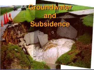
Groundwater Vulnerability and Susceptibility. Eng.S.S.Sivakumar. Deputy Director of Irrigation, Mullitivu Range. Vulnerability. *The probobility of groundwater pollution in the event of a pollutant release at the ground surface. Susceptibility

E N D
Groundwater Vulnerability and Susceptibility Eng.S.S.Sivakumar. Deputy Director of Irrigation, Mullitivu Range
Vulnerability • *The probobility of groundwater pollution in the event of a pollutant release at the ground surface. Susceptibility • * Qualitative measure of the relative ease with which a groundwater resource can potentially be contaminated by anthropogenic activities and includes both aquifer vulnerability and the relative importance of the aquifer in terms of its classification.
Terminology • Hazard – property or activity that could lead to failure • Consequences – the adverse effects of failure • Probobility- the likelihood of failure • Risk-the expected consequences of failure • Risk=Probobility of failure * consequences of faailure
Needed Information • Geology • Hydrogeology • Avereage Annual production per decade of boreholes • Effective infiltration (Actual Recharge) • Annual Rainfall • Groundwater Demand
Need to do • Identification of risk objects (hazards) • Assessment of the seriousness of the threat • Identificationof areas ffor potential rechaarge enchancements. • Assessments of resource value • Assessment of provisional risk • Delineation of classified protection zones
Vulnerability Assessments • Groundwater vulnerability based on the assumption. • Physical environment may provide some degree of protection against natural and human impacts, especially with regard to contaminants entering the subsurface environment.
DRASTIC:A Standardized System • Vulnerability determined within hydro geological settings • Depth to Ground water (Weight:5) • Recharge (Weight:4) • Aquifer media (weight:3) • Soilmedia (weight:2) • Topography (weight: 1) • Impact of vadose zone (weight: 5) • Hydraulic conductivity(weight:3)
Drastic-Weights and Ratings • Each factor is given a weight between 1 and 5 with respect to its relative importance • Each factor is then rated between 1 and 10 • A final index is calculated as: DRDW+RRRW+ARAW+SRSW+TRTW+IRIW+CRCW= DRASTIC Index Where R=raating W=weight
Examples for Weights and ratings • Depth to groundwater (weight:5) Rating 0 - 2m 10 2 - 5m 9 5 - 10m 7 10-17m 5 17-25m 3 25-33m 2 >33m 1
Examples for Weights and Ratings • Aquifer media (weight:3) Rating Karst 10 Fractured rock 4-9 Sand Gravel 6-9 Silts 2-3 Clay 1
Vulnerability of groundwater to contamination • It is a function of the susceptibility of its recharge area to infiltration. • Areas that are replenished at ahigh rate rea generally more vulnerable to pollution than those replenish at a slower rate • Unconfined aquifer that do not have a cover of dense material are susceptible to contamination.
Vulnerability of ground water to contamination • Bedrock areas with large fractures are also susceptible by providing pathways for the contaminants. • Confined deep aquifers tend to be better protected with a dense layer of clay material. • Wells that connect two aquifers increase the chance of croos contamination between the aquifers.
Aquifer System management Classification (ASMC) • Aquifer type Description Major aquifer region High yield good quality Minor Aquifer region Moderately yielding, variable quality Poor groundwater region Low yielding, poor quality Sole source aquifer To supply 50% or more of urban domestic water for a given area-no reasonably available alternative source, Special aquifer region Designated as special
Aquifer ContaminationSusceptibility (sus) Classes Vulnerability Classes ASMC low(1) Medium(2) High (3) Poor GW low low Medium Region(1) Sus (1) Sus(2) Sus(3) Minor GW low medium high Region(2) Sus (2) Sus (4) sus(6) Major GW Medium high high Region(3) Sus (3) Sus(6) sus(9)
Probobilty Estimation • Frequency based • Existing data from sampling programs • Degree of belief • Expert judgements • Existing data • Indicators and interpretation.
Potential Contabination Load • Identification of contaminant sources • Screening of identified sources • Characterization of remaining sources.