Download
1 / 34
380 likes | 601 Vues
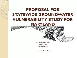
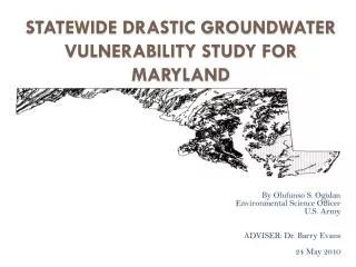
DRASTIc Groundwater Vulnerability map of Tennessee. James Bond – Capstone Proposal. GEOG 596A. Overview of Presentation. Introduction Methodology Anticipated Results & Problems References. INTRODUCTION. Introduction. My Project DRASTIC Groundwater Vulnerability Map of Tennessee

E N D
DRASTIc Groundwater Vulnerability map of Tennessee James Bond – Capstone Proposal GEOG 596A
Overview of Presentation • Introduction • Methodology • Anticipated Results & Problems • References
Introduction • My Project • DRASTIC Groundwater Vulnerability Map of Tennessee • DRASTIC • What is it? • Identifies areas where groundwater is susceptible to pollution • What are the applications? • Guides land development & resource protection • Flexible • Used at a variety of scales • Can be modified to include or exclude parameters
DRASTIC Overview • DRASTIC – methodology guided by EPA • Developed by EPA & National Water Well Assoc. • 600+ page guidance document • Link to Guidance: • http://nepis.epa.gov/Exe/ZyPURL.cgi?Dockey=20007KU4.txt • Purpose – Over large areas, used to identify regions where groundwater is more or less susceptible to impact from pollution.
DRASTIC Overview Cont. • Overview of DRASTIC • Simplified GW vulnerability model • Qualitative • Produces a relative-risk scale • Applicable over large areas • Used as a screening tool • Results guide land development & resource protection • For small, specific sites, more detailed assessment needed
DRASTIC Method Assumptions • DRASTIC Makes Four Assumptions: • Contamination is introduced at the ground surface • Contamination is flushed into the groundwater by precipitation • Contamination has the mobility of water • Area being evaluated is 100-acres or larger • If these assumptions are not met, then DRASTIC is not the appropriate methodology
DRASTIC Factors Seven hydrogeologic factors used. They form the acronym DRASTIC D – Depth to Water R – Net Recharge A – Aquifer Media S – Soil Media T – Topography I – Impact of Vadose Zone Media C – Hydraulic Conductivity of Aquifer
Weights & Ratings • Significance of each factor in contaminant transport varies • Relative weight is assigned to each factor • Scale of 1 to 5 • 1 is least important factor • 5 is most important factor • Each factor also has a rating applied according to a category or range of values.
DRASTIC – The Equation • Once ratings and weights have been applied, they are multiplied and added • DRASTIC equation: DrDw + RrRw + ArAw + SrSw + TrTw + IrIw + CrCw = Pollution Potential r = rating w = weight • Results are symbolized on a map overlaying study area
Methodology - Example • Example of how ratings and weights are applied • Will use D Factor (Depth to Water) as example • D receives a weight of 5 • It is very significant in potential impact to GW • Based on actual depth to groundwater, D also receives a rating.
Methodology – Example Cont. • If depth to water was 10 ft then D rating would be 9 DrDw= 9 x 5 = 45 • If depth to water was 100 ft, then D rating would be 2 DrDw= 2 x 5 = 10 • This process is repeated for each of the factors
Self-Imposed Project Parameters • Due to time constraints, need to impose parameters on the analysis • Use unmodified version of method • Use existing datasets as much as possible • To fill datagaps will use the easier of two approaches: • Derive missing data from other existing data • Use generalized values in EPA guidance
Anticipated Results • State of TN groundwater vulnerability map • Detailed report of methodology and data used • Map will be technically correct • Considered FINAL within context of capstone project • Considered DRAFT by public and professionals who may use it
Anticipated Problems • Low Resolution Data • Anticipate using only small scale data • Missing data • Not all inputs may be available • May have to infer data or use generalized inputs • Room for improvement • Analysis can be easily re-run with better data • Better data = better results • Additional refinement outside the scope of this capstone project
Summary • Project to produce groundwater vulnerability map of Tennessee • Has not been done for Tennessee • Use EPA DRASTIC vulnerability methodology • Use small scale, publicly available data • Result will be a first cut at groundwater vulnerability mapping • Model will have room for refinement • Outside the scope of this project
Q&A Questions?
References U.S. EPA DRASTIC Guidance Document • United States Environmental Protection Agency (EPA), 1987, DRASTIC: A Standardized System for Evaluating Ground Water Pollution Using Hydrogeologic Settings, EPA/600/2-87-035, Robert S. Kerr Environmental Research Laboratory, Ada, OK 74820 Examples of the Application of DRASTIC • Arthur, Jonathan D., et al., 2005, Florida Aquifer Vulnerability Assessment (FAVA): Contamination Potential of Florida’s Principal Aquifer Systems, Division of Resource Assessment and Management, Florida Geological Survey • Chowdhury, Shafiul, et al, 2003, Comprehensive approach of groundwater resource evaluation: a case study in the Chippewa Creek watershed in Ohio, The Ohio Journal of Science, December 2003 • Crider, S.S., 1989, A Cursory Application of DRASTIC to the Savannah River Site, WSRC-RP-89-744, DE92 009778, Division of Engineering Fundamentals, Virginia Polytechnic Institute and State University, Blacksburgh, VA 24061-0218 • Evans, Barry, et al, 1990, A GIS-Based Approach to Evaluating Regional Groundwater Pollution Potential with DRASTIC, Journal of Soil and Water Conservation, March-April, pp. 242-245 • Rupert, Michael G., 1999, Improvements to the DRASTIC Ground-Water Vulnerability Mapping Method, USGS Fact Sheet FS-066-99, Department of the Interior, US Geological Survey, Denver, CO 80225