Download
1 / 18
180 likes | 259 Vues
Regions of North America. Unit 4, Lesson 1. Vocabulary. Region Part of the earth’s surface that is alike or connected in some way Formal Region Group of places that have similar attributes, for example, a political region Functional Region

E N D
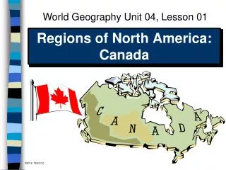
Regions of North America Unit 4, Lesson 1
Vocabulary • Region • Part of the earth’s surface that is alike or connected in some way • Formal Region • Group of places that have similar attributes, for example, a political region • Functional Region • Group of places connected by movement, for example, the region drained by the Amazon River. • Perceptual Region • Group of places that is defined by people’s feelings and attitudes
Migration • The United States and Canada are composed of several sub-regions that have unique physical and cultural geography. The Beringia Land Bridge was the geographic feature that was essential for migration to the Americas. • In the paper: “Beringian Standstill and Spread of Native American Founders,” One of the more interesting lines of evidence they found from their sequence comparison and their revised phylogenetic map is that the ancestral population literally chilled out in Beringia for a long time. The authors estimate about 15,000 years. That’s long enough so that specific mutations accumulated which separated the New World founder lineages from the Asian sister-clades. • The other more interesting thing that was uncovered was that the founding haplotypes are uniformly distributed across North and South America. They do not show a nested structure from north to south. That means that after what the authors are terming the Beringian standstill and what is called the Beringianchillout, the initial North to South migration was very swift. It was not a gradual diffusion.
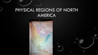
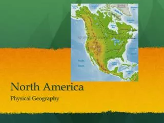
Regions of North America
The NOrtheast • Maine, New Hampshire, Vermont, Massachusetts, Connecticut, • Rhode Island, New York, • Pennsylvania, Delaware, • Maryland, • District of Columbia
The NOrtheast • Climate & Vegetation: No dry season with cold snowy winters and hot summers. Vegetation is mixed forests with deciduous and coniferous trees.
The NOrtheast • Population: Population is concentrated in the Megalopolis (Boston to Washington DC). Most densely populated region in the U.S. Megalopolis’s develop because of location near transportation routes and major economic development (jobs).
The NOrtheast • Cultural Geography: Northeast Mid-Atlantic: This is home to Washington D.C. (political center of the USA).
The South • North Carolina, South Carolina, Florida, Georgia, Alabama, • Mississippi, • Tennessee, • Arkansas, • Louisiana
The South • Southern Transition States: • Virginia, West Virginia, • Kentucky, • Missouri, • Oklahoma, • Texas
The South • Gulf Coast States:Florida, Alabama, Mississippi, Louisiana, Texas
The South • Historical Geography of the South:Early it was an agricultural region with slavery and cash crops as its driving force. Dominant settlers were the Anglo-Protestant plantation farmers.
The South • Economic Geography: Historically based on agriculture with tobacco and cotton being 1st cash crops. Service industries, manufacturing, and high tech industries are also located in the South. Fishing and tourism are common in the Gulf Coast. Oil drilling is also located in the South (Houston).
The midwest • Michigan, Ohio, • Indiana, Illinois, • Wisconsin, • Minnesota, Iowa. • Transition States: • Pennsylvania and • Missouri
The midwest • Historical Geography: known as part of the “Breadbasket” of the U.S. Also known for manufacturing (blue collar jobs).
The midwest • Population: Large cities • include Chicago & Detroit. • Population is dense along the • Great Lakes.
The midwest • Economic Geography: Dairy farming in Wisconsin & Minnesota. Corn in Indiana, Illinois, & Iowa. Manufacturing along Great Lakes & cities like • Pittsburg, Cleveland, Detroit & • Chicago.