Download
1 / 17
170 likes | 320 Vues
1. FY2009 GIMPAP Project Proposal Title Page Revised: October 31, 2008. Title : Using AWIPS to expand usage of GOES imagery and products (including those from the GOES Sounder) in National Weather Service Forecast Offices Project Type : GOES Utilization Proposal Status : Renewal

E N D
1. FY2009 GIMPAP Project Proposal Title PageRevised: October 31, 2008 • Title: Using AWIPS to expand usage of GOES imagery and products (including those from the GOES Sounder) in National Weather Service Forecast Offices • Project Type: GOES Utilization Proposal • Status: Renewal • Duration: 2 years • Leads: • Jordan Gerth (CIMSS/SSEC) • Scott Bachmeier (CIMSS/SSEC) • Gary S. Wade (NOAA/NESDIS/STAR/CoRP/ASPB at UW-CIMSS) • Other Participants: • Robert M. Aune (NOAA/NESDIS/STAR/CoRP/ASPB at UW-CIMSS) • Kris Bedka (CIMSS/SSEC) • Wayne Feltz (CIMSS/SSEC) • Scott Lindstrom (CIMSS/SSEC) 1
2. Project Summary • The Advanced Weather Interactive Processing System (AWIPS) is the primary tool used by National Weather Service (NWS) meteorologists for viewing current weather information, such as satellite imagery, model output, and observations, pertinent to forecast preparation. • Until recently, AWIPS could only be run at NWS Forecast Offices due to its complex infrastructure. It was difficult for research institutes to create training modules in which AWIPS was employed, which diminished their practical value to field meteorologists. Furthermore, there was no way to provide additional data which sampled cutting-edge research in progress, and could add value to the forecast process. • The potential exists for the creation and deployment of experimental satellite imagery and products into AWIPS, particularly from the Geostationary Operational Environmental Satellite (GOES) Sounder, that can enhance operations at National Weather Service offices nationwide. Subsequent training modules can provide a meaningful demonstration of such imagery in AWIPS to forecasters. • Current non-operational GOES Imager and GOES Sounder products from CIMSS/SSEC, undergoing evaluation at NWS Forecast Offices, have shown positive results to date, and the interest continues to grow. 2
3. Motivation/Justification • This effort supports the NOAA Mission Goal of: “serving society’s needs for weather and water information”in line with the NOAA cross-cutting priority of: development and distribution of “sound, reliable state-of-the-art research”. • Transitioning cutting-edge research to the operational environment through AWIPS maximizes the benefits to all cooperating NOAA employees and team members by: • Increasing the dialogue between researchers and forecasters so that scientists can tailor their research to meet the changing needs of field meteorologists, and forecasters can provide critical feedback to scientists before products are implemented operationally. • Encouraging the use of current Geostationary and Polar-orbiting Operational Environmental Satellites in new ways. • Providing a forum to answer questions from the field and provide meaningful training exercises to assure appropriate and maintained use of satellite data as a fundamental part of the forecast process. • Expanding the applications for satellite data. • Saving bandwidth on existing product delivery infrastructure through assuring forecasters only have the best, most pertinent imagery and products available. • Introducing researchers to AWIPS. 3
4. Methodology Conduct in-person training with NWS forecasters to explain the potential benefits of new satellite imagery and products and gauge the existing and future needs of field meteorologists. Provide support to NWS offices who need help obtaining new imagery or who have questions pertaining to existing offerings. Create training modules and hold telephone training sessions to maintain dialogue and connection between research and operations. The following methods are restricted due to finding cuts: • Review research currently in progress to find projects that may be fitting to expand into the operational realm. • Distribute surveys to and solicit feedback from NWS forecasters to assure products currently sent to offices are adding value to the forecast process, and determine areas where new satellite imagery could potentially improve local area forecasts. 4
5. Expected Outcomes • Increased usage of GOES Imager and GOES Sounder imagery and products in operational realms. • Improved training modules and increased training sessions pertaining to satellite applications and principles as they relate to the operational environment and AWIPS. • A stronger relationship between research and operations which fosters beneficial satellite imagery and products in the future. • The following outcomes are delayed due to finding cuts: • The development of a database of potential non-operational GOES Imager and GOES Sounder products from which local offices can choose those which are of greatest interest to them, deliverable from research institutes via the Unidata Local Data Manager (LDM). • The suggestion of certain new GOES Imager and GOES Sounder products to be added to the operational NOAAPORT feed for use in NWS offices across the United States. 5
6. Progress in FY2008 Milestones • FY2008 • Create and deploy experimental GOES Imager and GOES Sounder imagery and products for testing in select cooperating NWS offices. • Develop training to accompany new products. • Locate and load select archive cases for use with the newly acquired Weather Event Simulator (WES). • Provide materials (in this AWIPS environment format) for training, in conjunction with VISIT objectives and efforts. • Determine present and future satellite needs of forecasters. Information on the progress of each Milestone follows. 6
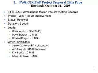
6a. Progress in FY2008 Milestones FY2008 Create and deploy experimental GOES Imager and GOES Sounder imagery and products for testing in select cooperating NWS offices. Progress -- new GOES Sounder DPI (Derived Product Imagery) of (1) CAPE (Convectively Available Potential Energy) and (2) Total Column Ozone have been added to the CIMSS data stream into AWIPS. These DPI augment other moisture, stability, and cloud DPI already in operational AWIPS. These Sounder DPI come from the current Ma et al. (1999) algorithm; it is anticipated that improved DPI may still be implemented during this calendar year, using a new Li et al. (2008) algorithm, depending upon ongoing evaluations. Develop training to accompany new products. Progress -- A total of 7 live teletraining sessions of the VISIT lesson “Water Vapor Imagery and Potential Vorticity Analysis” were given, with 17 NWS forecast offices participating in the training. This lesson demonstrates the utility of the GOES imager water vapor channel and the GOES sounder total column ozone product to diagnose important upper tropospheric dynamical structures. 7
VISIT tele-training session on satellite identification of upper dynamic features
6b. Progress in FY2008 Milestones FY2008 Locate and load select archive cases for use with the newly acquired Weather Event Simulator (WES). Progress -- preliminary thus far. The CIMSS WES was upgraded to Version 8.1, and then later to Version 8.2, in preparation for work on creating WES training cases. [Although not yet directly related to current GOES data applications, other funded work has been done recently on a WES case study showing GOES-R ABI (Advanced Baseline Imager) data, simulated from 05 June 2005 high quality model analyses; this ABI demonstration has shown that the WES software here at CIMSS is working successfully.] Provide materials (in this AWIPS environment format) for training, in conjunction with VISIT objectives and efforts. Progress -- S. Bachmeier participated as an instructor on Day 4 (17 Apr 2008) of the 15-day Cooperative Program for Operational Meteorology, Education, and Training (COMET) Mesoscale Analysis and Prediction Course (COMAP) residence course for NWS Science and Operations Officers (SOOs) held at Boulder, Colorado. 9
6c. Progress in FY2008 Milestones FY2008 (continued) A half-day lecture and lab session "Satellite Applications: Dynamic Feature Identification" was given, which discussed the use of GOES and MODIS water vapor channel imagery along with the GOES Sounder Total Column Ozone product to diagnose important upper tropospheric dynamical structures, such as potential vorticity anomalies and the dynamic tropopause. Determine present and future satellite needs of forecasters. Progress -- In-person collaboration/training with NWS staff continued as planned, with CIMSS and NESDIS ASPB staff visiting Kansas City on 29-30 May 2008. The NWS complex in Kansas City houses both the NWS Central Region (CR) Headquarters (CRH) and the NWS Aviation Weather Center (AWC). Besides CRH and AWC staff, a few forecasters were able to attend from local NWS Forecast Offices; in addition to those able to attend the presentations in person, NWS personnel in the field (at other CR NWS FOs) were able to participate via simultaneous Internet broadcast of the presentations via “webinar”. The speakers and titles of the talks for the workshop are included in the agenda shown in the following table. 10
6d. Progress in FY2008 Milestones FY2008 (continued) The Kansas City visit followed previous (to this funding) visits to the three NWS FOs in Wisconsin, where similar presentations and discussions were had. Another mechanism to assess how the forecasters are responding to these visits and the promoted products is to monitor any mention of some of these CIMSS AWIPS products in their posted discussion messages. Specifically, any mention of the CRAS (CIMSS Regional Assimilation System) forecast products or any of the MODIS (MODerate resolution Imaging Spectroradiometer) products in a NWS Area Forecast Discussion (AFD) is noted. CRAS assimilates GOES Sounder moisture and cloud information; MODIS provides imagery that can be used as a proxy version of future GOES-R ABI imagery, where horizontal and spectral resolution will be increased. As of the end of June 2008, there have been 80 AFDs mentioning CRAS and 55 AFDs mentioning MODIS (since this activity started in the late summer of 2006). For this last quarter, there had been 13 new CIMSS AWIPS product references in AFDs. 12
6e. Progress in FY2008 Milestones FY2008 (continued) One other tool to educate and help foster discussion is the compilation and posting of current, brief “mini case studies” on the CIMSS Satellite Blog [http://cimss.ssec.wisc.edu/goes/blog/]. For this calendar year, 37 new GOES-related entries, actually shown from AWIPS displays, have been added to the Blog. The CIMSS Satellite Blog is becoming a popular satellite training resource for NWS forecasters. A portion of one Blog entry follows, illustrating how one of the newer GOES Sounder DPI mentioned earlier, CAPE, can be incorporated into assessing a forecast situation. Lastly, in general, this project is making relatively good progress for starters, considering the funding has only been available since May 2008, and this “review” is as of mid July 2008. 13
Sample of a portion from the CIMSS Satellite Blog The GOES Sounder derived Convective Available Potential Energy (CAPE) product on 22 May 2008 indicated that the pre-convective environment across northeastern Colorado during the morning hours was becoming unstable, with CAPE values in the 2000-4000 J kg-1 range (yellow to red enhancement) at 16:00 UTC (10 am local time). The air mass south of the warm front and east of the dryline (from southern Kansas into Texas) was also very unstable, with CAPE values in some areas over 4000 J kg-1 (purple enhancement).
7. FY2009 Milestones • Milestones delayed for FY2009 due to funding cuts: • Submit products with exceptionally positive feedback for nationwide deployment via NOAAPORT. • Alter active GOES Imager and GOES Sounder product offerings based on feedback and expand base receiving imagery and products. • FY2009 • Expand training materials into a library of WES cases, emphasizing the studied GOES products. • Obtain feedback from forecasters in cooperating offices. • Contribute to development of AWIPS II, the next generation of AWIPS. 15
8. Funding Profile (K) • Summary of leveraged funding • Ground Systems funding had been used for current purchase items such as the computer for the Weather Event Simulator (WES). • Ground Systems funding, * if available, will be used for creation of the software documentation for the implementation and application of AWIPS at CIMSS. • Continued AWIPS utilization at CIMSS will generally, and substantially, be supported, by GOES-R Proving Ground funding, starting in FY2009. • Initial request for FY2009 was $75K. 16
9. Expected Purchase Items • FY2008 • $40K: STAR CIMSS Grant for 2 scientists at (0.2, 0.2) time each from 2008-01-01 to 2008-12-31 Budget consists of: • Personnel support (including benefits, IT charges, overhead, etc): $38K • Contracts: N/A • Software charges: N/A • Equipment: N/A • Travel: $2K/year to attend/coordinate local/regional workshops (NWS GRB, NWS CR HQ (Kansas City), Great Lakes Operational Meteorology Workshop (Chicago?)) • Publication charges: N/A • FY2009 $25K total budget • $21.5K: STAR CIMSS Grant for 2 scientists at (0.1, 0.1) time from 2009-01-01 to 2009-12-31 Budget consists of: • Personnel support (including benefits, IT charges, overhead, etc): $20K • Contracts: N/A • Software charges: N/A • Equipment: $1.5K (large screen display for Room 248 – the AWIPS situational awareness and NWS collaborative demonstration area at CIMSS • $3.5K: Federal Travel 1) Attend/coordinate local/regional workshops (Midwest FOs, Great Lakes Region, and/or venues with good NWS forecaster attendance). 17