WEATHER
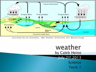
WEATHER. What is Weather?. Weather is the daily condition of the atmosphere. The atmosphere is the envelope of gases that surround the earth. Atmospheric Factors That Interact to cause weather. Heat Energy Air Pressure Winds Moisture. Heat Energy.

WEATHER
E N D
Presentation Transcript
What is Weather? • Weather is the daily condition of the atmosphere. • The atmosphere is the envelope of gases that surround the earth
Atmospheric Factors That Interact to cause weather • Heat Energy • Air Pressure • Winds • Moisture
Heat Energy • Most of the earth’s energy comes from the sun in the form of radiant energy. • Some is reflected back into space, much is absorbed by the atmosphere. • The ozone layer absorbs much of the ultraviolet (UV) radiation. Too much UV can cause sunburns/skin cancer.
Heat Energy absorbed by the atmosphere is spread by: • Conduction – direct transfer of heat (like touching something hot) • Convection – transfer of heat in a fluid. Cold air/water sinks, warm air/water rises. • Radiation – transfer of energy by waves. (What happens when the sun comes out from behind a cloud?)
Greenhouse Effect • Some gases in the atmosphere trap Infrared Rays (heat) like the glass in a greenhouse. • Temperature Variations are the result of changes in radiant energy. • Radiant energy decreases as you go farther from the equator. Why is this so?
Sunlight is more direct at the equator, less direct (lower angle) towards the pole.
Moisture • Humidity is moisture in the air. • Relative humidity is the percentage of moisture in the air compared to how much it could actually hold. • A psychrometer is used to measure relative humidity. Made of two thermometers, one wet and one dry.
Clouds • Clouds form when rising air cools, causing water vapor in the air to condense.
Three Main Types of Clouds • Cumulus – looks like piles of fluffy, white cotton balls. Usually indicate fair weather. Can form into thunderstorms as Cumulonimbus clouds. • Stratus – Smooth, gray clouds that cover the sky. Cause light rain, drizzle; fog if close to ground. • Cirrus – very high altitude, feathery white clouds made of ice crystals. Can indicate future rain or snow.
Precipitation • Water vapor that condenses and falls to earth • May be in the form of rain, snow, sleet, hail, ice
Precipitation • Rain – Up to 1 million cloud droplets combine to make one raindrop. • Sleet – Occurs when rain falls through an extremely cold layer of air, forming ice pellets. • Snow – Forms when water vapor changes directly into a solid. No two snowflakes are alike.
Precipitation • Hail – Forms when water droplets hit ice pellets in a cloud and freeze. Strong updrafts and downdrafts may continue cycle until hail I too large for winds to hold and it falls. • Largest recorded was 140 mm (5 1/2 inches) in diameter.
Air Pressure • The air pressure at any given point on the earth depends on the density of the air.
Three factors affect air pressure: • Temperature – lower temperatures mean contracted air; therefore higher pressure. Usually colder air=higher pressure • Water Vapor – moist air is less dense than dry air. Therefore moist air is lower pressure air than drier (higher pressure) air.
Factors continued: • Altitude (elevation) – air becomes thinner (less dense) with increasing directions.
Air Pressure • Air pressure is exerted in all directions. • In the Northern Hemisphere: • High pressure - air moves out and away from the center of the high in a clockwise (left-to-right) direction • Low pressure – the airflow is in towards the center in a counterclockwise (right-to-left) direction.
A barometer measures air pressure • There are two kinds of barometer: • Mercury barometer (1643), uses glass tube filled with Mercury (Hg) • Aneroid barometer uses a partially evacuated tube and has a dial to indicate air pressure
Winds • Winds are formed by movement of air from an area of high pressure to an area of low pressure. They are named for their source. For example, a westerly wind is from the West.
Local Winds include: • Sea breeze – blows form sea to land. Caused by differences in heating of land and sea. • Land breeze – blows from land to sea. Caused by difference in heating of sea and land. • Monsoon – a major sea and land breeze, it is seasonal. Important in many parts of the world.
Global Winds • Global winds are affected by the Coriolis Effect. The direction o the wind belts are changed by the friction of the atmosphere with the rotating earth. • An anemometer is used to measure wind speed.
Major Global Wind Patterns • Doldrums – warm weak winds, near the equator. • Trade Winds – from the equator to 300 North and 300 South. Steady, gentle, winds toward the equator, “horse latitudes” at 300. • Prevailing Westerlies– often strong, from 400 to 600 North and South of the equator.
Global Wind Patterns • Polar Easterlies – cold, weak winds, cause many weather pattern changes in the US. • Jet Streams – high speed, high pressure air moving west to east at up to 320 km/hr, altitude above 12 km. These winds can either steer or block other weather systems.
AIR MASSES • Air masses are large bodies of air that can cover thousands of sq./km. • An air mass is characterized by having the same temperature, air pressure, and humidity.
Major Air Masses • Maritime tropical – forms over the ocean near the equator and holds warm, moist air. • Maritime polar – forms over the Pacific Ocean in winter and summer, and in the North Atlantic in the summer. Heavy snow in winter.
Major Air Masses • Continental tropical – forms over Mexico in the summer. Hot, dry summers in the southwest. • Continental polar – forms over Northern Canada. In the winter brings extremely cold air into the US.
FRONTS • A FRONT is the boundary between two air masses with different properties. There are four different types of front: • Cold front – forms when a mass of cold air meets and pushes under a mass of warm air. Violent storms with fair, cool weather usually to follow.
Fronts continued • Warm front – forms when warm air overtakes a cold air mass and moves over it. Rain and showers, with hot, humid weather usually to follow. • Occluded front – forms when a cold front overtakes a warm front and pushes under it, lifting the warm air. Less extreme weather than either a cold or warm front.
More fronts • Stationary front – occurs when a cold and warm air mass meet and no movement takes place. Rain can fall for many days when a stationary front is in place.
Front Symbols • The teeth on the front symbol always point in the direction that the air mass is moving.
A cold front symbol—The direction that the teeth point indicate the direction the front is moving.
Warm Front symbol—The directions that the bumps face is the direction the front is moving.
Occluded front symbol – The directions that the bumps face is the direction the front is moving.
Other weather symbols • Isotherms – connect lines of equal temperature • Isobars – connect lines of equal air pressure
Tornadoes • Rapidly rotating column of air with low pressure in the center rotates counterclockwise in Northern hemisphere. • Seen as a funnel cloud, it can be narrow (a few yards) and tall, or wide (1 mile) and low • Frequently associated with colliding weather fronts, thunderstorms, or “supercell” thunderstorms.
Tornadoes • Usually move from Southwest to the Northeast • Rarely on the ground for more than 20 minutes • Strength not determined by the size of funnel • Common in the US, Australia, Central Europe, and some oceans (most in US) • More than 1,000/year reported in U.S.
Fujita Scale (1971) • F0 Gale Tornado 40-72 mph • F1 Moderate Tornado 73-112 mph • F2 Significant Tornado 113-157 mph • F3 Severe Tornado 158-206 mph • F4 Devastating Tornado 207-260 mph • F5 Incredible Tornado 261-318 mph • F6 Inconceivable Tornado 319-379 mph
Hurricanes • Very dangerous tropical storms are called by various names: • Hurricanes in the Atlantic • Typhoons in the Pacific (more and stronger than the Atlantic storms) • Willy-Willysin Australia
Hurricanes • Low pressure center, rotates counterclockwise, in the Northern Hemisphere, clockwise in the Southern Hemisphere • Formation requires warn surface water temperatures over the ocean • Travels East to West
Hurricanes • Path frequently turned to the northeast by the Coriolis Effect. • Dangers include: winds, heavy rain, storm surge, thunderstorms, and tornadoes • Storm intensity listed on the Saffir-Simpson Scale.