
Earthquakes
Earthquakes. Chapter 19. Crustal Movement:. Stress – The total force acting on crustal rocks per unit of area . 3 TYPES OF STRESS: Strain – The deformation of m aterials in response to stress. Types of Tectonic Stress. Tensional Stress- pulls outward (extensional stress)

Earthquakes
E N D
Presentation Transcript
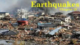
Earthquakes Chapter 19
Crustal Movement: Stress – The total force acting on crustal rocks per unit of area. 3 TYPES OF STRESS: Strain – The deformation of materials in response to stress.
Types of Tectonic Stress • Tensional Stress- pulls outward (extensional stress) • Compressional Stress- pushes inward • Shearing- pulls in two opposite directions
Deformation Elastic vs. Plastic Caused when a material is compressed, bent or stretched. Similar to stretching a rubber band by pulling on the ends. Caused when a material is permanently deformed. Similar to pulling a rubber band until it actually breaks. • The point at which Earth’s crust has reached its elastic limit is when permanent deformation occurs.
Folds (elastic deformation) – There are 2 types of bends that can occurs in Earth’s crust. Anticline folds up like a capital “A” Syncline “sinks”
What is an Earthquake? a sudden and violent shaking of the ground, sometimes causing great destruction, as a result of movements within the earth's crust or volcanic action. San Francisco 1906 – fence moved 8 feet
Faults (plastic deformation) – breaks in the Earth’s crust along which Earth’s crust moves. Faults produce 2 sides (walls): Foot wall – The side of the fault which is thicker at the bottom (you can “walk” up it) Hanging wall – The side of the fault which is thicker at the top (you can “hang” from it)
TYPES OF FAULTS Normal Fault – Tension pulls rock apart, forcing the footwall up and the hanging wall down. Normal Fault Animation
Normal Fault Stress = Tension
Normal Fault Examples Left: Fault scarp near Hebgen Lake, Montana, after the magnitude 7.1 earthquake of August 18, 1959, shows a displacement of 5.5 to 6.0 m. Right: This section of the normal fault scarp was produced by the earthquake of October 28, 1983, at Borah Peak, Idaho. Left: Dixie Valley-Fairview Peaks, Nevada earthquake December 16, 1954
TYPES OF FAULTS Strike-Slip Fault – Shearing forces two parts of Earth’s crust past each other with NO vertical movement. Strike-Slip Animation
Strike-Slip Fault Stress = Shearing
Strike-Slip Faults - Transform Faults • Strike-slip faults result from shear stresses acting on the lithosphere along transform boundaries. • Horizontal motion can be right lateral or left lateral. • Earthquakes along these boundaries tend to be shallow focus with depths usually less than about 100 km. Richter magnitudes can be large.
TYPES OF FAULTS Reverse Fault – Compression causes the hanging wall to move up and the footwall to move down. Reverse Fault Animation
Reverse Fault Stress = Compression
Below: Before and after pictures of the 2,000 yr. old citadel in the city of Bam, the largest mud-brick structure in the world. Reverse Fault Example – Collision ZonesBam, Iran 2003 Earthquakes in Iran and neighboring regions (e.g., Turkey and Afghanistan) are closely connected to their position within the active Alpine-Himalayan belt near the convergence of the Arabian and Eurasian plate. Map showing the Alpine-Himalayan Belt. The Mw 6.5 Bam Earthquake destroyed nearly 80% of the adobe buildings killing more than 26,000 people.
Thrust Faults - Reverse Faults • Reverse faults result from compressional stresses along convergent boundaries. • The hanging wall block has moved up relative to the footwall block. • A Thrust Fault is a special case of a reverse fault where the dip of the fault is less than 15o • It is a reverse fault at a very low angle. • There are two types of converging plate boundaries. • Subduction boundaries • Collision boundaries Left: Thrust Fault
Reverse, Normal, or Strike-Slip Fault? Normal Fault Tension Hanging Wall Sinks Down
Reverse, Normal, or Strike-Slip Fault? Reverse Compression Hanging wall is pushed up
Reverse, Normal, or Strike-Slip Fault? Strike-Slip Shearing No Vertical Movement
Earthquakes Defined Earthquakes are vibrations of the earth caused by the rupture and sudden movement of rocks that have been strained (deformed) beyond their elastic limit. The forces that cause deformation and the build-up of strain energy in the rock are referred to as stresses. Earthquakes occur along faults. Faults are fractures in the lithosphere where regions of rock move past each other (displaced). Inside Earthquakes Video
Earthquake Terminology • The focus is the point on the fault where rupture occurs and the location from which seismic waves are released. • The epicenter is the point on the earth’s surface directly above the focus. • When the fault ruptures, waves of energy called seismic waves spread out in all directions.
Earthquake Seismic Waves • Body waves travel through the interior (body) of the earth as they leave the focus. They include P-waves and S-waves. • Surface waves travel parallel to the earth’s surface. They are the slowest and most damaging. They include Love and Rayleigh Waves.
Interior seismic waves – These waves travel through the inner layers of Earth. Primary Waves Secondary Waves -Travel twice as fast as S-Waves. -Compressional Movement: rocks are squeezed and pushed in the same direction as the wave moves. -Move similar to a slinky that is stretched and then released. -Travel half as fast as P-Waves. -Rolling Movement: rocks shifted up and down perpendicular to the direction of the wave. -Move similar to a rope that is being shaken up and down. COMPARE P WAVES AND S WAVES
Shadow Zones – Areas on Earth where no seismic waves are recorded. -P waves can travel through all of the layers (solid, liquid and plastic), but they are deflected in different directions as they move from one layer to another. -S waves can travel through solid and plastic layers, but not liquid layers (the outer core). Shadow Zones
Surface Waves Surface waves travel parallel to the earth’s surface. They are the slowest, involve the greatest ground motion, and are therefore most damaging. They include: Love Waves - complex, horizontal motion Rayleigh Waves - Rolling or elliptical motion. -When combined, these waves move the ground up and down and side to side simultaneously. -They cause the most damage because the create the most ground movement and take the longest time to pass an area.
Distance from the EpicenterSeismic waves attenuate with distance.
Locating the epicenter of an Earthquake: Triangulation Scientists use seismic data received from at least 3 stations to triangulate (the same process GPS uses) the epicenter of an earthquake. We will explore this process more in lab.
Seismogram Seismogram - the record of an earthquake as recorded by a seismograph. It is a plot of vibrations versus time. Refer to pages 45-46.
How do we measure earthquakes? Richter Scale Mercalli Scale -Created by Charles Richter in 1934. -This scale measures earthquakes based on the largest seismic wave recorded during a quake. -The scale is from 0-10. Every whole number up on the scale represents an increase in energy of ten times more. -The original scale used to measure quakes. Created in 1902 by Giuseppe Mercalli. -Considered less accurate, because it uses eyewitness observations of damage to estimate the intensity of the quake. MERCALLI SCALE
Moment Magnitude Scale **This is the most accurate scale used today** -Introduced in 1979. -Measures earthquake strength based on the amount of energy released by calculating size of the fault, amount of movement, and type of rock (stiffness). -The moment magnitude scale is preferred over the Richter scale by seismologists because it is more accurate. -When hearing about an earthquake on the news, this is typically the final, most accurate magnitude given.
Earthquake Depth Shallow earthquakes cause the most damage. Intermediate earthquakes cause moderate damage Deep earthquakes cause the least damage.
Types of Faults The majority of earthquakes (90%) are caused by rocks rupturing in response to tectonic stresses at active plate margins.
Subduction Boundaries • At subduction boundaries there is a continuum of stress along the subducting plate. Shallow focus earthquakes can be generated near the trench, but focal depths can reach down to 700 km as earthquakes are generated along the subducting plate. • Rocks are strong under compression and can store large amounts of strain energy before they rupture. Therefore, these earthquakes can be very powerful. • 1960 Southern Chili = 9.5 • 1964 Alaska = 9.2 .
Reverse Fault Example –Subduction ZonesChile 1960 On May 22, 1960 the largest earthquake on record struck the coast of Chile with a Mw of 9.5. The earthquake ruptured along a 1,000 km length of the subduction zone. In Chile, the earthquake and the tsunami that followed took more than 2,000 lives. From Chile the tsunami radiated outward, killing 61 people in Hawaii and 122 in Japan. Left: Stuck to the subducting plate, the overriding plate gets squeezed. Right: An earthquake along a subduction zone happens when the leading edge of the overriding plate breaks free and springs seaward, raising the sea floor and the water above it. This uplift starts a tsunami.
Collision Boundaries • At collision boundaries two plates of continental lithosphere collide resulting in fold-thrust mountain belts. • Earthquakes occur due to the thrust faulting and range in depth from shallow to about Example: The Himalayas from the collision of India with Asia
Transform Fault Example The San Andreas Fault System The San Andreas Fault is the main strand of a zone of parallel faults resulting from interaction between the relative northwest movement of the Pacific Plate compared with the North American Plate.
Surface Faulting and Ground RuptureLand Uplift and Subsidence Ground rupture and surface faulting occur due to horizontal or vertical displacement of faults that break the surface. Damage can result from the ground shifting upward (called uplift) or downward (called subsidence). Above: The photo shows a fault scarp -- a cliff created by movement along a fault. This scarp formed during the 1992 Landers, CA, quake. Left: The 1999 Taiwan earthquake caused ground movement over a fault rupture of 50 miles. The photo shows a fresh scarp cutting across the running track at a local high school.
Liquefaction Liquefaction is a quicksand like condition that occurs in water-saturated soil and rock. The shaking of earthquake waves causes the soil or rock to turn into a weak, fluid-like mass. Structures built on areas that liquefy may fall over or sink. The figure below shows how liquefaction can occur. Shaking of water-saturated soils causes the particles to settle, driving the water out from between the particles and forcing it upward, thus liquefying the areas above. Above: Buildings in Niigata, Japan, fell over when the sediments below them liquefied during the 1964 earthquake
Landslides Vibration of water saturated sediment can force water into pore spaces between sediment grains reducing friction and permitting the mass to slide down slope. Turnnagin Heights,Alaska,1964
Famous Earthquakes – write in notes section at bottom of page 1) Anchorage, Alaska - March 27, 1964 -This is the most powerful U.S. earthquake in recorded history. -It registered as a 9.2 on the Richter scale. -The rumbling lasted nearly 5 minutes. -Ground fissures, collapsing buildings, and tsunami killed over 130 people. 2) San Francisco, California – 1906 (7.7 on Richter) -Significant earthquake in that it was one of the first instances where scientists were able to record information on seismic waves. -Caused approximately $400,000,000 of damage (at the time) -Several eye-witness accounts refer to the movement of the roads to be similar to the undulation of waves in the ocean. -Fires raged on for days, and S.F. had to be rebuilt.
Famous Earthquakes 3) Indian Ocean – December 26, 2004 -9.2/9.3 magnitude earthquake, making it one of the most powerful ever recorded on Earth. -The infamous tsunami that ensued killed over 200,000 people. -Released an amount of energy 1502 times more powerful than the Hiroshima atomic bomb. 4) Chile – May 22, 1960 -The most powerful earthquake ever officially recorded at a magnitude of 9.5. -The damage is estimated to be at over 3 billion dollars, and nearly 6,000 killed. -Once the red slab that is “stuck” finally gives way, this is when the earthquake occurs. The recoil of the plate causes the energy to be released.
Recent Earthquakes: Haiti-7.0 on 1/12/10, 52 aftershocks, over 250,000 dead and 1,800,000 homeless. Quake was created by a blind thrust fault with a very shallow quake and poor constructed homes lead to high deaths Chile (2/27/10) 8.8 (MM) shook central Chile creating a tsunami. Lasted 3 minutes and was ranked as 8th largest in the world and killed 802 people. Japan- 3/11/11, 8.9 shallow quake created a 23-30 foot tsunami which spread over 1500 miles, around 11,000 dead at this time but numbers will increase, nuclear crisis still impacts the soils and water/ocean of Japan. http://www.google.com/imgres?imgurl=http://www.japan-tsunami-2011.com/images/japan_earthquake_1846151c.jpg&imgrefurl=http://www.japan-tsunami-2011.com/&usg=__XwcXEmd6hcfdbHzaSjBGbCyx7kQ=&h=287&w=460&sz=38&hl=en&start=15&zoom=1&um=1&itbs=1&tbnid=1HhweKiZ7Q3
Largest Quakes in History • May 22, 1960, Chile (9.5) The world's most powerful earthquake left 4,485 people dead and injured and 2 million homeless and killed a further 170 people as the tsunami hit the coasts of Japan and the Philippines. • March 27, 1964, a magnitude 9.2 hit Prince Island Sound, Alaska. The earthquake caused landslides in Anchorage and raised parts of outlying islands by as much as 11 meters. The 67meter high tsunami killed another 128 people. • December 26, 2004, a magnitude 9.1 hit Sumatra, Indonesia. (The Tsunami of the Impossible) The deadliest tsunami ever spread to 14 countries killing 230,000 thousand people. • November 4, 1952 a magnitude 9.0 hit Kamchatka, Russia, known as the USSR. A volcanic peninsula was the epicenter but the tsunami hit Hawaii. No deaths occurred but it was 3000 miles from the epicenter. • Largest Quakes in US History • Largest Quakes Since 1900
Tsunami A series of waves that occurs when the ocean is disturbed by earthquakes, underwater explosions or impacts. 12/26/04- Southeast Asia experienced a large scale earthquake along the Ring of Fire that created a series of tsunamis that killed 225,000 people and displaced over 1.2 million people! The tsunami slammed into the coasts of several nations within two hours after the quake. tsunami animation


