Download
1 / 15
160 likes | 361 Vues
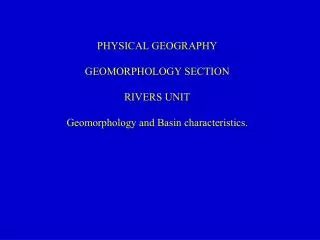
PHYSICAL GEOGRAPHY GEOMORPHOLOGY SECTION RIVERS UNIT Geomorphology and Basin characteristics. To understand the Physical Geography of rivers, you must understand one key concept:. Speed means energy. Energy means the ability to erode and carry material.

E N D
PHYSICAL GEOGRAPHY GEOMORPHOLOGY SECTION RIVERS UNIT Geomorphology and Basin characteristics.
To understand the Physical Geography of rivers, you must understand one key concept: Speed means energy. Energy means the ability to erode and carry material. Low energy means material is deposited. Sooooooooooooo... River features are all either due to erosion or deposition, depending on the speed of the river at that point.
Table of Contents: 1. Stages of a river. 2. Drainage basins. 3. A sample of Geomorphological features.
1. Stages of a river. A. Known as the Youthful or Upper stage. B. Known as the Mature or Middle stage. C. Known as the Old Age or Lower stage.
1. Stages of a river. The youthful stage : -steep -fast -fairly straight -erosion is mainly vertical
1. Stages of a river. The mature stage : -less steep -slower -bends -erosion is mainly horizontal
1. Stages of a river. The old age stage : -fairly flat -slow -meandering -erosion is mainly horizontal. -deposition predominates. http://www.geo.duke.edu/geo41/str.htm
2. Drainage basins. -the area in which all raindrops eventually drain into the same river system, ocean, or lake, is called its DRAINAGE BASIN. -other terms meaning the same thing (usually describing more local areas) are CATCHMENT and WATERSHED. The Amazon drainage basin. http://boto.ocean.washington.edu/gifs/river_maj.gif
2. Drainage basins. -smaller rivers that drain into larger rivers are called TRIBUTARIES -pieces of higher land between tributaries are called INTERFLUVES -higher ground between drainage basins is called a DIVIDE.
3. Geomorphological features. -SAPPING -undercutting of rock behind a waterfall. -causes an overhang which eventually falls. -result is migration of the falls upstream. -caused by erosion.
3. Geomorphological features. LEVEE -a flowing river carries particles in suspension. -when the river floods it loses speed. -when it loses speed it deposits particles... -first the larger, heavier particles... -then the smaller, lighter particles -the result is a large pile of coarse materials at the river bank. -this pile, extended all along the bank, forms a small ridge called a LEVEE. -artificial levees are also built to protect floodplains from floods.
3. Geomorphological features. -MEANDER -occurs in fairly flat areas. -Speed is greater on the outside of the bend. -therefore erosion occurs on the outside of the bend, and deposition on the inside.
3. Geomorphological features. -OXBOW LAKE -erosion on outside of a meander causes a “neck” to form. -eventually erosion breaks through the neck, and deposition occurs where the meander used to go. The cut off portion is an oxbow lake.
3. Geomorphological features. If you thought those diagrams were good... -OXBOW LAKE -erosion on outside of a meander causes a “neck” to form. -eventually erosion breaks through the neck, and deposition occurs where the meander used to go. The cut off portion is an oxbow lake.
3. Geomorphological features. -DELTA -where a river empties into a large body of water, such as a sea, ocean, or lake, it loses SPEED... -so it loses energy... -so it deposits suspended material. -since it is no longer constrained by riverbanks, and since it gradually loses speed as it reaches further into the sea, the result is a triangular formation, called a DELTA. -famous examples are the Mississippi: and the Mackenzie: