Download
1 / 57
570 likes | 591 Vues
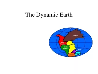
The Dynamic Earth. Why is the Earth not flat?. Or other questions such as Why are the continents where they are? Why are they the shapes they are Why are there mountains? How are they formed? In 1912 Alfred Wegener proposed the Theory of Continental Drift

E N D
Why is the Earth not flat? • Or other questions such as • Why are the continents where they are? • Why are they the shapes they are • Why are there mountains? How are they formed? • In 1912 Alfred Wegener proposed the Theory of Continental Drift • Pangea (all lands) and Panthalassa (single ocean)
Evidence • Puzzle pieces • Africa and South America seem to “fit” together • Fossils • Eg. Mesosaurus (270 M years ago)
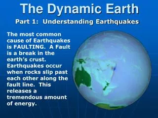
Evidence • Geological • Age and type of rock formations • Appalachians and similar mountains in Scotland and northern Europe • Climate changes • Evidence of glaciation in S.A and Africa • Coal deposits in US, Europe and Siberia
Mechanisms • WW II introduced sonar – noticed that the ocean floor was not flat • 1947 started mapping the Mid-Atlantic Ridge • part of a series of mid ocean ridges that extends around the world • rock they brought up was younger than continental rocks • none more than about 170 M years old
Mechanisms • sea floor spreading • Harry Hess suggested the theory/hypothesis that the valley at the center of the ridge was actually a rift or break in the Earth’s crust and that new rock was welling up from deep within the Earth
Mechanisms • Paleomnagnetism • As magma rising from the mantle cools, any magnetic mineral particles in it orient themselves to align with the Earth’s magnetic field • Scientists examined the cores from the ocean floor and found rocks with magnetic orientation pointing south, not north • When the rocks were dated it was found that those with the same magnetic variations were the same ages • The pattern was the same on each side of the ridge
Mechanisms • Paleomagnetism con’t • The intervals were not of the same length each time making the pattern unique • 1965 scientists finally accepted that the Earth’s magnetic pole does regularly reverse itself • How does Iceland provide good evidence for this theory?
Plate Tectonics • Is the name given to the modern theory that is based on Wegener’s original idea but that now incorporates so much more • This theory is not just about the continental plates moving but also includes the mechanisms that drive this movement • This explains the formation of many features of the Earth’s crust
Plate tectonics • There are two types of crust • Oceanic crust and continental crust • The two crusts combine to form the lithosphere – the thin outer shell of the Earth • This rides over the asthenosphere which is the layer of liquid or plastic rock that flows under pressure
Plate tectonics • The plates of the lithosphere ride on the more fluid asthenosphere • Most plates are made up of oceanic and continental crust • About 30 plates have been identified and they vary is size • How the plates interact with each other has created the major surface features of the Earth
Divergent Boundary • Two plates moving away from each other • When this happens the gap is filled with material from the asthenosphere • The Mid-Atlantic ridge is one example (all ocean ridges are divergent) • Rift valleys form where the plates separate, for exampleRed Sea, Great Rift Valley (Kenya)
Composite heat-flow model obtained by merging age-dependent model heat-flow from Stein & Stein [1992]. Color scale is selected to show detail in continental areas of relatively low heat-flow. All spreading ridges were assigned uniform 0.3 W/m2 conductive heat flow along their centers.
Divergent plates • Mid ocean rift valleys are typically broken into segments called fracture zones • These are perpendicular to the ridge • Movement along the fracture zones are a major cause of earthquakes along mid ocean ridges
Divergent plates • Mid ocean ridges are also the location for hydrothermal vents on the ocean floor that contain formerly unknown life forms who ecology is based on chemosynthesis and not photosynthesis
Convergent Boundaries • These are plates that are colliding with each other • Three different possibilities exist to deal with the excess of material at a single location • -Subduction boundaries • Ocean trenches and Island arcs • -Collision boundaries
This occurs when oceanic crust converges with continental crust Oceanic crust is denser so it is subducted or forced beneath the lighter continental crust This creates a region known as a subductionzone Subduction boundaries
Subduction zones • Other consequences of subduction include the formation of volcanoes and island arcs
Volcano formation • When the ocean crust moves under the continental crust heat and pressure plus ocean water cause the solid material to melt • For this reason chain of volcanoes are often found associated with convergent plates. • One of the best known examples is the Pacific “Ring of Fire” • Costal mountains in North America such as Mount St. Helens
Ocean Trenches • These are created where plates converge and are some of the deepest places on the planet • E.g Marianna Trench off the coast of the Marianna Islands near Japan • 11,000 m or 36,000 ft or over 6.5 miles deep
Island arcs • These are formed when the volcanoes at the subduction zone are not under a continent but instead form a ring of volcanic islands. • Examples – Aleutian Islands, Japan, Philippines, Indonesia
Collision Boundaries • When two continental crusts converge the material cannot be subducted instead the continental masses pile on top of each other forming mountain ranges • Himalayas, Rocky Mountains etc.
This occurs when two plates are moving past each other Since this not a smooth passing they tend to grind against each other Pressure builds up as the plates scrape past each other Movement tends to be in a series of jerks, often released with great force, known as earthquakes Transform Boundaries
The San Andreas fault is one of the best known due to its location in such populated areas in California It moves at about 5 cm year in some areas Some have not moved in over 100 years Mid ocean fractures are also examples of transform boundaries. Transform Boundaries San Francisco 1906
Mechanism of plate motion • Convection is considered the most likely mechanism that causes plates to move • There are three possible hypotheses that may account for these movements • Mantle convection • Ridge push • Slab pull
Magma that is hotter and less dense than its surroundings rises upwards at a mid-ocean ridge This creates one side of a convection cell As it moves it drags the lithospheric plate with it. Cooler plate material sinks down at a subduction boundary This balances out the new material being produced at the mid-ocean ridge This hypothesis may not explain the enormous force needed to move the plates Mantle convection
Ridge push • As new magma rises at the mid-ocean ridge it is less dense and floats • As it cools it becomes more dense and gravity causes it to slide away from the ridge and new molten magma rises • Computer models suggest that cooling subsiding rock could help drive plate movement – called ridge push
Slab pull • At subduction boundaries one plate is denser and heavier than the other • Since this is heaver and cooler than the mantle it continues to sink pulling the rest of the plate with it. • The force of sinking edge exerts on the rest of the plate is called slab pull.
Plate tectonics and Supercontinents • About 250 million years ago all the continents were formed into one landmass • Previous combined landmasses had existed • Data for many is reduced to evidence from cratons • The ancestors to the modern continents were smaller and land mass has increased over time • Whether surface rock is increasing, decreasing or constant is not certain at this time • Once complete super continent cycle takes 300 – 500 million years
Plate tectonics and Supercontinents • The oldest ocean floor is about 170 m years but the oldest rock is dated to 4 b years ago. • This means that knowing the history of landmasses comes from piecing together geological bits – either cratons (core continental rock) or terranes (from collisions) • Deep sea and river sediments and igneous rock also help build continents
Laurentia, the North American Craton • Some of the oldest rock in the world is found here (3.96 b yrs) • The craton shows the approximate shape 1 b yrs ago • The exposed parts are known as Canadian Shield, the rest is covered by sediment
Nena – about 1.8 b yrs ago Columbia (also called Nuna) – about 1.8- 1.5 b yrs ago Rodinia –about 1.1b - 750 m years ago) Pannotia – about 600 -540 m years ago Euramerica – about 300 m years ago Pangea – about 300 -180 m years ago Laurasia – about 300 -60 m years ago Gondawana- about 600 -30 m years ago Previous continents
Supercontinent breakup • Pangea broke into two smaller masses called Gondwana and Laurasia about 180 m yrs ago • Over time each of these broke up into smaller landmasses who shapes began to resemble present continents.