Download
1 / 19
190 likes | 347 Vues
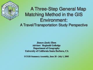
A Three-Step General Map Matching Method in the GIS Environment: A Travel/Transportation Study Perspective. Jianyu (Jack) Zhou Advisor: Reginald Golledge Department of Geography University of California Santa Barbara, CA UCGIS Summery Assembly, June 28 - July 1, 2005. Outline.

E N D
A Three-Step General Map Matching Method in the GIS Environment: A Travel/Transportation Study Perspective Jianyu (Jack) Zhou Advisor: Reginald Golledge Department of Geography University of California Santa Barbara, CA UCGIS Summery Assembly, June 28 - July 1, 2005
Outline • Introduction • Problem Statement • A general three-step map matching methodology that combines heterogeneous techniques: a) data processing; b) curve-to-curve mapping; c) noise and off-road travel discernment. • Conclusion and future research
Introduction • Map matching: the process of correlatingtwo sets of geographical positional information. • Application area: travel behavior/transport study, car navigation, car tracking, spatial data conflation, etc. • Point-to-point matching, point-to-curve matching, curve-to-curve matching • On-line matching and Off-line matching
Map Matching in Travel Study Perspective • In travel/transportation studies, map matching is used as a means to transfer the road network attributes to the mapping travel route in order to derive certain travel behavior. • Map matching in travel/transportation studies aims at: 1) identifying the correct road links traversed by the traveler; 2) ensuring that the identified links form a meaningful travel route; and 3) expect to help answer queries beyond the direct matching result.
Problem Statement-matching factor selection • Proximity, Heading and others: • “GPS position relative to the road link” ; • “average distance traveled on current link” and; • “large distance traveled on current road link” • Different select criteria could also result in conflicting matching conclusions. • Combine the selecting factors • A weighting scheme • Bayesian Belief Theory and Dempster-Shafter’s rule
Problem Statement- matching integrity • Selection criteria helps identify a series of the matched road segments from the pool of candidate links. They might show up as a group of disconnected “paths.” • Curve-to-curve matching: connecting the GPS points in sequence to form piece-wise linear curves • Improvement on point-to-point point-to-curve matching: topology relations to guide the search for the next matching candidate and eliminate unreachable links.
Defects with Existing Map Matching Methods • Weight-based map matching (Yin and Wolfson ,2004), Fuzzy-logic based map matching (Syed and Cannon, 2004), General map matching (Quddus et al, 2003) • Examinations of several map matching methods revealed: • Ignore global information, matching to branch. • Position of the street node and GPS sampling frequency affects matching results. • Doesn’t allow repetitive visit of street links.
A Three-step General Map Matching Methodology (1) Data Preprocessing - Cluster reduction: • Reduce the systematic noise in the data. Clusters phantom the slow moving speed and random travel directions of the GPS carrier. • DBSCAN (Ester et al., 1996) clustering algorithm for cluster searching since it doesn’t need assumption on the number and shape of the clusters in the input data.
A Three-step General Map Matching Methodology (1) Data preprocessing - Density leverage: • Dynamically adjust the GPS data sampling frequency against the model resolution of the base street map. • Generating pseudo GPS points when GPS sampling interval is greater than the length of a traversed street link
A Three-step General Map Matching Methodology (2) • Matching procedure -Curve-to-curve Matching: • GPS recorded travel trace is treated as a translated and rotated version of the matching route. • Dual selection criteria: accumulated 2-norm distance (A2ND) and rotational variation metric (RVM). • Develop a pool of the best candidates simultaneously and incrementally. • A2ND and RVM both serve to constrain the match search in the street network space. Two ranked solution pools are derived in terms of A2ND and RVM separately.
A Three-step General Map Matching Methodology (2) • Topological completeness: determine potential turning action around a street intersection: • The projection of current GPS point falls on or out of the end point of the current link, • The projection of the current GPS point comes near to the end point of the current link, but the point’s position is getting away from the current link, • The candidate set of next traversed link: the topologically connected links to the intersection node. Filtered with Prohibited maneuver and turn restriction info.
A Three-step General Map Matching Methodology (2) • Use the rank aggregation method to combine the ranking solution list in A2ND and RVM to obtain a combined ordering: • Kemeny ordering minimizes the sum of the “bubble sort” distances and thus generates the best compromise ranking. It is a NP-hard problem. • Borda’s method: Each candidate in the list is assigned a score of the number of candidates ranked blow it. Its total score across the different ranking list is finally sorted in a descending order. • Footrule optimal aggregation:Given n lists of same set of elements, generate the median permutation of the candidates in the lists.
A Three-step General Map Matching Methodology (1)(3) • Off-Road Travel/Noise Discernment Dempter-Shafter theory (Shafer, 1976) Yes Yes 1 1 No No 1 1 Perhaps Perhaps 1 1 90 20m 30m Heading Assignment Proximity Assignment
Conclusion • The method is unique in • 1) data preprocessing with point cluster reduction and density leverage, • 2) offering the candidate solution within a pool of “the best” • 3) balancing of matching results from multiple matching factors with rank aggregation • 4) intelligently utilizing the basic network constraint attributes with “expert rules” to increase the matching accuracy • 5) and Dempster belief test to discern the noise and off-road travel