Greenland Ice Sheet model simulations and validation
320 likes | 569 Vues
Greenland Ice Sheet model simulations and validation. Jeremy Fyke, Bill Lipscomb Los Alamos National Laboratory. Outline. Simulated Greenland surface mass balance in CESM Greenland Ice Sheet model optimization within CESM framework Ongoing development. Background.

Greenland Ice Sheet model simulations and validation
E N D
Presentation Transcript
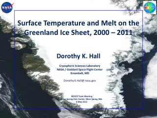
Greenland Ice Sheet model simulations and validation Jeremy Fyke, Bill Lipscomb Los Alamos National Laboratory
Outline • Simulated Greenland surface mass balance in CESM • Greenland Ice Sheet model optimization within CESM framework • Ongoing development
Background • The Glimmer Community Ice Sheet Model (Glimmer-CISM) has been coupled to version 1.0 of the Community Earth System Model (CESM 1.0). • Shallow-ice approximation; Greenland only • Higher-order ice sheet model (CISM 2.0) to be included in CESM 1.1 (aiming for Nov. 2012 release) • The surface mass balance (SMB) of ice sheets is computed in the Community Land Model (CLM) and passed to Glimmer-CISM. • Multiple (~10) glacier elevation classes on CLM’s coarse grid • Downscaled and interpolated in z to CISM’s fine grid
Model details • Fully coupled CESM 1.0 with 0.9 ox 1.25o FV atm/land, 1o ocean • Focusing on the surface mass balance (accumulation minus ablation) of the Greenland ice sheet • SMB(ice+snow) = incoming snow + incoming rain – runoff – sublimation • Positive ice SMB when snow exceeds max depth (1 m water equivalent) and turns to ice • Negative ice SMB when snow depth is zero and bare ice melts • The SMB of ice (not snow) is passed to the ice sheet model • Snow and ice physics: • Liquid water can percolate and refreeze in the snow, but not on bare ice • Snow albedo follows SNICAR model (depends on snow grain size, solar angle, etc.) • Bare ice albedo is prescribed (0.60 visible, 0.40 near IR)
CMIP5 simulations with glacier elevation classes, SMB evolution 2000 2100 1850 Pre-industrial 1940 400 Gt/yr 400 Gt/yr SMB = 0 SMB = 0 • Lower SMB in the 1940s than in the 1990s and 2000s • Negative SMB in several years after 2060
Greenland SMB, downscaled to 5 km Red = net accumulation Blue = net melting kg m-2 yr-1 • 1980-99 ablation rates are higher than pre-industrial in N & NE • The equilibrium line rises by ~500 m by end of 21st century • It reaches almost 2000 m in the NE and southern half of E margin • High snowfall rates help to keep equilibrium line low in NW and mid-W margins
SMB, comparison with RACMO (at 5 km res) • Good match in ablation zones • Accumulation rates are overestimated in the interior and underestimated in the SE (smoother orography in CESM) • Snowfall local maxima along W coast and impact on melt (via albedo) are well captured
Temperature and SMB: 1850-2005 JJA mean temperature over ice sheet Precip -5o -10o Melt Pi Runoff SMB 1850 2005 1850 2005 • Warm period during 1930s and 1940s, with high melt • Precipitation rates are higher in the 1990s • High SMB following Pinatubo (Pi) eruption in 1991
Temperature anomalies: 2080-99 minus 1980-99 annual JJA • MOC reduction reduces warming SE of Greenland • JJA increase is highest • In ice-free regions to N & E, in part due to stronger sea ice losses (>40%) along the coast • In the interior of the ice sheet, which remains below melting point
SMB (Gt/yr): 1980-2100 Blue = Precip Red = Melting Green = Runoff Black = net SMB SMB = 0 1980 2100 • Precipitation increases with time • Melt and runoff increase by a larger amount • SMB is negative for the first time around 2030
Summary: Greenland SMB • The SMB scheme works well. Greenland’s simulated 20th century surface mass balance and trends are in good agreement with RACMO, a state-of-the-art regional model (with differences due to smoother CESM topography). • During the 21st century simulation, the SMB decreases from ~400 Gt/yr to near zero. • Greenland average warming in the 21st century is roughly equal to global average warming. There is more warming in the North and East (less summer sea ice) than in the Southeast (reduced MOC).
Ice sheets in RASM • Coupling to CISM is included in the current version of the CESM coupler; should not be hard to include in RASM. • The coupler requires the ice-sheet surface mass balance in multiple elevation classes from the land model. Next step is to implement a similar scheme in VIC. • How much code can be reused from CLM?
Greenland Ice Sheet (GIS) optimization • Will be necessary for GIS in RASM • Carried out in support of SeaRise: model intercomparison project to assess range of modelled ice sheet responses to idealized climate perturbations (Δclimate, Δdynamics) • Initial state of ice sheet should reflect observed ice sheet: exercise in rapid (1 month turnaround) model optimization • Tool: Latin Hypercube Sampling of uncertain parameter space
Optimization approach • Generate 100 GIS realizations with LHS-determined random combinations of: • Ice sheet enhancement factors • Basal sliding coefficients • Geothermal heat fluxes • Compare equilibrium state (after 9 kyr simulation) to observed GIS state for: • Ice volume error • Ice area error • RMSE of ice surface elevation • Maximum ice elevation error • Summit horizontal offset error • Rank models by ‘worst diagnostic ranking’ to get best all-around GIS realization
Optimization approach SeaRise simulations 9000 years future today
Optimization results: example GIS model-observed elevation differences
Optimization results: dependence of diagnostics on LHS parameters
Optimization results: top-performing ice sheet model realizations
Ice sheet spinup issues • Spinup/optimization issues to work on: • Thermal timescale of ice sheet (thus, ice viscosity) is 105 years – analogous to spinning up the deep ocean (but worse!) • How to spin up a GIS model, using forcing that is continuous between past and future, that captures transient thermal and geometric state of ice sheet? • LHS ensemble limited to sampling internal ice sheet parameters
Conclusions • LHS sampling provides a fast way to determine optimal initial state for GIS models within a climate model framework • Flow factor exerts major control on ice sheet optimization in CISM • Similar optimization technique will be necessary to optimize the GIS under RASM forcing • RASM surface mass balance field (reflected in long-term GIS spinup geometry) will be sensitive indicator of regional atmospheric model biases
Ongoing development • New ice-sheet dynamical cores • Payne-Price: 3D higher-order, finite difference, structured grid, Trilinos solvers • BISICLES: Vertically integrated higher-order, finite volume, Chombo adaptive mesh refinement software • FELIX: Full-Stokes/higher-order, finite element, unstructured variable-resolution mesh (MPAS framework), Trilinos solvers • BISICLES and FELIX will be further developed under a new 5-year DOE SciDAC project, Predicting Ice Sheet and Climate Evolution at Extreme Scales (PISCEES).
Ongoing development • Improved physics parameterizations • Subglacial hydrology and basal sliding (S. Price, M. Hoffman) • Calving (based on Potsdam-PIK) • Two-way coupling with land model • Requires dynamic landunits (glaciers vegetation) • May not be important on decadal time scales • Coupling with ocean model • POP2X simulates ocean circulation beneath ice shelves (X. Asay-Davis); will be applied to Antarctica • May not be practical for RASM in near term; Greenland fjords require very high resolution (~1 km)
SMB trend 1958-2005 (kg m-2 yr-2) • Negative trend in ablation zones • Positive trend in the Southeast, due to increasing precipitation • Consistent with RACMO results and altimetry measurements
Terms of SMB: 1980-1999 • Runoff = Melt + Rain - Refreezing > 0 in the interior of the ice sheet, where all available liquid water should refreeze • In CLM, rain is overestimated in ice sheet interior (and rain cannot refreeze if snow thickness = 1 m w.e.) SMB Melt Runoff Rain
21st century temperature increase (ref: 1980-1990) global Greenland + ocean Greenland ice sheet JJA annual Temperature anomalies for 2080-2099
Seasonal cycle of melt Solid black line = Ice melt, 1980-1999 Solid red line = Ice melt, 2080-2099 Dotted black line = Snow melt, 1980-1999 Dotted red line = Snow melt, 2080-2099 J F M A M J J A S O N D • Length of snow melt season does not change (melt season begins in April) • Ice begins to melt ~15 days earlier and melts for ~15 days more in late September