Download
1 / 39
390 likes | 418 Vues
This report discusses the current status and major actions/recommendations for carbon observations from space. Participants are invited to provide input on the actions, responsible parties, and completion plans.

E N D
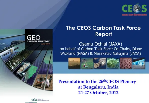
CEOS Strategy for Carbon Observations from Space Masakatsu Nakajima (JAXA) and Diane E. Wickland (NASA)CTF Side Meeting at CEOS SIT-28 Hampton , Virginia, USAMarch 11, 2013
Outline for Side Meeting Discussion • Background on rationale and plan for developing the report • Current status of the report • Summary and discussion of major CEOS actions / recommendations included in the report, seeking CEOS SIT participant inputs regarding: • Reasonableness of actions / recommendations • Owners / responsible parties for actions/ recommendations • “Missing” actions / recommendations • Issues or concerns about actions / recommendations • Plans for completion of the report
CEOS Response to the GEO Carbon Strategy CEOS established the Carbon Task Force (CTF) to coordinate the response from space agencies to the GEO Carbon Strategy: CEOS Strategy for Carbon Observations from Space
Rationale • CEOS established the Carbon Task Force (CTF) to coordinate the response from space agencies to the GEO Carbon Strategy. • Take into account information requirements of both the UNFCCC and IPCC and consider how future satellite missions will support them • Also take account of, and be consistent with, the GCOS and GEO Implementation Plans. • Help definition of next generation missions for individual agencies • Provide a basis for systematic observation and reporting of progress towards satisfying society’s carbon information needs
CEOS Response to the GEO Carbon Strategy: Approach to Report • Carbon Task Force co-leads (JAXA & NASA) take overall responsibility. • Domain leads have been identified by CTF to develop the atmospheric, terrestrial (land) and oceanic chapters: • Atmosphere: Prof Berrien Moore (Univ. Oklahoma, USA) • Land: Prof Christiane Schmullius (Univ. Jena, Germany) and Dr. Ralph Dubayah (Univ. Maryland) • Ocean: Dr Shubha Sathyendranath (Plymouth Marine Laboratory, UK) • And the Integration chapter: • Integration: Dr. Stephen Plummer (European Space Agency) • Domain leads supported by co-authors from the international EO scientific community based on recommendations made by CTF members as well as from the domain leads. • Follows the model of the CEOS Response to the GCOS Implementation Plan with actions identified for each domain and for integration as the basis for monitoring and reporting. • Recognised that the GEO Carbon Strategy Report may not cover the full spectrum of societal needs and CEOS should aim to address this.
Outline and Leads for CTF Report CEOS Strategy for Carbon Observations from Space Executive Summary (Nakajima, Wickland, Plummer) Section 1: Introduction (Nakajima, Wickland, and Ward) Section 2: Land Domain (Schmullius and Dubayah) Section 3: Ocean Domain (Sathyendranath) Section 4: Atmosphere Domain (Moore) Section 5: Integration (Plummer) Section 6: The Way Forward (Wickland, Nakajima, Plummer) Appendices
Domain Chapter Authors Atmosphere: Berrien Moore (University of Oklahoma) John Burrows (Universität Bremen) David Crisp (NASA Jet Propulsion Laboratory) Michio Kawamiya (Japan Agency for Marine-earth Science and Technology) Martin Heimann (Max Plank Institute for Biogeochemistry, Jena) Ray Nasser (Environment Canada) Peter Rayner (Laboratoire des Sciences du Climat et de L'Environnement) Ocean Shubha Sathyendranath (Plymouth Marine Lab) Prakash Chauhan (Indian Space Research Organization) Watson Gregg (NASA Goddard Space Flight Center) Nicolas Hoepffner (Joint Research Centre) Joji Ishizaka (Nagoya University) Johnny Johannessen (Nansen Environmental and Remote Sensing Centre) Milton Kampel (Instituto Nacional de Pesquisas Espaciais) Tiit Kutser (University of Tartu) Trevor Platt (Bedford Institute of Oceanography) J-H Ryu (Korea Ocean Satellite Center)
Domain Chapter Authors Land Chris Schmullius (Friedrich-Schiller University Jena) Ralph Dubayah (University of Maryland) Warren Cohen (USDA Forest Service) Eric Kasischke (University of Maryland) Kyle McDonald (City College of New York) Shaun Quegan (The University of Sheffield) Jean Ometto (Instituto Nacional de Pesquisas Espaciais) Stephen Plummer (European Space Agency) Steven Running (University of Montana) Sassan Saatchi (NASA Jet Propulsion Laboratory) Masanobu Shimada (Japan Aerospace Exploration Agency)
Current Status of Report • Atmosphere chapter completed in February 2013; some minor editing (e.g., references, formatting) in process • Ocean and Inland Waters chapter completed in February 2013; some minor editing (e.g., co-author proofing, references, formatting) in process • A complete draft of the Integration chapter was circulated to all co-authors and the CTF executive team in February 2013 and is in revision • Complete draft of revised Land chapter circulated to all co-authors and CTF executive team on March 5, 2013 • The Introduction and Way Forward chapters are being drafted
Actions / Recommendations • Each Chapter’s writing team took a slightly different approach to crafting their actions / recommendations statements: • Some followed CEOS response to GCOS IP format • Some made statements in text • Some sorted by types of actions • Some did not draft them as CEOS actions and/or may not have fully taken into account CEOS’s role • We recognize that when we integrate the report, we will need to: • Format and organize the statements consistently across chapters • Re-draft (and in some cases, possibly reconsider) some statements to more appropriately reflect what CEOS can do and be reasonably expected to address • Reduce the total number of actions / recommendations by integrating similar actions within and across chapters • Add one or more recommendations about implementation, likely in the Way Forward chapter
Land Chapter Actions / Recommendations • Develop satellite observations of forest height and biomass from such sensors as Lidar and P-band SAR and Pol-InSAR to meet the global requirements for forest biomass carbon stock and stock change. CEOS Action: Continue to strongly advocate for new satellite remote sensing missions that can be used to map aboveground biomass and forest height, including P-band SAR, Pol-InSAR, and Lidar. Such missions should clearly support climate treaty frameworks such as REDD+. • Develop and implement approaches to map wetlands, wetland inundation, and small lakes and ponds at medium resolutions (30 to 100m). CEOS Action: Continue research needed to develop approaches for developing land data products for mapping wetlands, wetland inundation and mapping small lakes and ponds. Implement projects to develop these essential land products at regional and global scales.
Land Chapter Actions / Recommendations 3. As new satellite remote sensing systems are launched and their data become available, conduct inter-comparison of land remote sensing products to ensure consistent global data sets. CEOS Action: Continue (and initiate if necessary) programs for the systematic inter-comparison of land data products that are generated from data collected by new remote sensing systems as they are launched. 4. Improve the continuity of land surface products through enhancements of the historical moderate resolution vis/IR and thermal IR data record. CEOS Action: Continue and expand projects focused on generation of moderate-resolution land remote sensing products using historical data records. 5. Expand development of land surface data products from historical medium resolution vis/IR data sets. CEOS Action: Continue and expand projects focused on generation of medium-resolution land remote sensing products using historical data records.
Land Chapter Actions / Recommendations 6. Develop data fusion and data assimilation algorithms using a combination of remote sensing data (Lidar, SAR, vis/IR) at medium to moderate resolutions (100-250m) to improve the accuracy of land variables. CEOS Action: Continue and expand projects focused on generation of land remote sensing products using historical and planned data records that require the use of multiple satellite data sets. 7. The collection of reference data needed for calibration and validation for all land remote sensing products should be regular and sustained. CEOS Action: Encourage national agencies to supply ground reference data in support of calibration and validation requirements. Support efforts to develop networks for providing observations needed for calibration and validation of land remote sensing products. 8. Provide spatial error characterization of land variables. CEOS Action: The Working Group on Calibration and Validation to expand the number of land variables currently being addressed by the land product validation sub-group.
Ocean and Inland Waters Chapter Actions / Recommendations Mission 1. Continuity: Ocean colour, SST and Microwave Sensors, for generation of products listed above, with stability and precision commensurate with GCOS Requirements. CEOS Action: CEOS and member agencies to ensure continuity of satellite missions with adequate on-board calibration and sustained cal/val operations. Coordinate efforts with corresponding Virtual Constellation and Climate activities of CEOS. Mission 2. Coastal waters: In contrast to the open ocean, the high spatio-temporal complexity of coastal regions requires a dedicated, oriented coverage rather than a global coverage. High spatial resolution (better than 0.5 km) is needed as well as fast repetition rate (< 1 day) for the observation of specific and often transitory events (e.g. unusual or transient algal blooms). In addition the challenging optical nature of coastal turbid waters entails more spectral channels in the visible spectrum (e.g. MERIS-type) that are not necessarily required for the open ocean. CEOS Action: Ensure continuity of MERIS-type missions.
Ocean and Inland Waters Chapter Actions / Recommendations Mission 3. Inland water bodies: Current estimates on the number of lakes on Earth are based on statistics showing that lakes and reservoirs cover a much greater portion (around 3%) of the Earth’s land surface than previously thought. Majority of the lakes in the world are small. Use of ocean-colour sensors such as MODIS or MERIS is therefore fairly limited in lake carbon research. On the other hand, land remote sensing sensors with sufficient spatial resolution (such as Landsat) do not have sufficient sensitivity to estimate lake CDOM content and monitor long-term trends. At present there are only a few sensors (such as ALI on EO-1 used in papers by that are suitable for mapping lake CDOM/DOC/pCO2 but they do not provide full global coverage. The launch of Landsat 8 and Sentinel-2 will change the situation, as sensors on both these missions will provide data with sufficient spatial and radiometric resolution as well as the global coverage needed for lake research. CEOS Action: Ensure prompt launch and continuity of missions such as Landsat 8 and Sentinel-2.
Ocean and Inland Waters Chapter Actions / Recommendations Mission 4. New missions: Ocean colour: MERIS-class sensors at full resolution meet most coastal requirements with respect to spectral, temporal and spatial resolution. But it is recognised that there are specific applications in coastal and inland-water bodies that require higher resolution in time, space and spectral domains. MERIS-type or better spectral resolution is needed for phytoplankton functional types and phytoplankton carbon by type); higher spatial resolution for certain coastal applications (of order 30 m, for applications including floods, tides, river discharge). Some of these requirements may be met through geostationary satellites. CEOS Action: CEOS member agencies to coordinate geostationary missions to ensure global coverage at most latitudes, complemented by polar-orbiting satellites for polar coverage. Mission 5. New Missions: Salinity (to derive alkalinity, improve pCO2 estimates). Improvements in spatial requirement over SMOS and Aquarius-type sensors needed, especially for coastal and inland water applications. CEOS Action: Explore potential for future salinity missions with higher spatial resolution.
Ocean and Inland Waters Chapter Actions / Recommendations Product/Processing 1. Global-scale validation of algorithms for estimating pools of carbon from satellite data, in carbon units, in close collaboration with in situ observation systems. CEOS Action: CEOS to encourage member agencies to include components of the ocean carbon pool among products from satellite data, and to ensure that they are validated appropriately. Link to CEOS Working Group on Cal/Val activities. Link to GEO Blue Planet initiative, which brings together communities engaged in satellite as well as in situ observations. Product/Processing 2. Ensure appropriate merging of different sensors to get a consistent, bias-free time-series of all products in Table 2 for climate impact analyses. Models exist, for example, in the CCI initiative of ESA, and the MEASURES project of NASA, but they do not cover all the carbon products required. CEOS Action: CEOS to coordinate satellite time-series product development to ensure appropriate merging of data and products from multiple sensors for climate impact analyses. A product-based approach rather than a mission-based approach is needed.
Ocean and Inland Waters Chapter Actions / Recommendations Product/Processing 3. Provide error characterisation of products. It is necessary to provide adequate error characterisation of ocean carbon products, ideally on a pixel-by-pixel basis, to ensure that the products are used appropriately. CEOS Action: The Working Group on Calibration and Validation to establish a sub-group dealing with validation and error characterisation of ocean carbon products analogous to the land product validation sub-group. Ocean Integration 2. Development of regional Cal/Val, air-sea fluxes and carbon measurement networks; adequate archival and distribution Ocean Integration 2. Development of regional Cal/Val, air-sea fluxes and carbon measurement networks; adequate archival and distribution Ocean Integration 3. Improved assimilation of ocean-colour data products in coupled ocean circulation and bio-geochemical models. Need of providing ocean-colour data with pixels/grid wise error estimates.
Ocean and Inland Waters Chapter Actions / Recommendations Ocean-Land 1. Compare similarities and differences between models for satellite-based estimates of terrestrial and oceanic primary production, to facilitate comparison of the two components of global primary production (see GCOS-GTOS workshop on the topic hosted by JRC, Ispra, a couple of years ago). CEOS Action: Member agencies engaged in development of carbon products to ensure compatibility and comparability and consistency of carbon products across two or more domains. Example: PAR products and primary production in land and ocean. CEOS Working Group on Climate to undertake this task. Ocean-Land 2. Fresh-water aquatic flora (lakes, rivers, reservoirs and wetlands) and associated biological productivity for land carbon budgeting. CEOS Action: Ocean-Land 3. River discharge
Ocean and Inland Waters Chapter Actions / Recommendations Ocean-Atmosphere 1. Retrieval of oceanic products (e.g. chlorophyll, water-leaving radiances, photosynthetically-available radiation) relies on knowledge of various atmospheric products (e.g. ozone, surface pressure, winds, aerosols including absorbing dust and soot). It is believed that the most consistent and accurate state estimation of the atmosphere arise from reanalyses (such as available from ECMWF). Different space agencies do not necessarily use the same reanalysis products. It is important that the best atmospheric products for use in retrieval of ocean products be identified, and used consistently across space agencies. CEOS Action: Virtual constellations to explore the use of consistent auxiliary data across sensors.
Atmosphere Chapter Actions / Recommendations Given that OCO-2 will launch in late 2014 or early 2015 , it is particularly important to extend the GOSAT mission as long as possible to provide continuity/overlap with OCO-2, especially since the ENVISAT mission has ended, and therefore, we will no longer have SCIAMACHY. Both of these objectives drive observational accuracy and coverage, with greater accuracy, precision, coverage and frequency required for constraining sources and sinks at finer space and time scales. Therefore, for the challenge of monitoring point sources like power plants, it has been recommended that Geostationary (GEO) satellites might be the best approach, since they provide continuous coverage of a selected area. However, consensus on the best observing strategy has not yet emerged, which might suggest that a balanced approach including LEO and GEO observations, would offer the most benefit. The strategy will require a coordinated effort among those doing surface based, in situ, and remote measurements, as well as engagement with the broader community studying carbon fluxes from ecosystems, which would include FluxNet among others.
Atmosphere Chapter Actions / Recommendations These are important tenets. There is only a slight expansion that would be needed; namely, to include within the context of the first tenet, the role of geostationary platforms, as noted by the previously referenced Jason study in the United States. In fact, the potential geostationary role may be implicit with tenet #1. This is not to suggest that Agency plans are not of value for moving forward; however, the focus of the first generation of greenhouse gas satellites has been on accurate measurements (useful) but with much less attention being given to ensuring adequate coverage, resolution, or repeat frequency (shortfall). Moreover, the stated Agency plans that were used in the GEO Carbon Strategy June 2010 are now quite out-of-date in critical areas: baseline missions have been moved out in time and/or left undefined and hence more distant.
Atmosphere Chapter Actions / Recommendations Given the extraordinary importance of climate change and the intrigue and close coupling of carbon and climate, it s useful to consider the remarkable role and structure of the operational systems for coordinated meteorological observations used in numerical weather prediction (NWP), which consist of multiple satellites in LEO and GEO orbits, aircraft, balloon, and ground observing systems; it is a true system of systems. This system presents a model for the type of satellite constellations, as part of this needed system of systems, which could be developed for CO2 and CH4 emissions monitoring. NASA’s Geostationary Coastal and Air Pollution Events (GEO-CAPE ) mission to launch after (how much after is unclear) 2022 aims to measure CH4 and other gases. Although it is not formally targeting CO2, broad spectral range instruments are being considered for the mission and some of these could be designed to include CO2 bands (and the O2 A-band) yielding GEO observations with the appropriate characteristics for emissions monitoring. The possibility of CO2 capability on this GEO mission and any others should therefore be thoroughly considered.
Atmosphere Chapter Actions / Recommendations The CarbonSat has been selected for Phase A B1 studies by ESA for its Earth Explorer Opportunity 8 Mission. If selected for CD studies this mission would start around 2020. In addition, the concept of a CarbonSat constellation has been proposed . ESA/EUMETSAT Sentinel 5 is planned to have some CO2 and CH4 capability, but at present, it has a sub-optimal selection of spectral channels for CO2 when compared to OCO-2 and CarbonSat . The Polar Communications and Weather (PCW) mission of the CSA is expected to launch around 2018 and will use two operational satellites in HEOs to obtain quasi-geostationary observations of northern latitudes for meteorological purposes. An enhancement to the mission called PHEOS (Polar Highly Elliptical Orbit Science) is being considered which would use an imaging FTS with heritage from GOSAT for NIR and TIR observations of northern CO2, CH4 (along with the O2 A-band), and air quality gases. The PHEOS atmospheric concept completed Phase A, and a decision from the CSA on inclusion of atmospheric research instruments will be made in the coming years.
Atmosphere Chapter Actions / Recommendations Finally, for any constellation the issue of validation and cross-calibration must be seriously considered. There is a clear need to developing an internationally coordinated and comprehensive global observing system that would a) provide the necessary information for fundamentally increasing our knowledge of the global carbon cycle and b) support monitoring and verification of CO2 and CH4 emissions for international purposes.
Integration Chapter Actions / Recommendations CTF-CEOS-I-1) To establish better links to the carbon cycle community in general and specifically focusing collective efforts on data provision for major model-data inter-comparison efforts. CTF-CEOS-I-2) To strengthen mechanisms for product validation, in particular the interface between in situ and satellite observations. CTF-CEOS-I-3) Collaboration in the development and strengthening of existing Key Science Bodies to act as product clearing-houses, independent assessment mechanisms following for example the efforts of IOCCP and GHRSST. CTF-CEOS-I-4) Reinforce efforts in cross-calibration and methodological inter-comparison CTF-CEOS-I-5) Reinforce multi-agency planning for satellites to ensure the priority observations are made in the future. CTF-CEOS-I-6) Ensure that the baseline observations required for carbon cycle science and policy related matters are maintained and the long-term archive preserved whilst maintaining efforts on calibration consistency
Integration Chapter Actions / Recommendations CTF-CEOS-I-7) Convene workshops on the interface between models (land-ocean-atmosphere) of the carbon cycle and satellite data products to reconcile methodological differences and spatial compatibility. CTF-CEOS-I-8) Promote consistency between individual and multiple space agency efforts addressing specific aspects of the carbon cycle to ensure there is methodological traceability and compatibility between studies conducted at different resolutions e.g. FCT v global model. Ultimately the idea would be to have FCT sites as validation supersites for carbon science. CTF-CEOS-I-9) Promote and encourage efforts at individual space agency level to inter-compare product outputs of relevance to the carbon cycle. Reinforce the mechanisms already in place in CEOS (WGCV for land, VC for atmosphere and ocean, WG Climate) to ensure this is achieved. Support existing mechnaisms ex-CEOS in this endeavour (e.g. GHRSST, IOCCP, GOFC-GOLD)
Integration Chapter Actions / Recommendations CTF-CEOS-I-10) Actively pursue a CEOS role within major model-data inter-comparison exercises as the point of reference for appropriate satellite products. CTF-CEOS-I-11) Identify the priority measurements to meet carbon cycle science and policy needs (see domain chapters) and target those measurements in future sensor calls. CTF-CEOS-I-12) Ensure that the carbon cycle community is actively engaged in the sensor selection process (not just associated to proposals) and in particular sensor and platform development. CTF-CEOS-I-13) Ensure that the products required for carbon studies in terms of their temporal resolution are available to the carbon cycle community. These require identification with the carbon cycle community since different temporal resolutions are required for different purposes (seasonal, ‘diurnal-weekly’, monthly, long time-series
Integration Chapter Actions / Recommendations CTF-CEOS-I-14) Ensure there is a continuous interface between the research agencies (ESA, NASA et al) and those with an operational mandate (NOAA, Eumetsat et al) to ensure long-term continuity opportunities for successful research systems are planned in advance. CTF-CEOS-I-15) Reinforce collaborative efforts to ensure products generated by different agencies are inter-compared and compatible. CTF-CEOS-I-16) Encourage the development of experiments designed to evaluate policy needs following the model of FCT (p32 GEOCS). CTF-CEOS-I-17) Ensure that the data required in a) are supplied and mechanisms developed to ensure these data are effectively evaluated using funding streams available at individual space agency level. CTF-CEOS-I-18) Identify the priority missing components for emissions/storage/stock assessment that are capable of being addressed with satellite data
Integration Chapter Actions / Recommendations CTF-CEOS-I-19) Encourage the development of these experiments in line with required in situ observation needs in addition to the satellite observations (e.g. for FCT are in situ observations present and models/methodologies available) CTF-CEOS-I-20) Develop (with WG Climate and WGCV) effective protocols for the generation of products from individual satellites and platforms and implement these to ensure long-term consistent datasets relevant to carbon cycle communit CTF-CEOS-I-21) Ensure that the generation of individual products takes account of ancillary data dependence (land cover, aerosol, cloud, DEM et al) such that there is consistency across individual variables. CTF-CEOS-I-22) Enforce requirements for clarity and traceability in the generation of products – make all necessary documentation public (p38 GEOCS). CTF-CEOS-I-23) Develop guidelines for the specification of uncertainty for given products from signal counts through the various CEOS Processing Levels
Integration Chapter Actions / Recommendations CTF-CEOS-I-24) Reinforce the activities of the WGCV for land products to generate validation methodologies, protocols and benchmark datasets for validation. At CEOS-GEO Level engage with in situ observation networks to make data collections compatible with the needs of satellite validation and ensure in situ data are accessible to the satellite community (GAW, Argos, Fluxnet, RAINFOR, AMAZZONICA, GEO-Carbon, TCCON). Reorganise the WGCV/VC interface to provide clear responsibilities for validation for all domains (land, atmosphere, ocean). Where necessary reinforce to individual agencies the need for investment in product validation as part of satellite development CTF-CEOS-I-25) Work closely the carbon cycle/climate communities, in particular for any upcoming inter-comparison activities (e.g. for IPCC) on data standards to ensure the data products generated with satellites are provide for these activities in the appropriate and consistent formats. Such data collections should be provide with clear information of product content to permit appropriate use. Coordination with ESGF is recommended
Integration Chapter Actions / Recommendations CTF-CEOS-I-26) Ensure through collaboration with major inter-comparison activities (model-data, data-data, multiple data-stream) that the appropriate data is available and accessible. This should be undertaken as a CEOS community effort in common with point f). Previous examples of this could serve as a model e.g. ISLSCP-I, II. CTF-CEOS-I-27) For each of the relevant variables in each of the domains assess the current provision of validation data in terms of quality (defined by protocols e.g. WGCV LAI protocol) and spatial and temporal coverage, identify potential additional sources and develop strategy to improve global in situ data distributions in relation to satellite validation and model parameterisation. Exploit existing infrastructures to develop key intensive collection sites. CTF-CEOS-I-28) Review current use of data products including current data limitations in collaboration with the carbon cycle community. Develop guidelines for appropriate data use and invest in mechanisms for community product assessment. Improve interaction through joint workshops targeting specific data needs, use and interfaces.
Integration Chapter Actions / Recommendations CTF-CEOS-I-29) At CEOS level establish improved interfaces to major inter-comparison exercises e.g. CMIP5, CxMIP, OCMIP, RECCAP dedicated to the carbon cycle. CTF-CEOS-I-30) In collaboration with the carbon cycle community identify for the period 2020 onwards what the key priorities for satellite observations (data gaps, process gaps) are and target these in satellite mission calls CTF-CEOS-I-31) Engage the carbon cycle community in the process of satellite development (beyond just association to proposals) in particular continuous updating of progress and engagement in key decision making steps. CTF-CEOS-I-32) For the near-term (2015-2020) identify any opportunities to develop additional items in support of existing planned missions as joint activities CEOS agencies and industry (e.g. DMS approach), national agencies (at least in Europe). Confirm key priority missions in land (BOIOMASS, DESDyNI-R), ocean (??) and atmosphere (OCO-2, GOSAT-2, CarbonSat).
Integration Chapter Actions / Recommendations CTF-CEOS-I-33) Ensure commitment to long-term continuity and archive exploitation for existing resources in terms of product generation specifically for the carbon cycle community. CTF-CEOS-I-34) Identify the priorities in terms of measurements in the context of time (2015-202-2025) and space (increasing resolution of needs) from the CEOS standpoint and issue to the carbon cycle community for feedback and eventual confirmation. CTF-CEOS-I-35) Request the carbon cycle community, through existing conduits (IOCCG, GCP, GHG-SAG, TRANSCOM, GAW), to undertake the same process for all domains. CTF-CEOS-I-36) Convene a working meeting of select representatives form the EO and carbon cycle communities to compare the two perspectives and produce a synthesized output with timelines. CTF-CEOS-I-37) Engage the carbon cycle community to support and hence protect collectively the existing planned missions
Integration Chapter Actions / Recommendations CTF-CEOS-I-38) Identify the Key Science and Policy Bodies that represent the international carbon community and engage them collectively (IOCCG, GCP, GHG-SAG) through the mechanisms of GEO. Reinforce these groups to permit them to undertake the work envisaged above and take advantage of existing major investments e.g. GEO-Carbon, USCCP in this process. CTF-CEOS-I-39) Exploit existing structures e.g WG Climate in pursuit of common objectives for climate and carbon. A Task group of WG Climate could be identified for carbon activities.
Plans for completion of report • Finish integrating report in March 2013. • Conduct internal CEOS Review – ask all CTF members to review carefully and to help ensure Space Agency representation and perspectives are adequately incorporated into each chapter and ensure appropriate people in their agencies review the final draft. [Side meeting on 11 March a first step; one or more full CTF teleconference calls will follow] We request your (CEOS SIT representatives) help as well! • Will then request review of final draft by CEOS, Global Carbon Project leadership, GEO Carbon Community of Practice, and the authors of the GEO Carbon Strategy. • Will revise report as needed in response to reviews in April-June 2013. • Anticipate delivery / release by end of August 2013.
Thoughts on Implementing the Strategy After the CEOS Strategy for Carbon Observations from Space has been completed and released in final form, CEOS will need to consider how to implement the strategy and report its progress • What CEOS entity or entities should be responsible for coordinating implementation of the recommendations/actions and monitoring progress on them? • Does the CTF or some variation on this group need to continue? • Should another Working Group do it? Should the actions be divided up and assigned to relevant Working Groups and Virtual Constellations? • Does CEOS need one or more new Virtual Constellations (e.g., GHG) • How should CEOS interact with GEOSS and UNFCCC in implementing and reporting on the report’s recommendations/actions? • Carbon supplement to our biennial GCOS IP response to UNFCCC? • Updated in synchrony with GCOS IP response?