Download
1 / 25
250 likes | 544 Vues
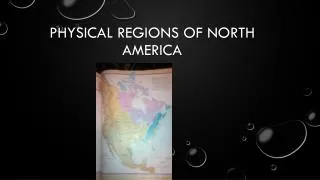
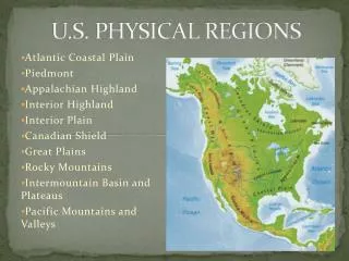
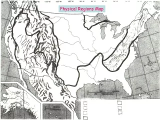
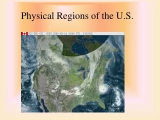
Physical Regions of the U.S. Coastal Lowlands. Southeastern Maine to Eastern and Southern U.S. to Eastern Texas. Forests of hickory, oak, pine, and other trees. Three Subdivisions. The Piedmont Southern New York to Atlanta. In the north referred to as the fall line.

E N D
Coastal Lowlands • Southeastern Maine to Eastern and Southern U.S. to Eastern Texas. • Forests of hickory, oak, pine, and other trees. • Three Subdivisions
The Piedmont • Southern New York to Atlanta. • In the north referred to as the fall line.
The Atlantic Coastal Plain • Piedmont to Atlantic Ocean, New England to Florida • In the south, cotton, vegetables, citrus fruit, and tobacco. • Resorts and Beaches
Gulf Coastal Plain • Florida to Southern Texas • Fertile Farmland • Petroleum and natural gas
Appalachian Highlands(Mountains) • Maine to Alabama • White Mts., Green Mts., Cumberland Mts., Allegheny Mts., Great Smokey Mountains
Resources • Coal • Iron • Oil
Foliage: Forest of Pine, Oak and Maple • Highest Point: Mt. Mitchell in N.C. 6,684 ft
Canadian Shield • Area around the Great Lakes • Covered by glaciers as recently as10,000 years ago • Forest of Spruce, and Fir • Many winter outdoor activities
Interior Plains • Extends from Appalachians to the Rocky Mountains
Sub Regions • Central Lowlands • From the Appalachian mtns To just west of the Mississippi River. • Rich farmland for soybeans and corn
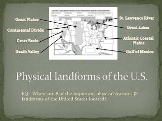
Great Plains • From the Rocky Mountains to west of the Mississippi • Known to the pioneers as the “ Great American Desert” • Grassland • Bison • Grain Farming • Cattle and sheep ranching
Ozark Plateau/Highlands • Between the Central and Gulf Coastal lowlands in Southern Missouri, Northwest Arkansas and Eastern Oklahoma. • Much of the area is poor farming except in the river valleys. • Coal, Iron Ore and other minerals are valuable resources
Rocky Mountains • The largest mountain system in North America that extends from Alaska to Southern New Mexico • Known as the Continental Divide, it separates water flowing to the Pacific and Atlantic Oceans. • Forests cover the lower slopes of the mountains and they are the home to many types of wildlife. • Timber, mining and recreation are the important industries of the area.
Some cattle and sheep are raised in the valleys and meadows and crops are grown in the lower valleys. • The highest place is Mt. Elbert in Colorado at 14,433 ft above sea level.
Intermountain Region • Located between the Rockies and the Pacific Coast Mountains • Subdivisions: • Columbia Plateau • Colorado Plateau • The Basin and Range Area
Columbia Plateau • Located in Washington, Oregon, Idaho, and Northern Nevada • Fertile volcanic soil, best grain and fruit crops in the northwest
Colorado Plateau • Unusual land forms in America such as flat topped rock formations, natural bridges, Grand Canyon • Indians lived here in cliff dwellings
The Basin and Range Area • The mountain and desert lowlands between the Columbian and Colorado Plateaus • Also known as the Great Basin
Includes “Death Valley” the lowest place in elevation in the U.S. at 282 ft. below sea level.
The Pacific Coast Mountains and Valleys • The coast from southern California to Alaska • Evergreen forests provide raw material for lumber and paper
Volcanic activity formed the Cascades, Lassen Peak in California and Mt. St. Helen’s in Washington, volcanoes today.
The eastern boundary is the Cascade Range in the north and the Sierra Nevada Range in the south.
The Sierras are granite mountains with many lakes and waterfalls.
The western boundary is the coast range which hassome major harbors such as Puget Sound and San Francisco Bay.