Download
1 / 19
190 likes | 293 Vues
Explore the physical regions, rock types, and climates of Western Canada. Learn about Igneous, Sedimentary, and Metamorphic rocks, the Canadian Shield, Interior Plains, Western Mountains, and climate factors affecting temperature and precipitation.

E N D
Types of Rock -Igneous -Sedimentary -Metamorphic
Igneous Rock • Rock formed from the hardening of molten material (magma/lava) • Intrusive-formed beneath the Earth’s surface (from magma) • Extrusive-formed above the Earth’s surface (from lava)
Metamorphic Rock • Rock changed from its original form: • Heat • Pressure • Erosion
Sedimentary Rocks • Rock made of sediment deposited in layers which have formed together
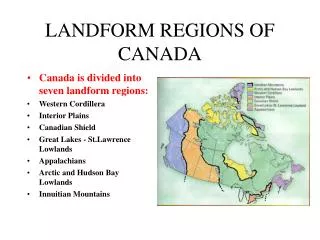
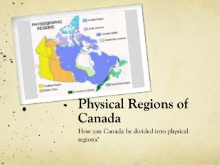
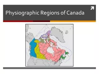
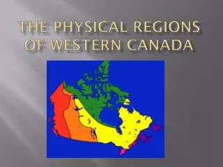
The Canadian Shield • Shield: large masses of hard rock that other areas of the continents have formed • largest and oldest region of Canada • once as high as the Himalayas; eroded down • Mostly Igneous rock and metamorphic rock • Many minerals (copper, gold, lead and nickel), • not very suitable for agriculture.
The Interior Plains • The area between the Canadian Shield and the Rocky Mountains • Sedimentary rock made from eroded material from the Canadian Shield • Other layers were created from deposits of plants and animals • Formed deposits of fossil fuels (oil and natural gas)
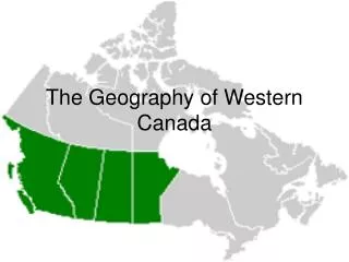
The Western Mountains The Rockies The Coastal Mountains The Insular Mountains
Parallel mountain ranges separated by plateaus and valleys • The Rockies and the Coastal Mountains were formed by plate collision that caused the Earth to rise. • Plate tectonics also created valleys, plateaus, and trenches • River and glacial erosion sculpted the rough landscape • many minerals: copper, gold and coal
The Climates of Western Canada • Continental climate: the climate of a continent’s interior • Temperature extremes • Low precipitation • Maritime climate: a coastal climate • Mild temperatures • High precipitation
Factors Affecting Temperature • Latitude: determines the amount and intensity of sunlight it receives. • North: sun rays hit the Earth at a lower angle • Length of days vary more from season to season • Higher temperatures in the south than in the north
2. Altitude • The higher the altitude, the colder the temperature • Every 150m rise in altitude = 1 degree drop in temperature
3. Distance from the Sea • Land surface warms up and cools down faster than the water surface • Large land masses has more extreme temperatures • High temperatures in the summer • Low temperatures in the winter • Areas near the water have more moderate temperatures
4. Wind Direction • Winds blowing from the sea have a moderating effect • Winds blowing off the land bring with them the extreme weather • The West Coast of Canada is the only area with temperatures above ‘0’ in the winter
5. Ocean Currents • Ocean currents are warm or cold depending where they come from • Currents warm or cool the air that passes over it • Warm air can hold more water than cold air
Precipitation • The amount of precipitation in an area depends on: • its distance from the sea • Prevailing winds • There are 3 types of precipitation: • Orographic • Convectional • Frontal
Orographic Precipitation Windward Side • Moist air rises and moves up the mountain • As the air cools, the vapour condenses, forming clouds and then rain falls Leeward Side • As the air descends on the eastern side, it becomes warm and dry (the rainshadow) • The descending air warms and picks up moisture • Very common in the Western Mountains region
Convectional Precipitation • Convectional precipitation results from the heating of the earth's surface that causes air to rise rapidly. As the air rises, it cools and moisture condenses into clouds and precipitation. • Very common in the prairie provinces.
Frontal Precipitation • Frontal precipitation results when the leading edge( front) of a warm air mass meets a cool air mass. The warmer air mass is forced up over the cool air. As it rises the warm air cools, moisture in the air condenses, clouds and precipitation result. • This precipitation is common in Atlantic Canada.