Download

1 / 59
600 likes | 640 Vues
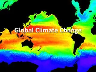
Explore graphs and data showing historical sea levels, ice melt patterns, and temperature records. Learn about greenhouse gases, human activities, and climate change drivers. Discover potential effects on species distributions.

E N D
This graph, based on the comparison of atmospheric samples contained in ice cores and more recent direct measurements, provides evidence that atmospheric CO2 has increased since the Industrial Revolution. (Source: NOAA) Much of the information from this presentation comes from: http://climate.jpl.nasa.gov/
The chart on the left shows historical sea level data derived from 23 tide-gauge measurements. The chart on the right shows the average sea level since 1993 derived from global satellite measurements, updated here monthly. Sea level rise is associated with the thermal expansion of sea water due to climate warming and widespread melting of land ice. http://climate.jpl.nasa.gov/keyIndicators/
This illustration on the left shows areas where ice melt occurred for more than three days over Greenland during 2007. Areas in which melt occurred for longer time periods are shown in a darker red while those areas melted for fewer days are shown in lighter red.
The time series shows the combined global land and marine surface temperature record from 1850 to 2007. The year 2007 was eighth warmest on record, exceeded by 1998, 2005, 2003, 2002, 2004, 2006 and 2001.
Between 1850 and 2007the eight warmest years on record were 1998, 2001, 2002, 2003, 2004, 2005, 2006 and 2007
The main cause of current global warming is an increased greenhouse effect caused by human activities http://climate.jpl.nasa.gov/causes/
The greenhouse effect results from heat energy being trapped in Earth’s atmosphere. In the past, much of this heat energy escaped Earth’s atmosphere. Today, increased greenhouse gases in the atmosphere don’t allow this energy to escape.
We live in a greenhouse http://climate.jpl.nasa.gov/causes/
Greenhouse gases • Water vapor • Carbon dioxide (CO2) • Methane • Nitrous oxide • Chlorofluorocabrons
Intergovernmental Panel on Climate Change, Fourth Assessment Report Greater than 90% chance that CO2, methane, and nitrous oxide increases in atmosphere as a result of human activities are responsible for warming patterns in the last 50 years.
Why have these gases increased in Earth’s atmosphere? Burning of coal and oil to fuel human civilization results in carbon and oxygen combining in the atmosphere to creat CO2 Clearing of forests also results in increased CO2 because forests typically take up CO2 so photosynthesis can take place
Could climate change be a result of changes in the amount of the sun’s energy that reaches Earth? Probably not
Evidence that changes in sun energy haven’t been responsible for climate change Since 1750, solar energy reaching Earth has been constant or increased slightly (based on sunspot and tree ring data) Warming has only occurred in Earth’s lower atmosphere, where greenhouse gases accumulate Climate models suggest solar energy changes can’t account for warming patterns of last century
Climate change drivers are categorized into Forcings—the ultimate drivers of climate change Feedback—processes that further influence climate change after being set in motion by forcings
Forcings Solar energy changes over time influence climate Particulate matter like aerosols, dust, or soot in atmosphere can result in cooling or warming
Feedbacks Ice-albedo feedback—ice reflects solar radiation. If ice melts because temperatures are rising, there is less ice to reflect solar radiation and more water to absorb it. More and warmer ocean waters on Earth will cause Earth to warm more.
Other important feedback phenomena Clouds Carbon cycle Ocean circulation Precipitation
Global climate change is predicted to have important effects on species’ distributions
Methods for studying climate change effects on distributions Comparisons over time Comparisons over space to determine if same responses are occurring in different parts of the world Modelling
Lenoir et al. 2008, plants in western Europe Question— Do species shift their optimal elevational range upward when the climate is warming? Question 2—Do species with particular life history traits have greater responses to climate change?
Studied forest plants in six mountain ranges in Europe, from sea level to 2600 m Used data from surveys conducted from 1905 through 1985 (early surveys) and compared these data to data from surveys conducted between 1986 and 2005 (late surveys)
1986 was chosen as the “break” year because at that year the average annual temperature shifted upward
Fig. 1. Climatic trends from 1965 to 2006. (A) Yearly mean surface temperature anomalies (using overall mean temperature as baseline) and (B) annual precipitation anomalies (using overall mean annual precipitation as baseline) averaged for 73 elevation sites in the French mountains ranging in altitude from 10 to 2010 m above sea level. Solid gray bars refer to positive anomalies, whereas open bars refer to negative ones. The solid curve is the smoothed average with use of a 10-year filter. The vertical dotted lines mark the split between the two studied periods. Data have been gathered from the French National Climatic Network (Météo-France). [View Larger Version of this Image (114K JPEG file)] Fig. 1. Climatic trends from 1965 to 2006. (A) Yearly mean surface temperature anomalies (using overall mean temperature as baseline) and (B) annual precipitation anomalies (using overall mean annual precipitation as baseline) averaged for 73 elevation sites in the French mountains ranging in altitude from 10 to 2010 m above sea level. Solid gray bars refer to positive anomalies, whereas open bars refer to negative ones. The solid curve is the smoothed average with use of a 10-year filter. The vertical dotted lines mark the split between the two studied periods. Data have been gathered from the French National Climatic Network (Météo-France).
Based on how many times each plant species was detected at particular elevations during the early surveys and the late surveys, scientists calculated the “optimal elevation” for the earlier and later time periods
There was a significant upward shift in optimal elevation for 2/3 of the plant species. The mean shift was 64.8 meters between the two time periods.
Fig. 2. Scatter diagram of forest plant species (n = 171) optimum elevation (i.e., altitude value at maximum probability of presence) for the periods 1905–1985 and 1986–2005. Each point represents one species: Species showing nonoverlapping 95% CIs around the optimum elevation between periods are displayed as solid triangles ( ) (n = 46), whereas species with overlapping 95% CIs are displayed as solid circles ( ) (n = 125) (see tables S1 and S2 for details) (23). (Inset) The distribution of the species differences in optimum elevation between periods. The vertical dotted line marks zero shift, and the vertical solid line marks the median shift. The arrow describes the direction of the shift. Fig. 2. Scatter diagram of forest plant species (n = 171) optimum elevation (i.e., altitude value at maximum probability of presence) for the periods 1905–1985 and 1986–2005. Each point represents one species: Species showing nonoverlapping 95% CIs around the optimum elevation between periods are displayed as solid triangles ( ) (n = 46), whereas species with overlapping 95% CIs are displayed as solid circles ( ) (n = 125) (see tables S1 and S2 for details) (23). (Inset) The distribution of the species differences in optimum elevation between periods. The vertical dotted line marks zero shift, and the vertical solid line marks the median shift. The arrow describes the direction of the shift.
Authors also found that species of higher elevation (mountainous areas) and species with shorter life cycles (i.e. faster rates of reproduction) showed the greatest upward shifts
Fig. 4. Magnitude of optimum elevation shifts for plant species in relation to their ecological and life history traits (23). Shifts in mean optimum elevation according to geographic distribution pattern (solid line and symbols) correspond to ubiquitous (n = 104), and mountainous species (n = 67). Shifts in mean optimum elevation according to life form (dotted line and open symbols) correspond to woody (n = 56) and grassy species (n = 115). Means are shown with standard errors. Significance of the magnitude of mean shift from the null hypothesis of zero shift is displayed for each trait (n.s. indicates nonsignificant, *P < 0.05, **P < 0.01, ***P < 0.001; Student's paired sample t test). Fig. 4. Magnitude of optimum elevation shifts for plant species in relation to their ecological and life history traits (23). Shifts in mean optimum elevation according to geographic distribution pattern (solid line and symbols) correspond to ubiquitous (n = 104), and mountainous species (n = 67). Shifts in mean optimum elevation according to life form (dotted line and open symbols) correspond to woody (n = 56) and grassy species (n = 115). Means are shown with standard errors. Significance of the magnitude of mean shift from the null hypothesis of zero shift is displayed for each trait (n.s. indicates nonsignificant, *P < 0.05, **P < 0.01, ***P < 0.001; Student's paired sample t test).
Results demonstrate upward shifts in optimal elevational range and that the magnitude of these shifts varies with species’ life history traits. Still unknown are how temperature shifts might interact with other changes like land-cover changes and the presence of invasive species to influence species’ distributions.
Hitch & Leberg 2006, North American birds Are distributions of North American birds moving north? Are distributional shifts similar to those seen in a study from Great Britain (similar results suggest a global cause may be responsible)
Methods Used Breeding Bird Survey (BBS) data
Volunteers drive routes each year during the peak of the breeding season in North America when bird singing should be at a peak Volunteers record all birds seen and heard during 3-minute stops each half-mile for 24.5 miles The data are available online
BBS has been going on since 1966 (Now it has expanded into other countries)
Investigators used data from east of the Rocky Mountains to exclude potentially confounding influences of geography Most bird species were used in analyses, except for game birds (because of human influences on distributions) and aquatic birds (because they may not be sampled well by BBS methods)
Birds with distributions not more north than 44° North were considered to have a southern distribution • Birds with distributions not more south than 34° North were considered to have a northern distribution
Figure 1. Sampling area (dark, solid line) for breeding bird distributions in North America. Figure 1. Sampling area (dark, solid line) for breeding bird distributions in North America.
Authors calculated whether birds with southern distribution had ranges that were shifting north and whether birds with northern distributions had ranges that were shifting south. It was necessary to do both types of calculations to exclude the possibility that all birds were experiencing range expansions for reasons not necessarily associated with climate change, like land-cover change for example
Authors use data from between 1967 and 1971 to compare to data between 1998 and 2002
Authors determined whether mean northern latitude (mean latitude determined from the 10 northernmost routes where the species was detected) had changed between the two time periods Analyses were conducted for all species simultaneously and for individual species
Results Birds with southern distributions showed a significant northward shift, averaging 2.35 km per year Birds with northern distributions did not show a significant southward shift Species varied in their individual responses but more species with southern distributions shifted north than shifted south
Results Results are similar to those of a study of birds from Great Britain, suggesting that a global force, likely climate change, is driving the shifts
Modelling approaches What are the advantages of modelling, as compared to field studies, to predict species’ responses to climate change?
Pearson and Dawson 2003 evaluate the bioclimate envelope modelling approach Use information that is known about how a species’ distribution relates to climate variables to describe the species’ “climate envelope” Then examine how future scenarios of climate change would affect species’ distributions, given their climate envelopes
Fig. 1 Simulated redistribution of suitable climate space for stiff sedge (Carex bigelowii) under future climate scenarios in Great Britain and Ireland as predicted by the SPECIES model (Pearson et al., 2002). Climate change scenarios are those of Hulme & Jenkins (1998). Suitable climate space is expected to be lost, with a general migration northwards as the climate changes.
Limitations of bioclimate envelope modelling Potential effects of biotic interactions on distributions, as well as other environmental characteristics like land-cover type, are not considered
Remember Connell’s work on impact of species interactions on distributions of barnacles However, at large scale, climate tends to be a dominant influence on distributions at large scales, so bioclimate envelope modelling that looks at distributions at large scales may reduce errors that stem from ignoring species interactions
Fig. 2 Observed European distribution of hard-fern (Blechnum spicant) alongside the distribution as simulated by the SPECIES model (Pearson et al., 2002). Presented as an example of the good agreement achievable between observed and simulated European-scale distributions using a bioclimatic model.
Fig. 3 Observed European distribution of yew (Taxus baccata) alongside the distribution as simulated by the SPECIES model (Pearson et al., 2002). Although the broad distribution trends are identified in the simulated distribution, the finer details of the distribution are not captured.