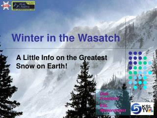
Winter in the Wasatch
Winter in the Wasatch. A Little Info on the Greatest Snow on Earth!. Dina Freedman KSL Meteorologist. Introduction. Utah is known for the “Greatest Snow on Earth” Light and fluffy Tons of snow Awesome Scenery and Mtns. It’s not super cold All around great for winter sports.

Winter in the Wasatch
E N D
Presentation Transcript
Winter in the Wasatch A Little Info on the Greatest Snow on Earth! Dina Freedman KSL Meteorologist
Introduction • Utah is known for the “Greatest Snow on Earth” • Light and fluffy • Tons of snow • Awesome Scenery and Mtns. • It’s not super cold • All around great for winter sports
Why is our snow so awesome? • It’s complicated, there’s no easy answer • If we knew the answers already, it would be a lot easier to predict! • Orographic Lifting • G.S.L. and Lake Effect • Synoptic Snows • Snowflakes
Mountain vs. City Snow • Salt Lake City’s average is about 58’’ • Alta’s averages about 520 inches a year • Max seasonal snowfall at Alta =743.5’’ (Nov 1983-Apr 1994) • Max snow in a season in SLC=117.3’’ (1951-1952)
Cool Facts • The Wasatch rise 4,000 to 6,500 feet in only 5 km to more than 11,000’ on the western slopes • Alta ski area typically observes 49 days per year with at least 5’’ and 21 days with at least 10’’ Can anyone guess the most snow in 24 hours at Alta? 55.5’’ Jan 5-6 1994
Snow Machine • So what gives the Wasatch Front those insane snow totals? Orographic Lifting!!!! Say What?
Orographic Lift • When air has to move up the mountain, it cools and condenses, these clouds create serious snow.
Elements to Lift • Summing up what’s also involved with lift and not getting too technical…. • Stable Ascent • Seeder Feeder • Sub-Cloud Evaporation • Upslope Potential Instability • Terrain induced convergence • Terrain induced T-storms Confusing!
Tons of other factors that go into the snow equation • Wind direction and speed • Winds from 240 to 300 degrees give the best snow for the Wasatch while south winds favor upslope on the Uinta Mountains.
Snows and Flows • With lifting you have to consider the flow of the wind. • You want wind perpendicular to the mountain ranges • Even when a front itself clears out, you can have lingering snow if the wind direction is right • East winds don’t really help
Snows and Flows • Your typical cold front does this…
Precipitation on the mountain ranges can vary with the topographic effects I.E. it’s not the same amount of snow on every peak or area Alta is favored for snow in 700 mb NW flow Park city gets mores snow during SW and WNW flow Snows and Flows
Storms and Movement • Storms can also intensify as they move downstream of the Sierra Nevada Mtns. • When they get here, they can be more organized.
The Great Salt Lake • It isn’t because of the Salt Lake that we have the greatest snow but it does help • Lake Effect here forms like lake effect anywhere else A lot of people say that because of the GSL, that’s the reason for the great snow in the Wasatch, this is a contributor but not the main factor
GSL • Often after a large upper low passes through and flow switches to the northwest, we can have some lake effect bands that effect the city and the mountains
GSL and Snow • In Steenburgh’s study in 1998 they found a few key igredients to good L.E.S • Need post frontal W or NW flow at 700 mb • Lake/Air Temperature difference of 16C • Limited directional SHEAR
GSL and LES Tendencies • Inclination to start later in the evening or overnight • Less common in the late afternoon hours • This may be related to the gradient (difference) in land vs. lake temp. • Also, if the 700 mb wind direction is from about 330 to 360 degrees, you can have additional enhancement from the Wasatch.
GSL • Because the lake doesn’t freeze, our lake effect season is long, early fall through late spring. • The October 17/18 1994 storm produced 27 inches of snow and caused one million dollars of damage
Other Cool Lake Facts • Lake effect does add about 10-20% to our annual total and that’s an estimate • But lake effect doesn’t happen with every storm • A storm that does contain lake effect may boost that storms snow potential by 30 to 50% • THESE ARE ESTIMATES, Needs more research
Air Masses • Air can feel different (moist vs. dry) • Sometimes our air masses are maritime, meaning they formed over a moist area and have moisture in them • Some are Continental and have more dry air. • Continental dirty air has more cloud droplets or basically more Cloud Condensation Nuclei for water to freeze on (like dust)
Dryer Snow • Since we have less liquid in the air we have a dryer snow pack • If you compared how much of a snow water equivalent we had with the snow in over the cascades, it would very different. We frequently have the right amount of moisture at the right temperatures to form low density snow!
More About the POWDAH!!! • “Dry Snow” well all snow has water in, ours just has less • Our snow tends to form when the air is the coldest or when there’s the NW flow • This NW flow comes after a cold front or the coldest air already has arrived • Cold air is less dense, our snow is then dryer than snow in places like East Coast of the US
More About the Cold Air • During our storms, the density of the snow tends to decrease, making for more fluff • Also, because the air is colder you have less rain/snow mix events or snow melting on the way down Drawing Time about Cold Air, storm movement and layers
Snow and Flake Types • We see different types of snow flakes all the time, like shapes and sizes • What causes those different shapes to form? TEMPERATURES INSIDE THE CLOUDS!
Snow Flakes The dendrites are forming and have a lower density, these are better for skiing on!
Wasatch North and South • Great differences in snow totals • The Wasatch Windward Convergence Zone will make for plentiful snow on the Northern Wasatch but not in the south. • This Convergence zone can set up during a SW flow event
Canyons and Snow** • Historically, it appears that LCC gets more snow than BCC. • This could be because the mountains are higher, steeper. • The height of the mountains means more air has to travel up them However, last year Solitude had about as much snow as Alta
Peak Snow on the Peaks • The width of the Wasatch range actually help us with our peak snow! • The range is about 10 km wide • In wider ranges, the peak snow can be downwind from the slopes
Storm Direction • The direction from which our storms come from make a difference in who gets the snow • Storms from the NW can dry out as they cross over other mountain ranges west of Utah • Storms from the SW can bring a ton of moisture and snow over the city and sometimes the Mtns too. Time for drawing!!!
Summary • Utah’s Wasatch are the snowiest Mountain range in the interior US • Dry snow happens with dryer air masses • Orographic Lift has many facets • Snow Flakes forming in certain temperatures can be less dense • The Great Salt Lake is not the main reason for Utah’s awesome snow
References • Schultz et al, 2002: Understanding Utah Winter Storms. Bull. Amer.Meteor.Soc. • Steenburgh, W. J., 2004: Dynamics and Microphysics of Cool-Season Orographic Storms. COMET. • Shafer, J., 2006: Personal Communication. Lyndon State College. • Steenburg, W.J., 1999 :Climatology of Lake-Effect Snowstorms of the Great Salt Lake. Mon. Weather Review. • Cohen, Lis., 2006: Personal Communication. University of Utah • NWS SLC Office