Download
1 / 55
550 likes | 752 Vues
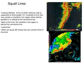
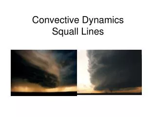
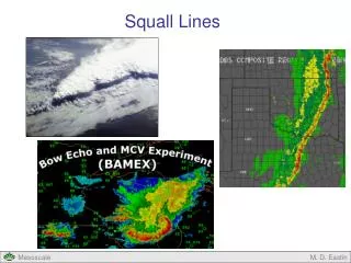
Convective initiation ahead of squall lines. Robert Fovell UCLA Atmospheric & Oceanic Sciences rfovell@ucla.edu. (Fovell, Mullendore and Kim 2006, MWR). Radar image of a squall line. Vertical cross-section. Vertical cross-section. Vertical cross-section.

E N D
Convective initiation ahead of squall lines Robert Fovell UCLA Atmospheric & Oceanic Sciences rfovell@ucla.edu (Fovell, Mullendore and Kim 2006, MWR)
Vertical cross-section “discrete convective initiation”
Vertical cross-section X “discrete propagation”
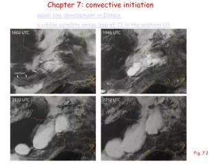
0509Z - Hastings, NE radar8 July 2003 gust front
0539Z - Hastings, NE radar new cells ~ 18 km ahead
05 June 2004 X = Hays, KS
05 June 2004 X = Hays, KS
2245Z (545 PM CDT)
2245Z (545 PM CDT) Ft. Worth
How do afternoon roll cloudsinfluence nocturnal convection? By organizing the moisture field; effect survives rolls themselves
MM5 simulation • 4 km horizontal resolution; 250x330 pts • Start 12Z previous day • Initial/boundary conditions from Eta model • MRF PBL scheme
MM5 model animation • 3 hour animation (01-04Z) • Colored field is 2 m water vapor • Vertically integrated condensate contoured • 10 m wind vectors
MM5 moisture bands • Remains of convective rolls present in model on previous afternoon • Rolls are spurious • reflect deficiency of PBL scheme • ~40 km wavelength >> theoretical value • actual roll clouds ~ theoretical value • Rolls are fortuitous • suggest orientation for the new cell lines
“Action at a distance” mechanism Trapped internal gravity waves
An ARPS simulation • 2D & 3D models • Horizontally homogeneous initial conditions • ∆x = 1 km, ∆z ≥ 40 m • Warm rain processes • Starts late afternoon
Vertical velocity (colored) ~ sunrise main updraft cold pool
Vertical velocity (colored) ~ sunrise gravity waves 20 m/s
Vertical velocity (colored) ~ sunrise Trapping or ducting below 8-9 km
Gravity wave ducting z x Scorer parameter
Closer look at Scorer parameter In mountain wave derivation, we had Difference: mountain waves presumed steady, therefore = 0 and c = /k = 0. Also, N*2 is BV frequency modified for moisture.
Ducting: sharp decrease of l2 with height • Here c > U • Forward anvil as wave duct • decrease in ambient stability • anvil: warming below, cooling above; saturated • partially opposed by (U - c) decrease • jet-like wind profile - curvature shear
Uzz min upstream sounding
Discrete initiation by gravity waves alone Note forward anvil
Discrete initiation by gravity waves alone Gravity waves trapped beneath anvil
Discrete initiation by gravity waves alone Wave-relative flow shown (recall c > U)
Internal gravity waves alone apparently can’t account for the orientation of the new cell bands Combine gravity waves & moisture bands
Hypothesis Plane view, looking from above Moisture bands remaining from earlier roll activity
Hypothesis Squall line and its forward anvil
Hypothesis Trapped internal gravity waves beneath anvil