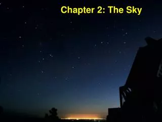
Chapter 2: The Sky
Chapter 2: The Sky. Constellations. Scorpius, the Scorpion. Sagittarius, the Archer. In ancient times, constellations only referred to the brightest stars that appeared to form groups, representing mythological figures.

Chapter 2: The Sky
E N D
Presentation Transcript
Constellations Scorpius, the Scorpion Sagittarius, the Archer
In ancient times, constellations only referred to the brightest stars that appeared to form groups, representing mythological figures. Today, constellations are well-defined regions of the sky, irrespective of the presence or absence of bright stars in those regions.
The stars of a constellation only appear to be close to one another. • Usually, this is only a projection effect. • The stars of a constellation may be located at very different distances from us.
Orion Betelgeuse Rigel Stars are named by a Greek letter (α, β, γ,) according to their relative brightness within a given constellation followed by the possessive form of the constellation name: Betelgeuse = α Orionis, Rigel = β Orionis
This stamp shows the constellation Orion. Why does this look odd to residents of northern hemisphere?
The Magnitude Scale First introduced by Hipparchus (160 - 127 B.C.): • Brightest stars = 1st magnitude • Faintest stars (unaided eye) = 6th magnitude • (The greater the magnitude, the fainter the star!) • More quantitatively: • 1st mag. stars appear 100 times brighter than 6th mag. stars • 1 mag. difference = a factor of 2.512 in apparent brightness
Example: Betelgeuse Magnitude = 0.41 mag For a magnitude difference of 0.41 – 0.14 = 0.27, we find an intensity ratio of (2.512)0.27 = 1.28 Rigel Magnitude = 0.14 mag Intensity is a precise term for brightness and expresses the amount of light energy received by each square meter every second. (Units: joules/m2/sec)
The magnitude scale system can be extended toward negative numbers (very bright) and positive numbers > 6 (faint objects): • Sirius (brightest star in the sky): mv = –1.42 • Full moon: mv = –12.5 • Sun: mv = –26.5
The “Concept Art Portfolio” helps with visual understanding of important concepts
The Celestial Sphere — A model of the sky • Zenith: Point on the celestial sphere directly overhead • Nadir: Point on the celestial sphere directly underneath (never visible!) • Celestial equator: projection of Earth’s equator onto the c.s. • North celestial pole: projection of Earth’s north pole onto the c.s.
Skip this slide at first reading—Come back during or after Chapter 3 [ More general view of the celestial sphere ] • The ecliptic is shown crossing the celestial equator at an angle of 23.5°. • Do not confuse the ecliptic plane with the horizon plane of the previous slide*. *The ecliptic (the plane of Earth’s orbit) always makes 23.5° with the celestial equator, while the horizon makes an angle that depends on the person’s latitude.
The Celestial Sphere — A model of the sky • From geographic latitude +ℓ (northern hemisphere), you see the celestial north pole ℓ degrees above thehorizon. 90° - ℓ ℓ • From geographic latitude – ℓ (southern hemisphere),you see the celestial south pole ℓ degrees above thehorizon. • Celestial equator culminates 90° – ℓ above the horizon.
Example: New York City: ℓ ≈ 40.7° north celestial pole Celestial Equator 49.3° 40.7° Horizon Horizon North South The south celestial pole is not visible from the northern hemisphere.
Horizon System • The horizon system is a convenient system to use to locate stars and other celestial objects from one’s local vantage point. Star • Altitude (“height”) is angular distance from the horizon. Height Altitude Horizon Azimuth • Azimuth (“direction”) locates the place on the horizon just below the star. Direction East
Terrestrial Coordinate System • The terrestrial coordinate system is used to locate places on Earth • Latitude describes distance north or south of the equator • Longitude describes distance east or west from the zero point. The zero point is located on the equator, directly south of Greenwich, England, along the prime meridian.
Latitude lines Longitude lines
Equatorial System • The equatorial system uses right ascension (or hour angle) and declination to locate stars on the celestial sphere. • Right Ascension (RA) = projection of longitude onto the celestial sphere. • Declination (Dec) = projection of latitude onto the celestial sphere.
Lines of declination Lines ofright ascension
Precession Bulging Earth Gravity is pulling on a spinning top.→ Wobble around the vertical. Sun and Moon are pulling on the spinning Earth. The resulting “wobble” of Earth’s axis of rotation around the vertical w.r.t. the orbital plane takes about 26,000 years and is called precession.
As a result of precession, the north celestial pole follows a circular pattern on the sky, once every 26,000 years. • It will be closest to Polaris ~ A.D. 2100. • ~ 12,000 years from now, it will be close to Vega in the constellation Lyra. **There is nothing special about Polaris. (neither particularly bright nor nearby, etc.)