Download
1 / 54
540 likes | 767 Vues
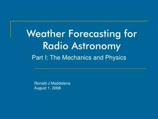
Weather Forecasting for Radio Astronomy. Part I: The Mechanics and Physics. Ronald J Maddalena August 1, 2008. Outline. Part I Background -- research inspirations and aspirations Vertical weather profiles Description Bufkit files Atmospheric physics used in cm- and mm-wave forecasting

E N D
Weather Forecasting for Radio Astronomy Part I: The Mechanics and Physics Ronald J Maddalena August 1, 2008
Outline • Part I • Background -- research inspirations and aspirations • Vertical weather profiles • Description • Bufkit files • Atmospheric physics used in cm- and mm-wave forecasting • Details on software: downloading, processing, archiving, archive retrieval, web site generation, watch dogs, …. • Part II • Results on refraction & air mass (with Jeff Paradis) • Part III • Results on opacity, weather statistics, observing techniques and strategies.
Opacity Calibration System performance – Tsys Observing techniques Hardware design Refraction Pointing Air Mass Calibration Pulsar Timing Interferometer & VLB phase errors Aperture phase errors Cloud Cover Continuum performance Pointing & Calibration Winds Pointing Safety Telescope Scheduling Proportion of proposals that should be accepted Telescope productivity The influence of the weather at cm- and mm-wavelengths
Broad-brush goals of this research Improved our estimations of: • Current conditions • Calibration, pointing, safety, telescope productivity • Near-future conditions • Safety, telescope productivity • Past conditions • Calibration • Weather statistics • Telescope productivity, hardware decisions, observing techniques, proposal acceptance
Project inspiration • Unfortunately, the standard products of the weather services (other than winds, cloud cover, precipitation, and PW somewhat) do not serve radio astronomy directly. • But, can their product be used for radio astronomy?
Project inspiration • 5-years of observing at 115 GHz at sea level. • Harry Lehto’s thesis (1989) • 140-ft/GBT pointing - refraction correction • 12-GHz phase interferometer & 86 GHz tipper • Research requiring high accuracy calibration • Ardis Maciolek’s RET project (2001) • Too many rained-out observations
Project inspiration Lehto : Measured vertical weather profiles are an excellent way of determining past observing conditions for radio astronomy
Vertical profiles are:Atmospheric pressure, temperature, and humidity as a function of height above the telescope (and much, much more).
Project inspiration • Lehto : Measured vertical weather profiles are an excellent way of determining past observing conditions • No practical way to obtain vertical profiles and use Harry’s technique until… • Maciolek : Vertical profiles are now easily available on the WWW for the current time and are forecasted!!
Project aspirations • Leverage Lehto’s ideas to use Maciolek’ profiles • Current and near-future weather conditions • Automate the archiving of Maciolek’ profiles • Weather conditions for past observations • Makes possible the generation of detailed weather statistics • Archive integrity supersedes all else – Don’t embed the physics into the archive • Produce the tools to mine the archive, display and summarize past, current and future conditions • After two years labor on the mechanics and physics, alpha system launched in May, 2004, full release in June 2005, with on-going, sometimes extensive modifications and refactoring.
Vertical profiles • Atmospheric pressure, temperature, and humidity as a function of height above a site (and much more). • Derived from Geostationary Operational Environmental Satellite (GOES) soundings and, now less often, balloon soundings • Generated by the National Weather Service, an agency of the NOAA. Bufkit, a great vertical profile viewer http://www.wbuf.noaa.gov/bufkit/bufkit.html
Bufkit and Bufkit files • 65 layers from ground level to 30 km • Stratospheric (Tropopause ~10 km) • Layers finely spaced (~40 m) at the lower heights, wider spaced in the stratosphere • Available for Elkins, Hot Springs, Lewisburg from Penn State University (and only PSU!)
Bufkit and Bufkit files • Three flavors of Bufkit forecast files available, all in the same format • North American Mesoscale (NAM) • The 3.5 day (84 hours) forecasts • Updated 4-times a day • 12 km horizontal resolution • 1 hour temporal resolution • Finer detail than other operational forecast models • 1350 stations, all North America
Bufkit and Bufkit files • Global Forecast System (GFS) • 7.5-day (180 hrs) forecasts • Based on the first half of the 16-day GFS models • 35 km horizontal resolution • 3 hour temporal resolution • Updated twice a day • Do not include percentage cloud cover • 1450 stations, some overseas
Bufkit and Bufkit files • Rapid Update Cycle • Accurate short range 0-12 hrs only • Updated hourly with an hour delay in distribution (processing time) • 12 km horizontal resolution • 1 hour temporal resolution • Not used or archived
Bufkit & Bufkit files • Raw numbers include: • Wind speeds and directions, temperatures, dew point, pressure, cloud cover, … vs. height vs. time vs. site. • Summary indices: K-index, precipitable water (PW), rain/snowfall, etc. vs. time vs. site • Derived numbers: • Inversion layers, likelihood of fog, snow growth, storm type, …
Issues with Bufkit files • PSU -- a one-point failure but with a solution • PSU derives Bufkit files from BUFR sounding files (the meteorologist’s equivalent of FITS files). • Half a dozen FTP sites provide BUFR files • MODSND utility converts BUFR files to Bufkit (and other) formats. • BUFR/Bufkit files contain errors that readers must circumvent • 5 yrs of experience. • Other than winds, clouds, precipitation, and PW, Bufkit doesn’t display anything else significant for radio astronomy. • This is where cm- and mm-wave atmospheric physics comes in.
References • G. Brussaard and P.A. Watson, “Atmospheric Modelling and Millimetre Wave Propagation,”, 1995, (New York: Chapman & Hall) • B. Butler, "Precipitable Water Vapor at the VLA -- 1990 - 1998", 1998, NRAO MMA Memo #237 (and references therein). • L. Danese and R.B. Partridge, "Atmospheric Emission Models: Confrontation between Observational Data and Predictions in the 2.5-300 GHz Frequency Range", 1989, AP.J. 342, 604. • K.D. Froome and L. Essen, "The Velocity of Light and Radio Waves", 1969, (New York: Academic Press). • W.S. Smart, "Textbook on Spherical Astronomy", 1977, (New York: Cambridge Univ. Press). • H.J. Lehto, "High Sensitivity Searches for Short Time Scale Variability in Extragalactic Objects", 1989, Ph.D. Thesis, University of Virginia, Department of Astronomy, pp. 145-177. • H.J. Liebe, "An Updated model for millimeter wave propagation in moist air", 1985, Radio Science, 20, 1069 • R.J. Maddalena "Refraction, Weather Station Components, and Other Details for Pointing the GBT", 1994, NRAO GBT Memo 112 (and references therein). • J. Meeus, "Astronomical Algorithms", 1990 (Richmond: Willman-Bell). • K. Rohlfs and T.L. Wilson, "Tools of Radio Astronomy, 2nd edition", 1996, pp. 165-168. • P.W. Rosenkranz, 1975, IEEE Trans, AP-23, 498. • J.M. Rueger, "Electronic Distance Measurements", 1990 (New York: Springer Verlag). • F.R. Schwab, D.E Hogg, and F.N. Owen, "Analysis of Radiosonde Data for the MMA Site Survey and Comparison with Tipping Radiometer Data" (1989), from the IAU Symposium on "Radio Astronomical Seeing", pp 116-121.
Basics of atmospheric modeling • “Macroscopic measure of interactions between radiation and absorbers expressed as complex refractivity…” (Liebe, 1985) • For each layer of the atmosphere, calculate: • Density of water vapor and dry air • For each layer of the atmosphere, for five different components of the atmosphere, for any desired frequency calculate : • Real part of refractivity • Ray-trace at desired observing elevation through the atmosphere to determine total refraction and air mass • Imaginary part of refractivity • Determines absorption and emissivity as a function of height • Use radiative transfer to determine: • Total opacity at desired observing elevation • Contribution of the atmosphere to system temperature at desired observing elevation
Basics of atmospheric modeling • So far, this is not new stuff. Has been done many times before with balloon data or using a ‘model’ atmosphere. What is new? • Uses recently-available forecasted weather data • Updates automatically twelve times a day for every desired frequency, elevation, time, site, and model (GFS, NAM, …). • Automatically summarizes the results on the WWW in a useful way for predicting conditions for radio astronomy • Automates the generation of an archive • Provides tools that anyone can use to mine the current and archived forecasts in ways the WWW summaries do not. • Applied to a sea-level, mid-Atlantic, 100-m telescope that can observe up to 115 GHz and down to an elevation of 5º.
Refractivity at different heights • Modeled as arising from five components of the atmosphere • Dry air continuum • Non-resonant Debye spectrum of O2 below 100 GHz, pressure-induced N2 attenuation > 100 GHz • Water vapor rotational lines: • 22.2, 67.8 & 120.0, 183.3 GHz, and higher • Water vapor continuum from an unknown cause • “Excess Water Vapor Absorption” problem • Oxygen spin rotation resonance line • Band of lines 51.5 – 67.9 GHz, single line at 118.8 GHz, and higher • Modeled using Rosenkranz’s (1975) impact theory of overlapping lines • Hydrosols • Mie approximation of Rayleigh scattering from suspended water droplets with size < 50 μm
How it works…. Generate a table for every desired frequency, site, time
Opacities from the various components Dry Air Continuum
Opacities from the various components gfs3_c27_1190268000.buf Water Continuum
Opacities from the various components gfs3_c27_1190268000.buf Water Line
Opacities from the various components gfs3_c27_1190268000.buf Oxygen Line
Opacities from the various components gfs3_c27_1190268000.buf Hydrosols
Opacities from the various components gfs3_c27_1190268000.buf Total Opacity
Hydrosols – the big unknown • Require water droplet density • Not well forecasted • Using the Schwab, Hogg, Owen (1989) model of hydrosols • Compromise technique • Assumes a cloud is present in any layer of the atmosphere where the humidity is 95% or greater. • The thickness of the cloud layer determines the density • 0.2 g/m3 for clouds thinner than 120 m • 0.4 g/m3 for clouds thicker than 500 m, • linearly-interpolated densities for clouds of intermediate thickness • And forget about it when it rains! No longer droplets!!
Relative Effective System Temperatures: A way to judge what frequencies are most productive under various weather and observing conditions • Atmosphere hurts you twice • Absorbs so your signal is weaker: TBG exp(-τ) • Emits so your Tsys and noise go up: Tsys = TRcvr + TSpill +TCMB exp(-τ)]+ TAtm [1 – exp(-τ)] • Signal-to-noise goes as: • TBG exp(-τ)/Tsys • Define Effective System Temperature(EST) as: • Proportional to the square root of the integration time needed to achieve a desired signal to noise
Relative Effective System Temperatures: A way to judge what frequencies are most productive under various weather and observing conditions • RESTs = EST / The best possible EST • RESTs proportional to Sqrt(t / tBest) • tBest = integration time needed to achieve your signal to noise on the best weather days • t = integration time needed under current weather conditions • RESTs > 1.41 require twice as much telescope time and are likely to be unproductive use of the telescope. • Requires a good weather archive to determine “the best possible EST: • Uses: • The TRcvr measured by the engineers • An estimate of TSpill ~ 3 K, TCMB ~ 3 K • Forecasted TSys_Atm
Basics of refraction and relative air mass a = Earth radius n(h) = index of refraction at height h n0 = index of refraction at surface ρ(h) = air density ElevObs, ElevTrue = refracted and airless elevations
Also provide • Ground level values for • Precipitable Water ∑ρWater(h)– good summary statistic • Temperature and wind speeds (safety limits) • Pressure, humidity, wind direction • Fractional cloud cover = max[CFRL(h)] – for continuum observers • Comparison of various refraction models • Differential refraction and air mass • Surface actuator displacement to take out atmospheric-induced, weather-dependent astigmatism • Summary forecasts from weather.com • Also archived • NWS weather alerts.
Current modeling and limitations • Uses Liebe’s Microwave Propagation Model, with Danese & Partridge’s (1989) modifications plus some practical simplifications • Although accurate up to 1000 MHz, current implementation < 230 GHz to save processing time • Uses the Froome & Essen frequency-independent approximation of refraction (to save processing time) • Opacities < 5 GHz are too high for an unknown reason • Cloud predictions (presence, thickness) are not very accurate • Model for determining opacities from clouds (hydrosols) does not match observations • Schwab, Hogg, Owen model for water drop density and size may not be accurate enough
Current modeling and limitations • Uses a ‘fuzzy’ cache of opacities to save processing at the expense of memory and accuracy • Fractional cloud cover does not consider whether a cloud is cold or warm (i.e. its importantance). • Must extrapolate real part of refractivity to 50 km (forecasts go to 30 km). • Assumes all absorption is below 30 km • Total opacity estimate uses 1/sin(elev) instead of ray-traced path • TRcvr table, used for calculating RESTS, has a 1 or 2 GHZ resolution.
How accurate are ground-level values and a standard atmosphere?
Web Page Summaries • http://www.gb.nrao.edu/~rmaddale/Weather/index.html • 3.5 and 7 day NAM and GFS forecasts. For each, provides:: • Ground weather conditions • Opacity and TAtm as a function of time and frequency • Tsys and RESTs as functions of time, frequency, and elevation • Refraction, differential refraction, comparison to other refraction models • Weather.com forecasts • NWS alerts • Short summary of the modeling • List of references
User Software: cleo forecasts Type: cleo forecasts Or cleo forecasts -help