Latitude and Longitude: Exploring Earth's Coordinates
Discover the significance of latitude and longitude in mapmaking, defining borders, and locating places. Learn about time zones, cartography, and the International Date Line.

Latitude and Longitude: Exploring Earth's Coordinates
E N D
Presentation Transcript
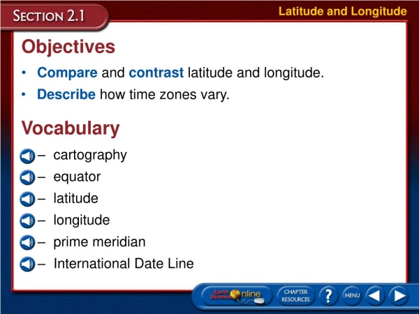
Latitude and Longitude Objectives • Compare and contrast latitude and longitude. • Describe how time zones vary. Vocabulary • cartography • equator • latitude • longitude • prime meridian • International Date Line
Latitude and Longitude Latitude and Longitude • For thousands of years, people have used maps to define borders and to find places. • Cartography is the science of mapmaking. • Cartographers use an imaginary grid of parallel lines and vertical lines to locate points on Earth.
Latitude and Longitude Latitude and Longitude • For thousands of years, people have used maps to define borders and to find places. • The equator circles Earth halfway between the north and south poles separating Earth into two equal halves called the northern hemisphere and the southern hemisphere.
Latitude and Longitude Latitude • Lines of latitude are lines running parallel to the equator. • Latitude is the distance in degrees north or south of the equator.
Latitude and Longitude Latitude • Latitude is thus measured from 0° at the equator to 90° at the poles. • Locations north of the equator are referred to by degrees north latitude (N). • Locations south of the equator are referred to by degrees south latitude (S).
Latitude and Longitude • Each degree of latitude is equivalent to about 111 km on Earth’s surface. • To locate positions on Earth more precisely, cartographers break down degrees of latitude into 60 smaller units, called minutes (´). • A minute of latitude can be further divided into seconds (´´). • Longitude is also divided into degrees, minutes, and seconds. Degrees of Latitude
Latitude and Longitude Longitude • To locate positions in east and west directions, cartographers use lines of longitude, also known as meridians. • Longitude is the distance in degrees east or west of the prime meridian.
Latitude and Longitude Longitude • To locate positions in east and west directions, cartographers use lines of longitude, also known as meridians. • Longitude is the distance in degrees east or west of the prime meridian. • The prime meridian, representing 0° longitude, is the reference point for longitude.
Latitude and Longitude Longitude • Points west of the prime meridian are numbered from 0° to 180° west longitude (W). • Points east of the prime meridian are numbered from 0° to 180° east longitude (E).
Latitude and Longitude Longitude Semicircles • Lines of longitude are not parallel; they are large semicircles that extend vertically from pole to pole. Degrees of Longitude • The distances covered by degrees of longitude vary with location. • One degree of longitude varies from about 111 km at the equator to essentially the distance covered by a point at the poles.
Latitude and Longitude Longitude Locating Places with Coordinates • Both latitude and longitude are needed to precisely locate positions on Earth. • For example, the location of New Orleans is 29°57´N, 90°04´W. • Note that latitude comes first in reference to the coordinates of a particular location.
Latitude and Longitude Longitude Locating Places with Coordinates • What is Georgia Latitude Longitude coordinates?
Latitude and Longitude Longitude Locating Places with Coordinates • What is Georgia Latitude Longitude coordinates? • Latitude 30-35 N • Longitude 80-85 W
Latitude Longitude for Marietta? 34* N 84.5* W
Latitude and Longitude Time Zones • Because Earth takes about 24 hours to rotate once on its axis, it is divided into 24 times zones, each representing a different hour.
Latitude and Longitude Time Zones • Each time zone is 15° wide, corresponding roughly to lines of longitude. • Time zone boundaries have been adjusted in local areas for convenience.
Latitude and Longitude Time Zones • There are six different time zones in the United States.
Latitude and Longitude Time Zones Calendar Dates • Every time zone experiences this transition from one day to the next, with the calendar advancing to the next day at midnight. • Each time you travel through a time zone, you gain or lose time, eventually gaining or losing an entire day.
Latitude and Longitude Time Zones Calendar Dates • The International Date Line, or 180° meridian, serves as the transition line for calendar days. • Traveling west across the International Date Line, you would advance your calendar one day. • Traveling east, you would move your calendar back one day. Current local time in Sydney, Australia? http://www.timeanddate.com/worldclock/australia/sydney
Latitude and Longitude Section Assessment 1. Match the following terms with their definitions. ___ latitude ___ longitude ___ prime meridian ___ equator D B A C A. the reference point for longitude B.the distance in degrees east or west of 0° C.the reference point for latitude D. the distance in degrees north or south of 0°
Latitude and Longitude Section Assessment 2. If it is 10 A.M. in Madagascar, what time is it in Washington, D.C.?
Latitude and Longitude Section Assessment 2. If it is 10 A.M. in Madagascar, what time is it in Washington, D.C.? It is 2 A.M. in Washington, D.C.
Latitude and Longitude Section Assessment 3. Identify whether the following statements are true or false. _______ A degree of longitude always represents the same distance. _______ If you travel west across the International Date Line, you advance your calendar one day. _______ Lines of latitude are not perfectly parallel to each other. _______ When referencing a specific place on Earth by its coordinates, latitude always comes first. false true false true
Types of Maps Objectives • Compare and contrast different map projections. • Analyze topographic maps. • Describe map characteristics, such as map scales and map legends Vocabulary • Mercator projection • conic projection • gnomonic projection • topographic map • contour line • contour interval • map legend • map scale
Types of Maps Types of Maps • Maps are flat models of a three-dimensional object, Earth. • All flat maps distort to some degree either the shapes or the areas of landmasses. • Cartographers use projections to make maps. • A map projection is made by transferring points and lines on a globe’s surface onto a sheet of paper.
Types of Maps Mercator Projections • A Mercator projection is a map that has parallel lines of latitude and longitude. • In a Mercator projection, the shapes of the landmasses are correct, but their areas are distorted.
Types of Maps Conic Projections • A conic projection is a map made by projecting points and lines from a globe onto a cone. • The cone touches the globe at a particular line of latitude along which there is very little distortion in the areas or shapes of landmasses. • Distortion is evident near the top and bottom of the projection.
Types of Maps Gnomonic Projections • A gnomonic projection is a map made by projecting points and lines from a globe onto a piece of paper that touches the globe at a single point. • Gnomonic projections distort directionanddistance between landmasses. • Gnomonic projections are useful in plotting long-distance trips by air or sea.
Types of Maps Gnomonic Projections • Great circles are imaginary lines that divide Earth into two equal halves. • On a sphere such as Earth, the shortest distance between two points lies along a great circle. • Navigators connect points on gnomonic projections to plot great-circle routes.
Types of Maps Topographic Maps • Topographic maps are detailed maps showing the elevations of hills and valleys of an area. • Topographic maps use lines, symbols, and colors to represent changes in elevation and features on Earth’s surface.
Types of Maps Topographic Maps Contour Lines • Elevation on a topographic map is represented by a contour line. • A contour line connects points of equal elevation. • Elevation refers to the distance of a location above or below sea level.
Types of Maps Topographic Maps Contour Intervals • Topographic maps use contour lines to show changes in elevation. • The contour interval is the difference in elevation between two side-by-side contour lines. • The contour interval is dependent on the terrain.
Types of Maps Topographic Maps Index Contours • Index contours are contour lines that are marked by numbers representing their elevations. • If a contour interval on a map is 5 m, you can determine the elevations represented by other lines around the index contour by adding or subtracting 5 m from the elevation indicated on the index contour.
Types of Maps Topographic Maps Depression Contour Lines • Depression contour lines are used to represent features that are lower than the surrounding area. • On a map, depression contour lines have hachures,or short lines at right angles to the contour line that point toward the lower elevation, to indicate depressions.
Types of Maps Map Legends • Topographic maps and most other maps include both human-made and natural features that are located on Earth’s surface. • These features are represented by different symbols. • A map legend explains what the symbols represent.
Types of Maps Map Scales • When using a map, you need to know how to measure distances. • A map scale is the ratio between distances on a map and actual distances on the surface of Earth.
Types of Maps Map Scales • There are three types of map scales: verbal scales, graphic scales, and fractional scales. • A verbal scale expresses distance as a statement, such as “One centimeter is equal to one kilometer.” • A graphic scale consists of a line that represents a certain distance, such as 5 km or 5 miles. • A fractional scale expresses distance as a ratio, such as 1:63 500.
Types of Maps Section Assessment 1. Match the following terms with their definitions. ___ projection ___ contour interval ___ map legend ___ map scale C A D B A. the difference in elevation between two side-by-side contour lines B.a diagram that explains what the symbols on a map represent C.a map made by transferring points and lines on a globe’s surface onto a sheet of paper D. the ratio between distances on a map and actual distances on the surface of Earth
Types of Maps Section Assessment 2. Which type of map would be best suited for the following applications? ___ An aviator is trying to identify the shortest route between New York and London. ___ A cartographer for the state department of transportation has been tasked with making a new state road map. ___ A group of friends is planning on hiking in the back country of Idaho. ___ A sailor is sailing up the coast from South America to North America. C B D A A. Mercator projection B.conic projection C.gnomonic projection D. topographic
Types of Maps Section Assessment 3. What does it mean if a map says “Scale 1:100 000”? This fractional scale means that one unit on the map represents 100 000 units on Earth’s surface. For example, one inch on the map would equal 100 000 inches on Earth’s surface.
Remote Sensing Objectives • Compare and contrast the different forms of radiation in the electromagnetic spectrum. • Discuss how satellites and sonar are used to map Earth’s surface and its oceans. • Describe the Global Positioning System. Vocabulary • remote sensing • electromagnetic spectrum • frequency • Landsat satellite • Topex/Poseidon satellite • Global Positioning System • sonar
Remote Sensing Remote Sensing • Until recently, mapmakers had to go on-site to collect the data needed to make maps. • Today, advanced technology has changed the way maps are made. • Remote sensing is the process of collecting data about Earth from far above Earth’s surface.
Remote Sensing The Electromagnetic Spectrum • Satellites detect different wavelengths of energy reflected or emitted from Earth’s surface. • This energy has both electric and magnetic properties and is referred to as electromagnetic radiation. • Electromagnetic radiation includes visible light, gamma rays, X rays, ultraviolet waves, infrared waves, radio waves, and microwaves.
Remote Sensing The Electromagnetic Spectrum Wave Characteristics • All electromagnetic waves travel at the speed of 300 000 km/s in a vacuum, a value commonly referred to as the speed of light. • Electromagnetic waves have distinct wavelengths and frequencies. • The electromagnetic spectrum is the arrangement of electromagnetic radiation according to wavelengths. • Frequency is the number of waves that pass a particular point each second. • These unique characteristics help determine how the energy is used by different satellites to map Earth.
Remote Sensing The Electromagnetic Spectrum Wave Characteristics
Remote Sensing Landsat Satellites • A Landsat satellite receives reflected wavelengths of energy emitted by Earth’s surface, including some wavelengths of visible light and infrared radiation. • Since the features on Earth’s surface radiate warmth at slightly different frequencies, they show up as different colors in images