Download
1 / 49
500 likes | 529 Vues
Explore the theory of plate tectonics and the movement of Earth's crust, leading to earthquakes and volcanoes in this comprehensive guide.

E N D
When you answer a question that requires a longer answer, remember the PEEL technique. P Make your POINT E Give your EVIDENCE E EXPLAIN your evidence L If possible, LINK to your next statement or the original point.
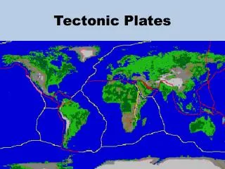
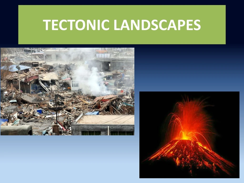
A theory: Plate tectonics • The Earth's crust is broken into a number of large and small plates. • Plate tectonics is the study of the structure of the Earth, and how the Earth's surface changes according to the movement of plates.
Depending on the direction of the convection currents, the plates can move • Towards each other (convergent) • Away from each other (divergent) • Slide past each other (transform)
The importance of crust There are two types of crust which have different characteristics. Older, lighter, cannot sink and is permanent. Younger, heavier, can sink and is constantly being destroyed and replaced.
Tectonic plates can include continental crust or oceanic crust, and many plates contain both. For example, the African Plate includes the continent of Africa and parts of the floor of the Atlantic and Indian Oceans.
How to describe the distribution of…. Describe the distribution of volcanoes shown on Figure 6. Use evidence from Figure 6 in your answer. (3)
Describe the distribution of volcanoes shown on Figure 6. Use evidence from Figure 6 in your answer. (3) E.g. In belts/bands (1) along the coast (1) Along plate boundaries (1) such as Chaiten volcano which is located along the plate boundary of the Nazac and South American Plates(1) Some found in centre of ocean (1) such as Kilauea (1)
1- Constructive/divergent margins As plates move apart, magma comes to the surface, forming new crust on the ocean floor at the mid-ocean ridges and forcing plates apart. When the magma builds up above the surface of the ocean, volcanic islands form, e.g. Iceland Next slide shows the mid-Atlantic Ridge.
Mid-Atlantic ridge
Divergent or constructive boundaries 4-A mid-ocean ridge is formed by the new crust. 6-Earthquakes are caused by volcanic eruptions or by tensional forces. 5-Submarine volcanoes appear along the ridge. Some may grow to form islands, e.g. Iceland. Oceanic crust Oceanic crust 1-Convection currents pull plates apart. 2-This leads to gaps being formed in the crustal rocks. 3-As the plates move apart, magma from the mantle rises to fill the gaps and forms new oceanic crust.
Describe and explain the characteristic features of a constructive boundary. (4) What are the features? Mid-ocean ridges, volcanic islands and earthquakes are the features of a constructive boundary. The question asks for an explanation , i.e. the reasons for these features. You may answer this question using the ‘case study’, i.e. located example, of the Mid-Atlantic constructive boundary. The use of a located example may be part of the question: With the aid of a located example, describe and explain ……..
East African Rift Valley Constructive boundaries may also be found in land. The East African Rift valley is opening up and new land is being formed in the bottom of the valley. The East African Rift Zone includes a number of active as well as dormant volcanoes (red triangles on map), among them: Mount Kilimanjaro and Mount Kenya. The rift is a narrow zone in which the African Plate is in the process of splitting into two new tectonic plates.
Destructive/Convergent boundaries A- Oceanic-continental boundaries B- Continental-continental boundaries C- Oceanic-oceanic boundaries
Ocean-to-continent boundary 7-The collision causes folding and uplift of rocks which form fold mountains. 6-The Peru-Chile trench forms where the oceanic plate is being subducted. 5-The melting plate creates lighter magma that rises towards the surface to form volcanoes. 1-The Nazca Plate and the South American Plate move towards each other due to convection currents. Andes fold mountains Pacific Ocean Trench Volcano South American Plate (Continental) Nazca Plate (Oceanic) Mantle Earthquakes Subduction zone 4-The heat from the mantle causes the oceanic plate to be destroyed. 2-The Nazca Plate (oceanic) is being subducted below the South American Plate (continental). 3-Friction and pressure cause earthquakes to occur along the subduction zone
b- Continental-to-continental boundary 2- This results in intense folding and uplift and leads to the formation of fold mountains. 4- However, earthquakes occur due to the collision of the plates. 1- When two continental plates meet at a destructive boundary, a slow collision takes place as both plates have a low density. 3- There is no subduction. Therefore, there are no volcanoes.
Ocean-to-oceanboundaries 5- After several eruptions, these volcanoes break the ocean surface to form islands 4- As the Philippine plate begins to melt, magma escapes to the surface to form volcanoes, a few kilometres from the trench. 6- When several volcanic islands form together they are called an island arc. Ryuku Islands (Japan) Eurasian Plate Philippine Plate Subduction zone 2-The Philippine Plate is subducted beneath the Eurasian Plate. 3- As it is subducted, friction and pressure cause earthquakes along the subduction zone. 1- Due to convection currents in the mantle, the two oceanic plates collide.
Conservative [transform] boundaries Plates just slide past each other with crust neither created nor destroyed. Friction builds up and energy is released when the plates ‘jerk’, causing earthquakes. The San Andreas Fault in California marks the junction of the North American and Pacific plates. Both plates are moving north-west but at different speeds. Instead of slipping smoothly past each other, they tend to ‘stick’. The pressure builds up until suddenly the plates move forward and an earthquake occurs. There is no volcanic action because the crust is not being destroyed.
Why do some volcanoes not occur on plate boundaries?... Hot spots
Volcanoes at HOTSPOTS TECTONIC HAZARDS
In this lesson you will discover : (I) The reason why some volcanoes do not occur on plate boundaries. (II) What happens to volcanoes located over a hotspot as they are carried away by the tectonic plate.
Study the distribution of volcanoes shown on figure 6. Where is Kilauea located? Kilauea is located in the middle of the Pacific Ocean far from plate boundaries.
Extinct volcanoes Underwater volcano
A few key words to help you VIDEO Stationary: which doesn’t move. Motion=movement Intrusion: Magma slowly pushes up from deep within the earth into any cracks or spaces it can find. Mantle Plume: A column of hot rock rising inside the mantle Solid part of the mantle Semi-molten part of the mantle (magma) An extinct volcano is not expected to erupt again.
As the plate moves over the stationary hotspot, new volcanoes are formed.
RECAP: Understanding hotspots Some volcanoes do not occur on plate boundaries. These volcanoes are formed over hotspots. These are fixed points in the mantle that generate intense heat. Small, long lasting, exceptionally hot areas of magma exist under the Earth's surface which in turn sustains long-lasting volcanic activity.
At areas where the pressure is greater in the mantle, magma erupts through the crust as when the plume reaches the crust it causes the crust to dome (and crack). Volcanoes are created if the magma rises above the ocean surface. As the crustal plate moves over the stationary hotspot, new volcanoes are formed. Hotspots are associated with chains of islands such as Hawaii.
How are earthquakes measured? Two main methods are used to measure earthquakes. The Mercalli scale gives an indication of the intensity of an earthquake while the Richter scale refers to its magnitude.
Question Outline the differences between the Mercalli and the Richter scales. (4) The Mercalli scale measures the intensity of an earthquake whereas the Richter scale measure its magnitude. The Mercalli scales is based on observations by people while the Richter scale is based on accurate measurements by a seismograph.
What is the focus and epicentre of an earthquake? • The focus of an earthquake is its central point-the point deep below the surface where the earthquake starts. Seismic waves are released and then spread in all directions. • The point on the surface directly above the focus is called the epicentre. It is the place on the surface that is nearest to the focus and therefore where the greatest effects will be felt.
Epicentre Seismic waves are released and then spread in all directions The focus is the point deep below where the earthquake starts
Why do people continue to live in areas of tectonic activity? Social reasons Economic reasons Environmental reasons
Case study-example The causes and effects of a volcanic eruption: Montserrat, 1997 See knowledge organiser
Prediction and prevention of the effects of volcanic eruptions and earthquakes
Prediction and prevention of the effects of volcanic eruptions Most volcanic eruptions are preceded by clear warning of activity from the volcanoes. After the first seismic activity was detected in 1992 in Montserrat measures were taken to predict if and when the volcano was going to erupt:
4 methods to monitor volcanoes 1-.Sulphur dioxide is produced by magma in large quantities and so its emmissions are monitored as they are a good indicator that magma is near the surface. e.g. The area surrounding Mount Pinatubo was evacuated because of gas monitoring. 2- Mesuring ground deformation by using GPS . Pressure form rising magma changes the shape of the volcano.
3- As the magma collects in the magma chamber, its movement creates small earthquakes and tremors. Seismometers close to the volcano record ground movements. E.g. In Montserrat, 14 seismometers used 4- Tiltmeters measure tiny changes in the slope angle of the ground e.g. Five electronic tiltmeters record ground movement in Montserrat.
Montserrat hazard map • Three Zones have been defined: • Exclusion Zone: No admittance except for scientific monitoring and National Security Matters. • Central Zone: Residential area only, all residents on heightened state of alert. All residents to have rapid means of exit 24 hours per day. Hard hat area, all residents to have hard hats and dust masks. • Northern Zone: Area with significantly lower risk, suitable for residential and commercial occupation.
How to lessen the impact (effect) of earthquakes? 1- Education:(i) Emergency drills such as in Japan (1 September /Disaster Prevention Day)(ii) In the USA, the Federal Emergency Management Agency gives information on how to prepare for an earthquake 6 ways learn 4 2- Building design
Case study: the San Francisco International Airportprhttp:// Science.howstuffworks.com/transport/engines-equipment/bearing4.htmecautions can people take to protect themselves from earthquakes? (4) 3-What can be done to limit the effects of: • Volcanic eruptions (6) • Earthquakes (6) Include names examples in your answers.
What can be done to limit the effects of volcanic eruptions (6) 1- Hazard map: Three Zones have been defined in Montserrat after the first eruption in 1995 including an exclusion zone in the south withno admittance except for scientific monitoring and National Security Matters. 2- Three ways to divert or stop lava flows:(i)Divert lava flows by detonating explosives, for instance in 1996, the Italian army used explosives to block a lava flow from Mount Etna threatening villages below.(ii) Construction of earth walls can deflect lava. Used successfully in July 2001 eruption of Mount Etna to protect tourist facilities.(iii) Spraying large volumes of water can cool an advancing flow. Two small lava flows from Mount Etna were cooled by using this method.