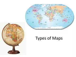
Types of Maps
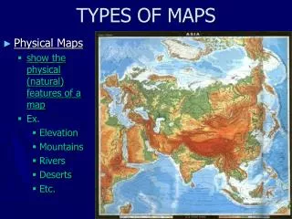
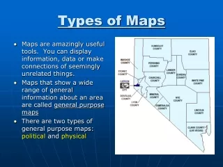
Types of Maps. Maps that show a wide range of general information about an area. General Purpose Maps. Physical Maps Demonstrate the landforms and water features. General Purpose Maps could be:. Political Maps


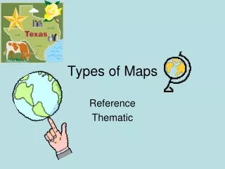
Types of Maps
E N D
Presentation Transcript
Maps that show a wide range of general information about an area General Purpose Maps
Physical Maps Demonstrate the landforms and water features General Purpose Maps could be:
Political Maps Show the names and boundaries of countries, the location of cities and other human-made features of an area General Purpose Maps could be:
Shows elevation with contour lines Contour Maps
Road Maps General Purpose Maps could be:
General Purpose maps • Who would use them?
Demonstrate specific kinds of information on certain themes or topics Special Purpose Maps
Special Purpose Maps could be: • A climate map
Special Purpose Maps could be: • A historical map
Special Purpose Maps could be: • A population density map
Play-Doh Mapping Activity • Get in groups of 2-4 students. Each group will get one jar of play-doh. • Create a “landform” out of the play-doh. • You must include at least 5 landforms. Types of landforms can be found on p. 46 of the Geography textbook. • You have about 10 minutes to create your landform.
Trade play-doh “maps” with another group. • The play-doh represents the land area, and you must map it. • The map must be the width of the paper. • Include all of the indentations, holes, curves, etc. • Construct a legend of the actual play-doh map identifying all of the different landforms. Label this Legend 1. • Study the play-doh map. Label the various types of landforms and water bodies you can identify on your map. Use appropriate USGS symbols or terms from the landform and water body charts. See hand out. • Make a Legend of all your symbols used. Label this Legend 2. • Include the TODALSIGSs: Title, Orientation, Date, Author, Legend, Scale, Index, Grid, Surrounding Places. See handout. • Color your land. • Decide where in the world this map could be located and indicate the grid points that would apply. • Determine natural phenomenon that may cause damage in that area of the world. Indicate on you map. • Hand in before you leave.