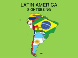
Exploring Latin America's Diverse Physical Geography
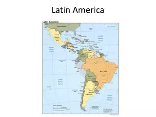
Latin America, encompassing around 8 million square miles, comprises Middle America, South America, and the debated Caribbean region. It features diverse landscapes, from the high Andes mountains and Pacific ranges to the driest Atacama Desert. Major waterways like the Amazon River system and Lake Titicaca, the world's highest navigable lake, are vital to the region. This geographical diversity influences climate, culture, and natural resources, including abundant oil, minerals, and unique ecosystems, despite challenges in resource development.

Exploring Latin America's Diverse Physical Geography
E N D
Presentation Transcript
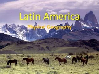
Latin America Physical Geography 8.1
Physical Geography 8 mil sq. miles (~equal to N.A.) • Made up of Middle America and South America • Caribbean sometimes debated as part of MA
Yellow- Caribbean Green- Central America Red- Middle America Purple- South America All together is LATIN AMERICA
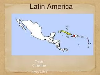
Physical Geography • Caribbean aka West Indies • 3 parts: Lesser Antilles, Greater Antilles, & Bahamas • Brazil is largest and most pop. of SA’s 13 countries
Highlands • Begins in Pac. Ranges/ Rockies Mexico’s Sierra Madre CA’s Central Highlands SA’s Andes • map pg 195 • Crust collision, sits on Ring of Fire
Highlands • Mexico’s Sierra Madre • Sierra Madre Oriental (eastern) & Sierra Madre Occidental (western) meet at Sierra Madre del Sur • Surrounds Mxn Plateau • Mild climate, volcanic soil in South= settlement
Highlands • Most Caribbean islands part of Central Highlands (range goes across sea) • Volcanic islands • Some still active
Highlands • Andes Mtns • 4500 miles long, world’s longest • Cordilleras- several ranges running parallel • Encircle high plains (altiplano) in Peru & Bolivia
Atacama Desert • Driest place on Earth! • Some areas have never received rainfall since recordkeeping began • More than a million ppl live here • Live near coast, oases, or farm with drip-irrigation • Fog Catching Net: • Fog rolls in condenses on net drips to pipes water crops
Highlands • Mato Grosso Plateau- from eastern Peru & Bolivia to most of Brazil • Low pop. • Brazilian Highlands- from MGP to eastern Brazil, ends in escarpment (cliff)
Lowlands • Coastal plains along Brazil’s coast • Next to escarpment • Prime area for settlement/tourism • Llanos (Colombia & Venezuela) & Pampas (Argentina & Uruguay) • Grazing plains, pampas= breadbasket • Cowboys= llaneros or gauchos
WATER • MA’s rivers are small, but SA’s are HUGE! • Rio Grande (Rio Bravo del Norte) is major one, though, outside SA • Amazon- 4000 miles (NYC to Rome, Italy) • 20% of Earth’s freshwater, 10X the volume of the Mississippi • Hundreds of sm. rivers join it Amazon Basin (creates a valuable functional region) 40% of SA • Only navigable for 2300 miles from Atlantic
WATER • Parana, Paraguay, & Uruguay next lrgst water system • Commercial highway, hydroelectricity • Flow into estuary (Rio de la Plata) before Atlantic
Notice the intense terracing!! • Lake Titicaca- world’s highest (elev.) navigable lake (Andes- Peru & Bolivia) • 12,500 ft above sea level • Center for Incas
WATER • Lake Titicaca is fed by rivers, melting glaciers, & rainfall • Losing water with shorter rain seasons & less glaciers (lowest since 1949)
Caribbean Sea • Lake Maracaibo- SA’s largest (Venezuela) • Caribbean inlet • Rich oil fields
Lake Nicaragua- CA’s largest lake (b/w Nicaragua & Costa Rica) • Smaller than Titicaca • Has small volcanic islands w/in • Known for Caribbean pirates!
Resources • Oil: Gulf of MX and southern Caribbean MX and Venezuela are leaders in world (OPEC) • Leaders in gold, silver, emeralds, copper (ancient civs. prospered with them) • Problems: geography, lack of $, social/political unrest prevent development of resources
5 Min Video • Physical geography video