Download

1 / 74
740 likes | 1.05k Vues
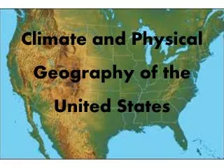
The Geography of the United States. By: Ms. Susan M. Pojer Horace Greeley HS Chappaqua, NY. US Geography Basics. Third largest country in the world. Half the size of Russia. One third the size of Africa. Half the size of South America. 2 ½ times the size of Western Europe.

E N D
The Geography of the United States By: Ms. Susan M. PojerHorace Greeley HS Chappaqua, NY
US Geography Basics • Third largest country in the world. • Half the size of Russia. • One third the size of Africa. • Half the size of South America. • 2 ½ times the size of Western Europe.
A New England Fall The back roadsof Vermont Kancamagus Highway, Maine Covered Bridge over the Connecticut River
North-South Divide: The Mason-Dixon Line Charles Mason & Jeremiah Dixon: 1763-1767
Bodies of Water Great Salt Lake Chesapeake Bay LakeOkeechobee
Rivers St. Lawrence R. Columbia R. Hudson R. Missouri R. Potomac R. Mississippi R. Ohio R. Colorado R. Arkansas R. Rio Grande R. Yukon R.
The Mississippi: America’s Great River Road • The “Big Muddy”. • 2,350 miles. • Draining all or part of 31 states & 2 Canadian provinces. • Covers 40% of the U. S.
Great Mississippi Flood, 1993 St. Louis, MO before the flood St. Louis, MO during the flood St. Louis, MO after the flood
Great Salt Lake • 2000 square miles. • 10’ – 28’ deep. • 6 times saltier than the oceans.
Mountains & Plateaus Adirondack Mts. Cascade Mts. Rocky Mts. Appalachian Mts. Sierra Nevada Mts. ^ Mt. Whitney ^ Pike’s Peak ^ Mt. McKinley Alaskan Range
Plains GreatBasin Central Plains Atlantic Coastal Plains Gulf Coastal Plains
Plateaus Cumberland Plateau
Cumberland Plateau & ‘Gap’ • AL, KY, TN, VA, WV • 24,640 sq. mi. • Natural passage [Gap] through the Cumberland Mts.
Deserts Death Valley Mohave Desert
Death Valley, CA • 3.3 million acres. • 95% wilderness.
Completed Map St. Lawrence R. Columbia R. Adirondack Mts. Cascade Mts. Hudson R. Missouri R. Rocky Mts. Great Basin Potomac R. Cumberland Plateau Great Salt Lake Mississippi R. Chesapeake Bay Central Plains Appalachian Mts. Sierra Nevada Mts. ^ Mt. Whitney Ohio R. Colorado R. ^ Pike’s Peak Death Valley Atlantic Coastal Plains Arkansas R. Mohave Desert Gulf Coastal Plains LakeOkeechobee Rio Grande R. Yukon R. ^ Mt. McKinley Alaskan Range