Download
1 / 24
240 likes | 356 Vues
HURRICANE THREAT PREPAREDNESS in Rhode Island. By Natacha Thomas, Assistant Professor, URI, CVE Alolade Campbell, Graduate Research Assistant, URI, CVE Christopher Hunter, Associate Professor, URI, CVE Donald, Cunnigen, Professor, URI, Sociology Liliana Gonzalez, Professor, URI, CSS.

E N D
HURRICANE THREAT PREPAREDNESSin Rhode Island By Natacha Thomas, Assistant Professor, URI, CVE Alolade Campbell, Graduate Research Assistant, URI, CVE Christopher Hunter, Associate Professor, URI, CVE Donald, Cunnigen, Professor, URI, Sociology Liliana Gonzalez, Professor, URI, CSS
Risk Explanatory VariablesDefinitions • Threat ̶ Source of harm • Exposure ̶ Subjection to a threat • Resilience ̶ Ability to cope with a threat • Vulnerability ̶ Susceptibility to exploitation by a threat • Preparedness ̶ Readiness to demonstrate resilience • Risk ̶ Measure of the potential for harm from a threat and of its severity
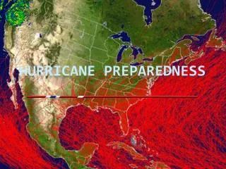
Hurricane Exposure Facts—RI • Hurricane Frequency = 13% • Exposure = 133,000 (Census Bureau, 2000) residents of the hurricane evacuation zones A, B and C • 10,400 (7.8%) without vehicles • 1,304 without vehicles in zone C • Northeast hurricanes tend to belong to lower Saffir-Simpson category and yet to display faster forward moving speed
Hurricane Frequency • Expressed as an average number of hurricanes per year. • Number of historical hurricanes within a 75-nautical mile radius of RI1. • Divided by number of years spanned by data source. 1 (Tropical Cyclone of the North Atlantic Basin 1851– 2001, US National Oceanic and Atmospheric Administration, Tropical Prediction Center/National Hurricane Center).
RI Towns Most at Social Risk • to Storm Surges: Warwick, Newport, Barrington, East Providence, Narragansett, Warren, Providence • to Maximum Sustained Winds: Pawtucket, Warwick, Cranston, Coventry, East Providence, Woonsocket
Perceived RI Household Preparedness • Recent survey (Campbell et al., 2007) indicatesa lack of perceived preparedness for hurricanes of RI households. • Prepared (49 %) • Not Prepared (51 %)
Actual RI Household Preparedness • Campbell et al., probe the actual preparedness of RI households. • Hazard knowledge • Formal/Informal Response Plans • Life Safety Protection • Property Protection • Emergency Coping and restoration of key function • Initiation of Recovery
Hazard Knowledge Campbell et al. (2007) expose a lack of awareness of the evacuation zones and alimited recognition of a potential for exposure to hurricane threat agents. • Storm Surge — Major Hurricane • Exposure Threat Recognition (24/74/2 %)2 Of the 24 %, 15 % in evacuation zones, 9 % outside the zones Of the 74%, 55 % not in evacuation zones, 19% in evacuation zones • Evacuation Zone Awareness Do Not Know (52 %) • Sustained Winds — Major Hurricane • Exposure Threat Recognition (71/27/2 %) 2(yes/no/missing) with 34% of the respondents living in the flood zones
Formal/Informal Response Plans Campbell et al. (2007) expose a heavy reliance on own perception and a lack of compliance with elected officials in making the evacuation decision • Compliance with Evacuation Order • Elected officials (80/18/2 %) • Compliance with Evacuation Advice • police officers or firefighters (75 %), weather services (61 %), elected officials (57 %), own concern about severity of hurricane (53 %) • Evacuation Concerns—Possible Reasons not to Evacuate • no official notice (38 %), crowded roads (31 %), well built and safe home (30 %), stolen possessions (29 %), pets (24 %), evacuation unnecessary per officials (21 %)
Formal/Informal Response Plans Campbell et al. (2007) expose numerous evacuation stragglers, a lack of evacuation trip destinations for 27% of households • Evacuation Startup Time • < 6 hours (71 %), <6 and <12 (6.5 %), > 12 hours (8 %), undecided (3 %), missing (12%) • Evacuation Destination • Friend’s/Family Member’s home (46 %), Sheltering (11 %), Hotel/Motel (10 %), Other (3 %), Do not Know/Undecided (27 %), Missing Data (3 %)
Formal/Informal Response Plans Taubman’s Center for Public Policy (2006) exposes lack of knowledge of evacuation routes. • Evacuation Destination (Taubman’s Center for Public Policy, 2006) • Could Stay with Acquaintance/Relative in other Community (82 %), Could not (15 %), Do not Knowor Missing Data (3 %) • Evacuation Route (Taubman’s Center for Public Policy, 2006)3 • Have Knowledge (28 %) 3Taubman’s Center for Public Policy, Brown University, Providence, RI, http://www.insidepolitics.org/REL206.html
Formal/Informal Response Plans Campbell et al. and Taubman’s Center for Public Policy expose large extent of non-vehicular evacuation. • Transportation at Evacuation (Campbell et al, 2007) • Own Car (86 %), Friend’s Car (1 %), Public Transportation (2 %), Walking or Riding Bicycle (4 %),Undecided (4 %) or Missing Data (3 %) • Transportation at Evacuation (Taubman’s Center for Public Policy, 2006) • Own Car or Truck (87 %), Friend’s Car or Truck (7 %), Bus (1 %), Plane (1 %), Do not Know or Missing Data (4 %)
Formal/Informal Response Plans Campbell et al. expose some trust in government rescue. • Trust in government rescue if shelter-in-place • Trust (~50 %) • No Trust (~50 %)
Life Safety Protection Campbell et al. (2007) expose need for orlack of resources that aim to protect life. • Health Insurance Ownership (90/9/1 % Hhlds) • Prescription Drug Needed (74/25/1 %) • No Extra (3-week) Drug Supply (41 % or .55*74 %) • Insurance coverage prevents extra supplies • Chronically Ill/Disabled/Need help evacuating (11/88/1 %)
Property Protection Campbell et al. (2007) expose alack of resources that aim to protect property. • Home Insurance (74/25/1 %)4 • Flood Insurance (16/83/1 %) • Rental Insurance (7/92/1 %) 4Note that the sample contains 78/20/2 % of homeowners/renters/missing.
Emergency Coping and Restoration of Key Function Campbell et al., 2007, and Taubman’s Center for Public Policy, 2006, expose alack of resources that aim to cope with hurricane emergency. • Resources • Emergency kit with food and water (35 %) (Taubman’s Center for Public Policy, 2006), • Food (81/17/2 %), water (61/37/2 %), battery-operated radio (63/36/2 %), flashlight (88/10/2 %), first-aid kit (73/25/2), extra batteries (74/24/2 %), cell phone (88/10/2 %), $300 cash (36/62/2 %), sterno (35/63/2 %) (Campbell et al., 2007)
Initiation of Recovery Campbell et al. (2007) expose a lack of intention/abilityto secure the resources necessary to protect property • Items retrieved prior to evacuation • Proof of health insurance (84/13/3 %) • Prescription drugs (67/30/3 %) • Homeowners Insurance (51/45/3 %) • Social Security Cards (57/40/3 %)
CONCLUSIONS • Rhode Island households are in dire need of enhanced preparedness for a hurricane threat.