Download
1 / 14
140 likes | 270 Vues
This update from the MWCOG Technical Committee in November 2004 covers the Clearinghouse Project, new features in 2004, future steps, and a demonstration. The project includes a regional transportation database with datasets available from 1986 to 2003, traffic volume data from DC, MD, VA, COG survey data, and more. The update introduces new views like Census Data View, Detailed Traffic Volume View, and Clearinghouse Network. It also includes data on trends such as population, households, and employment. The demonstration showcases the Detailed Traffic View with network volumes for MD and VA in May 2001 with various menu choices for detailed traffic counts. Future steps involve continued data acquisition, adding more years and sources, and enhancing the availability of the Clearinghouse Project.

E N D
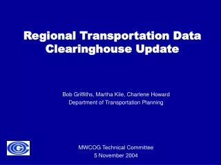
Regional Transportation Data Clearinghouse Update MWCOG Technical Committee 5 November 2004 Bob Griffiths, Martha Kile, Charlene Howard Department of Transportation Planning
Overview • Background • Clearinghouse Project • What’s New in 2004 • Views • Future Steps • Demonstration
Background • Regional transportation database • Datasets available for 1986 - 2003 • Updates and additions as data become available • Data in Clearinghouse • COG transportation network data • Traffic volume data received from DC, MD, VA • COG survey data • Cooperative Forecast (Round 6.3) • Alternative transportation data (transit, bike, etc.)
Clearinghouse Project • Arcview 3.2 project • Six different ‘views’ of data • View-specific menu choices • Buttons available throughout project • Spatial data- ESRI Arcview shapefile format • Other files- DBF tables, Avenue scripts, custom legends
What’s new in 2004 • New Views • Census Data View • Detailed Traffic Volume View • New data in other views • Datasets • Menu choices
Clearinghouse View • New Clearinghouse Network • 2003 network • Additional years for traffic volumes • 2001 • 2002 • 2003 • Truck Restrictions dataset
Regional Trends View • Round 6.3 Cooperative Forecast data • Population • Households • Employment • Compare data • 1990-2000 • 2000-2010 • 2010-2030
Survey View • 2003 Arterial Travel Time Study data • 2002 Metro Core Cordon Count data
Transit View • Bicycle Facilities data • 2003 AM Peak and Off Peak Bus Routes • WMATA Spring 2002 Rail Passenger Study • Mode of Access • Mode of Egress
Census View • Entirely new view • Census Tracts and Block groups • Menu options • Mode of Transportation to Work • Travel Time to Work
Detailed Traffic View • Entirely new view • Network volumes for MD and VA for May 2001 (trial period) • Menu choice: zoom to links with detailed traffic counts • View Tool: get counts • Choices • Specific Date • Average of all days • Average of weekdays • One table for each direction • Volume information • Link information
Detailed Traffic View Example table
Future Steps • December Technical Committee Meeting • Distribution of Clearinghouse Project on CD • Current Plans • Continued data acquisition • Additional years • Additional sources • Detailed traffic view: additional time periods such as AM and PM peak, off-peak • Clearinghouse availability • Alternatives to Arcview GIS project?