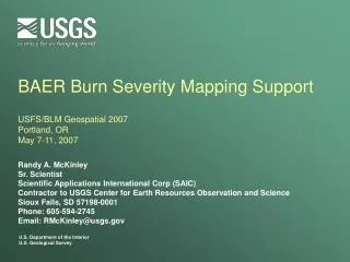
Post-Fire Burned Area Reflectance Classification (BARC) and Data Request Information
The Burned Area Reflectance Classification (BARC) provides immediate post-fire analysis maps essential for Burned Area Emergency Response (BAER) teams. For US Forest Service lands, access resources via the FS link to the Remote Sensing Applications Center in Utah. Extended assessments highlight delayed impacts such as mortality and vegetation recovery, ideally assessed with post-fire imagery at peak green during the next growing season. Explore various data products including Landsat imagery and Burn Severity Measures to evaluate and enhance field assessments.

Post-Fire Burned Area Reflectance Classification (BARC) and Data Request Information
E N D
Presentation Transcript
Burned Area Reflectance Classification (BARC) http://burnseverity.cr.usgs.gov/help.asp
Request Data "Emergency Requests" are for an immediate post-fire Burned Area Reflectance Classification (BARC) map for use by BAER teams. For US Forest Service lands, follow the FS link to the to the USFS Remote Sensing Applications Center in Utah. For other requests, please follow "Other Agencies." "Extended Assessments" give a more comprehensive assessment of the impact of the fire. Delayed mortality and vegetation recovery become more evident. Ideally, the post-fire imagery is acquired at peak of green during the next growing season. Click on "National Park Service" for fires on National Park Service lands. Click on "Other Agencies" for other fires.
Product List • ArcView project on CDROM (specified projection) containing: • Differenced Normalized Burn Ratio image • Pre-Fire Landsat Data (subset around fire area) • Post-Fire Landsat Data (subset around fire area) • Fire Perimeter (user-provided or digitized from Landsat) • Color-Coded Burned Area Reflectance Classification, BARC • Note: the BARC will denote a first approximation of the burn severity. You will need to evaluate, compare and perhaps modify the results with field knowledge.
Landsat 7 Path 42 row 28 July 27, 2000
Landsat 7 Path 42 row 28 August 28, 2000
Craig Mountain area before and after the Maloney Creek Fire July 27, 2000 August 28, 2000
Image pre-processing – conversion of DN to reflectance values -- atmospheric correction if necessary
Normalized Burn Ratio (NBR) – A Landsat TM Radiometric Measure of Burn Severity NBR = (R4 – R7) / (R4 + R7) http://nrmsc.usgs.gov/research/ndbr.htm
Delta NBR cheat sheet http://burnseverity.cr.usgs.gov/pdfs/LAv4_BR_CheatSheet.pdf