Bathymetry
Bathymetry. Oceanography Lab 1 Prof. Rodriguez. bathymetry (bathymetric) – from the Greek root bathy – meaning depth, and metry – meaning measurement. Sounding – depth measurements isometric - lines of equal measure contour lines - lines of equal height isobath - lines of equal depth.

Bathymetry
E N D
Presentation Transcript
Bathymetry Oceanography Lab 1 Prof. Rodriguez
bathymetry (bathymetric) – from the Greek root bathy – meaning depth, and metry – meaning measurement. • Sounding – depth measurements • isometric - lines of equal measure • contour lines - lines of equal height • isobath - lines of equal depth
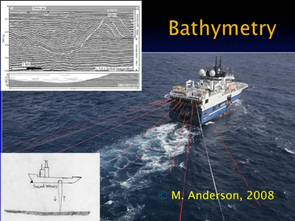
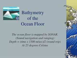
Echo sounder or fathometer – produces sound and is used to measure depth • Sound in sea water travels • about 1450 meters/second • We can calculated the depth if we know the time it takes sound to travel
The deepest part of the ocean, the Marianas Trench, compared with the highest point of land, Mt. Everest is approximately 5.5 miles (29,000 feet) high, and the Marianas Trench is approximately 7.4 miles (39,000 feet) deep. • This means we could set Mt. Everest in the Marianas Trench and still have almost two miles (10,000 feet) of ocean water between its highest point and the ocean's surface.
Topographic maps are basically a bird's eye view of a region of land in which elevations are expressed with labeled contour lines. • The path of the lines follow the contours of the slopes they represent.
Such drawings of the land are known as maps, but if the drawings are of the sea floor, they are known as charts. • The 805 meters would be the highest point on land, but it would be the lowest point in the sea. If a straight line is drawn horizontally across the map above such that two of its points cross the two highest elevations, the profile of the land along that line looks approximately like this:
If those two points are considered depth because the drawing is a chart of the sea floor, the profile would be a mirror image:
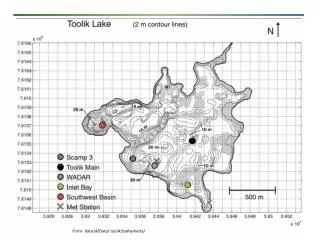
Rules of Construction of Bathymetric Chart • 1. Isobaths never cross one another • 2. When isobaths go thru a canyon or a deep valley, they have a V-shape with the apex of the V pointing toward shallower water. • 3. An isobath must separate depth zones completely • 4. Close spacing indicates a steep slope, widely separated a gentle slope • 5. An isobath or contour line closes upon itself.