LATIN AMERICA
360 likes | 376 Vues
Explore the physical characteristics of Latin America, including its diverse climates, rainforests, grasslands, mountains, and rivers. Learn about the cultural region and the Spanish and Portuguese languages spoken in the region. Test your map knowledge and delve into vertical zonation in the Andes Mountains. Let's embark on a journey through Latin America!

LATIN AMERICA
E N D
Presentation Transcript
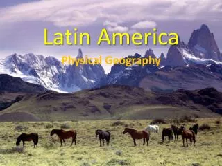
LATIN AMERICA Physical Characteristics SOL WG.6
Where is Latin America? • Find Mexico on a World Map... …and move southward
WHY is it called Latin America? And Spanish just about everywhere else!!! Portuguese is spoken in Brazil • Latin is a language • The two widely spoken languages are Latin-based www.skokienet.org/ festival/cultures.html
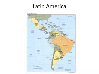
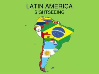
Wow! • Did you know that Latin America includes 28 countries in Central America, South America, and the Caribbean. • Latin America is known as a Cultural Region, because the majority of the countries speak Spanish. • Test your map knowledge! • Go to the following website: _ https://education.maps.com/games/latin-america-quiz-game/ • Click on Latin America Map Game • Practice labeling the map at least once!
What physical characteristics do we need to know? CLIMATE • Most of the region experiences TROPICAL climates because of its location near the equator.
The area directly on the equator has a tropical rainforest climate. This rainforest is the largest in the world, and is called the Amazon Rainforest!
Draw the Amazon River on your map!
Unfortunately, we’re being cut down and set aflame to make room for interior farmland and construction!!!! OUCH!!! This is called “Slash and Burn” Agriculture Rainforests: Costa Rica and Brazil~ Amazonia (in Brazil) is the largest in the world! “Amazonia” http://www.ran.org/info_center/about_rainforests.html
Along with climate, • In the Southern Hemisphere: • Remember that SEASONS are REVERSED:desrever
What calendar picture might be in the month of August in Chile?
The western coast of South America experiences a dry climate. What is the name of the desert that is found here? Random Art Work found in the Atacama Desert. Constructed by Chilean Sculptor Mario Irarrazabal. Dedicated in 1992. Stands 36 feet tall.
Label the Atacama Desert on your map!
#4c on Chapter 7 HW Grasslands: huge, flat plains in Latin America- known for agriculture: • The Llanos are in Colombia & Venezuela and the most famous are the Pampas in Argentina & Uruguay
We’re usually found in grassland ranches…like the Llanos in Venezuela Or the Pampas of Argentina…. where the best beef cattle in the world is raised!! Llanos Latin American Cowboys are called Gauchos Pampas
Label the Llanos and the Pampas on your map!
Greater (Bigger) Antilles More Physical Features: • There are MANY islands in Latin America • The Caribbean Islands are called the “West Indies” or the “Greater and Lesser Antilles” • The Caribbean Islands are well known for their agriculture and tourism Lesser (Smaller) Antilles What is the name for a chain of islands? ARCHIPELAGO!
ANDES MOUNTAINS: The longest chain and 2nd highest mountains in the world!!
The western side of Latin America is part of the That encircles the Pacific Rim. What natural occurrences do you think occur here? RING OF FIRE!
Earthquakes volcanoes
Rio Grande Forms the border between Mexico & US The AMAZON!! The largest river in the world!! Rivers in Latin America
Mountains in Latin America Sierra Madres ANDES MOUNTAINS: The longest chain and 2nd highest mountains in the world!!
The next slide will help you with question # 17 on Chapter 7HW GET IT OUT AND USE THE NEXT SLIDES TO HELP YOU!
Mountains in Latin America can be split into agricultural “zones” as you move higher up the mountain. This is called “vertical zonation” Tierra Helada Sierra Madres Tierra Fria Hardy crops – Potatoes, wheat, barley Tierra Templadacrops that like temperate land ANDES MOUNTAINS: The longest chain and 2nd highest mountains in the world!! Tierra Calientecrops that like hot temperatures
Let’s learn Some Spanish!
Tierra = Land Helada = Frost/Frozen Fria = cold
Templada=Temperate Caliente = Hot/Warm
Now that you are done with the notes, go back to Map Game and practice one more time! • Test your map knowledge again! Try this website out! • http://www.lessonpaths.com/learn/i/us-geography-states-for-fourth-grade/sheppard-software-usa-geography-geography-online-games