Download
1 / 36
360 likes | 494 Vues
This report, presented by Nate Mantua, PhD, from the University of Washington's Climate Impacts Group, focuses on the resilience of the Pacific Northwest to climate variations and change. Supported by NOAA, it discusses accumulated precipitation data, temperature anomalies, and forecasts for 2007-2008, highlighting the influence of La Niña and Pacific Decadal Oscillation (PDO). The report predicts a cool-wet beginning to fall 2008 and outlines expectations for ENSO-neutral conditions, emphasizing risks of major flood events due to prevalent climate patterns.

E N D
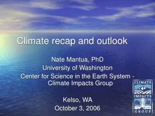
Climate recap and outlook Nate Mantua, PhD University of Washington Center for Science in the Earth System - Climate Impacts Group Vancouver, WA October 2, 2008
The CSES - Climate Impacts Group http://cses.washington.edu/cig/ • Goal: help the Pacific Northwest become more resilient to climate variations and climate change • Supported by NOAA Climate Program Office as part of the Regional Integrated Science and Assessments (RISA) program
Accumulated Precip for the past year Source: http://www.cpc.ncep.noaa.gov/products/global_monitoring/precipitation/northwest_1yrprec.shtml
Accumulated Precip for the past year December 3rd storm Source: http://www.cpc.ncep.noaa.gov/products/global_monitoring/precipitation/northwest_1yrprec.shtml
Chehalis River Flooding at Centralia, WA Seattle PI, Dec 5, 2007 Seattle Times, Dec 17, 2007
Daily Temperatures -0.67ºC
A big snow year for the Cascades Mark Stoelinga at his Skykomish Cabin January 31, 2008 http://www.komonews.com/news/15089626.html Elev 3500ft
Summer ocean conditions upwelling downwelling
Coastal Upwelling • Area below (above) black line indicates climatological upwelling (downwelling) season. • Climatologically upwelling season progresses from March to July along the west coast of North America from 36ºN to 57ºN. • Figures provided by Yan Xue, NOAA NCEP Winter downwelling was weak; upwelling was strong in April, May, and June, but weak in July-August
Coastal ocean temperatures were cold from winter through July
Oct 2007-June 2008 SST anomalies: La Niña and a cool phase of the PDO
Land and Ocean temperature anomaly was +0.72°C (1901-2000 climatology), 8th warmest in 129 years
Pacific Climate Outlook Summary from Oct 2007 • forecasts rated La Niña as most likely situation for 2007-08 • PDO: Transiting to cool phase as La Niña fades Forecast summaries European Center 2007 2008 2007 2008
Typical winter climate pattern jet stream during past La Niña winters
Last Year’s forecast: Wet Autumn and winter, Equal Chances on Temperature Temperature Precip OND OND DJF DJF
Blame the circulation pattern • observed 500mb height anomalies from Dec 2007-June 2008 shows a persistent region of high heights in the Gulf of Alaska and low heights over south-central Canada … L H
Blame the circulation pattern • At left is a “composite” for the last 8 La Niña periods … a close match to 2007-2008 pattern
La Nada • Tropical ocean temperatures have generally returned to long-term averages
Equatorial subsurface ocean temperature anomaly • Colder than average waters in the east indicate a shallow thermocline, favoring additional cooling in the near term
The latest ENSO forecasts See http://iri.columbia.edu/climate/ENSO European Center Forecast summary
PDO forecast: drifting toward neutral territory -- index has been negative since last September From June-July-August 2008 initial conditions http://www.cdc.noaa.gov/forecast1/for1pdo.html
Another factor in seasonal forecasts PNW December-January-February temperatures
30-day climate forecast: expect a cool-wet beginning to fall (from Sept 30, 2008) See http://www.cpc.ncep.noaa.gov
CPC Forecasts from Sept 18, 2008 precipitation temperature
The Bottom line • expectation for ENSO-neutral conditions, combined with recent trends, favors “Equal Chances” for fall-winter precipitation and a small increase in the odds for warmer than average temperatures • ENSO neutral and La Niña years tend to favor major flood events • Additional influence from PDO might offset another factor… • Persistent warming trends See http://www.cpc.ncep.noaa.gov
Sept 30 estimated soil moisture percentiles • Courtesy of Andy Wood, University of Washington, data and images are available at http://www.hydro.washington.edu/forecast/monitor
Daily Temperatures -0.67ºC +0.03ºC -0.64ºC