Bathymetry Lab
Bathymetry Lab. Adam Fox Coastal Carolina University. What is Bathymetry?. Bathymetry : the measurement of water depth. Multiple measurements of depth can used to visualize the topography of the sea floor. Why Map the Sea Floor?. Why Map the Sea Floor?.

Bathymetry Lab
E N D
Presentation Transcript
Bathymetry Lab Adam Fox Coastal Carolina University
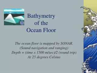
What is Bathymetry? • Bathymetry: the measurement of water depth. Multiple measurements of depth can used to visualize the topography of the sea floor.
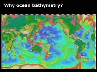
Why Map the Sea Floor? • To learn about the deep parts of the ocean that are hard to observe • To gather information about plate tectonics • To find shipwrecks and other items of interest • To aid in navigation
Mapping the Sea Floor • How do we map the sea floor today?
Satellite Altimetry • Use satellites to measure sea surface height • Sea surface height corresponds to sea floor height Graphic: topex.ucsd.edu
Side-Scan Sonar • Very detailed images of small areas of sea floor
Satellite Altimetry • Use satellites to measure sea surface height • Sea surface height corresponds to sea floor height • AUVs can also be used to map the sea floor Photo: NOAA
Mapping the Sea Floor • How did we map the sea floor before satellites?
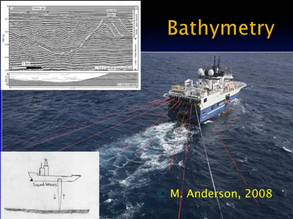
Echo-sounding • Send sound waves down to sea floor • Listen for them to bounce back. • Use a formula to calculate water depth • Multi-beam bathymetry • Use lots of sound beams at once Graphic: saddleback.edu
Mapping the Sea Floor • What about before then?
Mapping the Sea Floor • Lead Lines • A weighted rope with depth markings Photo: NOAA
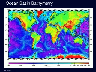
Maps of the Ocean Floor • Contour Map • Contour lines (isobaths) connect areas of similar height/depth • Bathymetric Cross-Section • Shows what it would be like if you walked along the sea floor on a specific line • Depth often exaggerated to make features more visible
Maps of the Ocean Floor Contour Map Cross-Section Image: NOAA
* We would like to know more about our local water body. What questions do we have about the pond itself?