Exploring the Diverse Geography of Latin America: Mountains, Plains, and Rainforests
220 likes | 415 Vues
Latin America is a vast region influenced by Spanish and Portuguese settlers, covering 1/6 of the world's land surface from the Rio Grande to Cape Horn. This area is rich in geographical features, including the majestic Andes mountains, expansive plains like Argentina's Pampas, and the lush rainforests of the Amazon Basin. The region's unique landscapes present challenges such as difficult travel and communication, while supporting a diverse ecosystem with a plethora of flora and fauna. Experience the beauty of mountains, rivers, and deserts throughout this captivating region!

Exploring the Diverse Geography of Latin America: Mountains, Plains, and Rainforests
E N D
Presentation Transcript
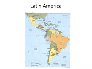
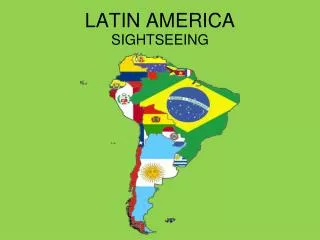
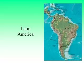
Latin America • a region that was influenced by Spanish/Portuguese settlers • 1/6 of world’s land surface • Runs for 5,500 miles • From Rio Grande to Cape Horn • In between have • Mexico • 7 countries of Central America • 13 island nations • 12 countries of South America • Lies between Pacific and Atlantic Oceans Map of Latin America
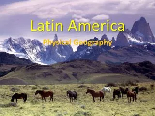
Geographical features • Mountains • Plains • Rivers • Rain Forests • Deserts
Mountains • Dominate much of Latin America • One chain called La Cordillera • In Mexico split and are called • Sierra Madre Occidental • Sierra Madre Oriental • Sierra Madre del Sur • South America • The Andes • 4000 miles/Longest continuous mts chain in the world/back bone of South America In Peru Copper Canyon in Mexico In Argentina
Problems Mts. cause • Block communication • Travel is difficult • Loyalties and ties with region rather then to nation • Mts are young and still developing = volcanic eruptions/earthquakes/avalanche Earthquake in Mexico City - 1985
Plains • Coast and inland plains • Two of the most important • Pampas of Argentina • Llanos of Colombia and Venezuela
Argentine Pampas • Spread almost 500 miles north to the Salado del Norte River and south to the Colorado River • In the east the Pampas are hot, west they are dry • Domain of the gaucho = person who works with cattle • Late 1800s way of life disappeared • One of the breadbaskets of the world • Cereals/cattle/pigs
Llanos of Colombia and Venezuela • From the delta of the Orinoco River in Venezuela westward into southern Colombia • Made up of level areas, rolling plains and low mesas (broad flat elevated areas) • Cattle major economic activity
Rivers • Five major river systems • Magdalena in Colombia • Orinoco in Venezuela • Amazon in Brazil • Sao Francisco in Brazil • Rio de la Plata in Argentina
Rain Forest • Mostly near the Equator • Stay green all year-round • Rainy and hot • More kinds of trees and animals than any other area of the world • Largest/oldest = Amazon Basin • Covers 1/3 of South America
Deserts • Patagonian and Monte deserts of Argentina • Atacama Desert in Chile • One of the driest in the world • No vegetation grows • People in towns have never seen rain Patagonian Desert Atacama Desert Atacama Desert