Download
1 / 28
330 likes | 668 Vues
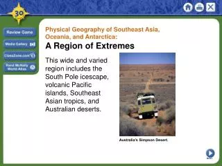
Physical Geography of Southeast Asia, Oceania, and Antarctica: A Region of Extremes. This wide and varied region includes the South Pole icescape, volcanic Pacific islands, Southeast Asian tropics, and Australian deserts. Australia’s Simpson Desert. NEXT.

E N D
Physical Geography of Southeast Asia, Oceania, and Antarctica: A Region of Extremes This wide and varied region includes the South Pole icescape, volcanic Pacific islands, Southeast Asian tropics, and Australian deserts. Australia’s Simpson Desert. NEXT
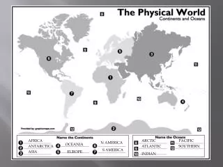
Physical Geography of Southeast Asia, Oceania, and Antarctica: A Region of Extremes Landforms and Resources SECTION 1 SECTION 2 Climate and Vegetation Human-Environment Interaction SECTION 3 Unit Atlas: Physical Unit Atlas: Political NEXT
Section 1 Landforms and Resources • This region includes two peninsulas of Asia, two continents, and more than 20,000 islands. • Its landforms include mountains, plateaus, and major river systems. NEXT
SECTION Landforms and Resources 1 Southeast Asia: Mainland and Islands Peninsulas and Islands • Mainland Southeast Asia lies on two peninsulas - rectangular Indochinese Peninsula is south of China - Malay Peninsula is 700-mile strip south from mainland • Malay Peninsula bridges mainland and island archipelagoes - archipelago—set of closely grouped islands, often in a curved arc - Malay Archipelago includes the Philippines, Indonesian islands Continued . . . NEXT
SECTION 1 continuedSoutheast Asia: Mainland and Islands Mountains and Volcanoes • Mainland mountain ranges, like Annamese Cordillera, run north-south - fan out from northern mountainous area • Island mountains are volcanic in origin, part of Pacific Ring of Fire - volcanic eruptions, earthquakes are common in region Map Continued . . . NEXT
SECTION 1 continuedSoutheast Asia: Mainland and Islands Rivers and Coastlines • Several large mainland rivers run south through mountain valleys - spread out into fertile deltas near coast •Mekong River starts in China, ends in wide delta on Vietnam coast - farming, fishing along river support millions of people Image Resources • Volcanic activity, flooding rivers create nutrient-rich, fertile soil •Rivers, seas provide fish; some areas have petroleum, tin, gems NEXT
SECTION 1 Lands of the Pacific and Antarctica No Exact Number • No one knows how many islands there are in the Pacific - some estimate there are more than 20,000 - hard to count because islands vanish and new ones appear • As a group, the Pacific Islands are called Oceania - includes New Zealand, Australia (a continent, not an island) - doesn’t include Philippines, Indonesia—culturally Asian Continued . . . NEXT
SECTION 1 continuedLands of the Pacific and Antarctica Oceania’s Many Islands • Some islands vanish due to erosion, new ones are created •Volcanoescreate high islands, coral reefs make up low islands - most islands are small; total land area is smaller than Alaska •In general, islands lack minerals but: - New Caledonia has nickel, chromium, iron - New Guinea has copper, gold, oil - Nauru has phosphate Interactive Continued . . . NEXT
SECTION 1 continuedLands of the Pacific and Antarctica Majestic New Zealand • New Zealand has two main islands, North Island and South Island •Southern Alps—300-mile mountain range down center of South Island - 16 peaks over 10,000 feet; over 360 glaciers •North Island has hilly ranges, volcanic plateau - fertile farmland; forests for lumber; natural harbors •Few mineral resources, but dams generate electricity Image Continued . . . NEXT
SECTION 1 continuedLands of the Pacific and Antarctica Flat Australia • Australia is earth’s smallest, flattest continent • Great Dividing Range—chain of highlands parallel to east coast • West of range are plains and plateaus • Murray River is largest of continent’s few rivers • Little forestry, but rich in bauxite, diamonds, opals, lead, coal • Great Barrier Reef—1,250-mile chain of 2,500 reefs, islands Chart Continued . . . NEXT
SECTION 1 continuedLands of the Pacific and Antarctica Icy Antarctica • Fifth-largest continent is circular in shape, centered on South Pole • Thick ice sheet covers landscape—world’s largest fresh-water supply • Transantarctic Mountains divide continent - East Antarctica is plateau surrounded by mountains, valleys - West Antarctica is group of separate islands linked by ice • There could be coal, minerals, petroleum under ice - in 1991, 26 nations agreed not to mine region for 50 years Image NEXT
Section 2 Climate and Vegetation • This region’s climates range from tropical to desert to polar icecap. • There is a great diversity of plant and animal life, including some species found nowhere else in the world. NEXT
SECTION Climate and Vegetation 2 Widespread Tropics Year-Round Rains • Tropical wet climate in coastal Myanmar, Thailand, Vietnam, Oceania - also in most of Malaysia, Indonesia, Philippines • High temperatures—annual average of 80 degrees in Southeast Asia • Parts of Southeast Asia get 100, even 200 inches of rain annually • Some variations—high elevations in Indonesia have glaciers Image Continued . . . NEXT
SECTION 21 continuedWidespread Tropics Wet and Dry Seasons • Tropical wet and dry climate borders the wet climate - weather is shaped by monsoons - found in parts of Myanmar, Thailand, Laos, Cambodia, Vietnam • Temperatures are consistently hot, but rainfall varies • Monsoon areas often have disastrous weather - typhoons can occur in region during the wet season Continued . . . NEXT
SECTION 21 continuedWidespread Tropics Tropical Plants • Southeast Asia has great vegetation diversity - tropical evergreen forests near equator - deciduous forests in wet and dry zone - teak is harvested commercially • Oceania doesn’t have diverse vegetation - low islands have poor soil, little rain (few plants) - high islands have rich volcanic soil, rain (flowers, coconut palms) NEXT
SECTION 2 Bands of Moderate Climate Hot Summers, Mild Winters • Australia and New Zealand have generally mild climates • Mountain chain runs parallel to east coast of Australia • Strip between mountains and coast divides into two climate zones - northern part is humid subtropical—hot summers, mild winters - heavy rainfall—gets 126 inches of rain annually - also climate of northern Vietnam, Laos, Thailand, Myanmar Map Continued . . . NEXT
SECTION 21 continuedBands of Moderate Climate Mild Summers, Cool Winters • Marine west coast climate on Australian southeast coast, New Zealand - ocean breezes warm the land in winter, cool it in summer - New Zealand’s forests are primarily evergreens, tree ferns • New Zealand gets rain all year; regional amounts vary dramatically - South Island mountains bring rain down on western slopes • Australia’s Great Dividing Range keeps rain on populous east coast Image NEXT
SECTION 2 Hot and Cold Deserts Arid Australia • One-third of Australia is desert, located in the continent’s center - under 10 inches of rain annually; too dry for agriculture • Band of semiarid climate encircles desert - 20 inches of rain annually; crops need irrigation • Dryness caused by tropical, subtropical heat that evaporates rain • Few live in dry inland region called the outback Image Continued . . . NEXT
SECTION 21 continuedHot and Cold Deserts The White Desert • Antarctica is earth’s coldest, driest continent - icecap climate: temperatures can drop to –70 degrees • Cold air doesn’t hold moisture well - has 1/10 the water vapor of temperate zones • Area receives little precipitation; called a polar desert • Plants are lichens, mosses; animals are sea life, birds (penguins) NEXT
Section 3 Human-Environment Interaction • Pacific Islanders developed technology that enabled them to travel the Pacific Ocean. • This region has been damaged by nuclear testing and the introduction of European animals. NEXT
SECTION Human-Environment Interaction 3 Traveling the Pacific Navigation Charts • It’s believed Pacific Island settlers came from Southeast Asia - use land bridges, small rafts, canoes to reach nearest islands • Later venture further out, use stars and charts to navigate - on charts, sticks show wave patterns, shells show islands • Islanders keep secrets of charts until late 1800s - then begin using European navigation methods Continued . . . NEXT
SECTION 3 continuedTraveling the Pacific Special Canoes • To sail ocean, islanders develop special voyaging canoes - double hulls stabilize canoe, allow it to carry lots of weight - canoes use sails, sometimes have cabin on top for shelter - carry plants to be grown at destination • Large voyaging canoes are awkward in island lagoons - use outrigger canoe—float attached on one side for balance NEXT
SECTION 3 Invasion of the Rabbits The Rabbit Problem • European colonizers bring animals to Australia, including rabbits • In 1859, Thomas Austin releases 24 rabbits into Australia to hunt - one pair can have 184 descendents in 18 months - Australia has over one billion rabbits by 1900 • Rabbits strip sparse vegetation, ruin sheep pastures, cause erosion - resulting lack of food endangers native animals Continued . . . NEXT
SECTION 3 continuedInvasion of the Rabbits Control Measures • Efforts are made to control number of rabbits - import foxes to prey on them, but foxes also endanger native wildlife • In 1950s, they’re intentionally infected with myxomatosis; 90% die - ranches then able to support twice as many sheep - rabbits become immune to disease; back to 300 million by 1990s • Today a combination of poisons, diseases, fences are used NEXT
SECTION 3 Nuclear Testing Tests in Bikini Atoll • Nuclear arms race between U.S., USSR begins in the 1940s - U.S. conducts 66 nuclear bomb tests on Bikini, Enewetak atolls - atoll—ringlike coral island, or islands, surrounding a lagoon • Marshall Islands’ Bikini Atoll is far from shipping, air routes • “Bravo” hydrogen bomb test vaporizes several islands - radiation contamination injures or sickens many islanders Continued . . . NEXT
SECTION 3 continuedNuclear Testing Long-Term Effects • Bikini Islanders moved to the island of Kili in 1948 - conditions there don’t allow them to fish or grow enough food • U.S. declares Bikini safe in late 1960s, some islanders return - in 1978, doctors find dangerous radiation levels in islanders - islanders leave again • Cleanup of Bikini Atoll begins in 1988 - still unknown when Bikini will be suitable for humans again NEXT
This is the end of the chapter presentation of lecture notes. Click the HOME or EXIT button. NEXT
Print Slide Show • 1. On the File menu, select Print • 2. In the pop-up menu, select Microsoft PowerPointIf the dialog box does not include this pop-up, continue to step 4 • 3. In the Print what box, choose the presentation format you want to print: slides, notes, handouts, or outline • 4. Click the Print button to print the PowerPoint presentation • Print Text Version • 1. Click the Print Text button below; a text file will open in Adobe Acrobat • 2. On the File menu, select Print • 3. Click the Print button to print the entire document, or select the pages you want to print Print Text Print Text CONTINUE