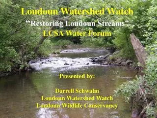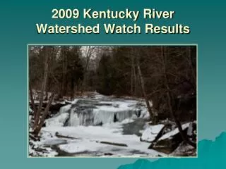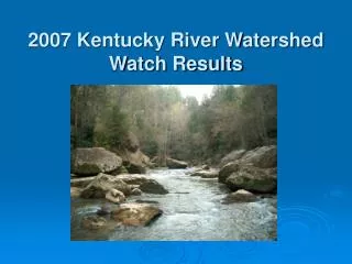
Watershed Watch
Watershed Watch. What is a Watershed?. Watershed Watch Project Overview and Logistics. Goals for this module Discuss the goals and objectives of the project Learn who we are and how we are organized Lean about our basic activities. Determine the streams and sites you want to work on

Watershed Watch
E N D
Presentation Transcript
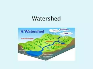
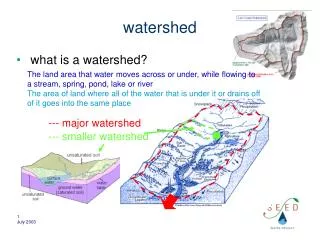
What is a Watershed?
Watershed Watch Project Overview and Logistics • Goals for this module • Discuss the goals and objectives of the project • Learn who we are and how we are organized • Lean about our basic activities. • Determine the streams and sites you want to work on • Complete essential registration paperwork • Check out the equipment you need.
Mission Statement Watershed Watch in Kentucky is a statewide citizens monitoring effort to improve and protect water quality by raising community awareness, and supporting implementation of the goals of the Clean Water Act.
Goal:Get people into the real world to see first hand the condition of their streams.
Watershed Watch Is Statewide Watershed Watch holds 501.C3 status KWA Inc, LRWW Inc, UCWW Inc, TGWW Inc, KRWW Inc, and JPF Inc
Inter-basin Coordinating Committee Watershed Steering Committee Sampling Event Coordinator Science Advisor(s) Lab Manager County Area coordinator County Area coordinator County Area coordinator Supervising Sampler Supervising Sampler Supervising Sampler Supervising Sampler
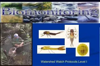
What we do: • 1. Conduct field surveys • 2. Collect samples for • lab analysis • 3. Discuss and act on results
1 2 3 4 5 6 7 8 9 10 11 12 13 14 15 16 17 18 19 20 21 22 23 24 25 26 27 28 29 30 31 32 33 34 35 36 Common Measurements Common Language With Resource Management Agencies 1. Habitat Assessments 2. Biological Assessments 3. Field Chemistry 4. Lab Analysis
Initial Training Workshops 2. Habitat and Biological Assessment 1. Field Chemistry and Grab Sample Collection
1. Field Chemistry-Grab Sample Collection State Of The Basin Project Logistics and Overview Equipment Checkout and Site Selection Field Chemistry Grab Sample Collection and QAPP Field Test. (Performing the tests in a field situation) 2. Habitat and Biological Assessment Stream Hydrology Habitat Assessments Benthic Macroinvertebrate Survey Methods Field Work and Assessments
1. “Recertification” for Grab Sample Collection Training lasts for two years if you participate in more than half of the sampling events Training Updates Recommended at least every two years If you don’t sample for one year, you need to be retrained. 2. Biological and Habitat Assessment Stream Hydrology Habitat Assessments Benthic Macroinvertebrate Survey Methods Field Work and Assessments
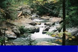
Field Work
Field Chemistry Measurements Analysis that can only be done at the creek • Dissolved Oxygen • pH • Conductivity • Temperature
“Grab Sample” Collections for Laboratory Analysis • Herbicides,Spring • Pathogens,Summer • Water Chemistry,Fall
Volunteers receive materials by mail or from their area coordinator. instructions are included (Critical info on sample times and delivery included)
Sampling Event Logistics (It moves!) Sampler Sampler Sampler Sampler Runner Drop LAB Off Sampler
What happens to the data? 1. Lab sends results to “Basin Data Manager” 2. Data Manager reviews for accuracy 3. “Draft” report circulated for review and corrections (You should get to see it in this form) 4. Revised draft posted on web in MS Excel format 5. Reports released at year end conference 6. Data archived on web in electronic form and in “hard copy” at KY Division of Water as a public record.
What the data are used for 1. Participants get first hand information 2. Community awareness 3. Assessment screening 4. PRIDE watershed assessments 5. Grant Applications 6. Enforcement efforts 7. Scientific research. 8. Data use depends on quality control applied...
Year End Conferences 1. Discuss findings 2. Network with fellow volunteers and agency representatives
Follow Up Focus Studies and Citizen Action Plans 1. Conduct more detailed sampling on a specific waterway 2. Develop a plan of action based on your findings
What am I getting myself Into? As a volunteer, you are invited to: Complete basic training -Participate in Sampling Events -Conduct basic field surveys Complete Habitat/Biological training -Conduct advanced field surveys
Participant Agreement Outlines Project Activities (pull them out now! (please) • Participant Agreement • Your Name_________ • Contact Information • _____________________ • Activity list • ___Creek Visit • __sending reports • __Herbicide Event • __Take Sample • Equipment checkout • Monitoring schedule • ___Site info • ___Safety
Participant Agreement • Your Name_________ • Contact Information • _____________________ • Activity list • ___Creek Visit • __sending reports • __Herbicide Event • __Take Sample • Equipment checkout • Monitoring schedule • ___Site info • ___Safety Participant Agreement Fill both out Turn one in (before you leave) Keep one as your reminder. We will answer questions about them as the workshop progresses.
Selecting your stream site Selection Criteria: Sign up for a “Priority Site” or, Identify a site that interests you. Site must have Water all year round Should be within 5 miles of where you live or work. (no more than 20)
Identify your Site 1. Stream name from map 2. Location Description Correct! 50 meters upstream of Hwy 1533 bridge. 100 m Due South of Knott Central High School. 3. Latitude and Longitude Use www.topozone.com for “decimal degrees” or talk to your sampling event coordinator or area coordinator.
Be Safe and Get Permission! Know where you are going Ask permission on private property Stream banks are hazardous places BE CAREFUL!
Getting Organized You are the “Supervising Sampler” Equipment is checked out to you. Plan outings and expeditions Recruit others to join in Set Safety Rules Keep in touch with sampling event coordinators
Getting Organized Who to contact? Your “Area Coordinator” Sampling Event Coordinator Lab Manager (Limit contact) 1-800-928-0045 Ext 473 (State) Http://kywater.org/watch/
Getting Organized Get Involved Don’t want to be the Supervisor? Join an existing team Participate in a "high visibility event" Reclaim The River Day Earth Day Events
BUZZ BREAK! Complete Forms Select your waterway Check out equipment