GLOBAL POSITIONING SYSTEMS
GLOBAL POSITIONING SYSTEMS. Introduction. Introduction. Geographic Positioning Systems have in many ways taken taken over the need to know where you are going.

GLOBAL POSITIONING SYSTEMS
E N D
Presentation Transcript
Introduction • Geographic Positioning Systems have in many ways taken taken over the need to know where you are going. • You can dial your destination in, and then be taken there, but once you get there, you may not have the slightest idea of where you are.
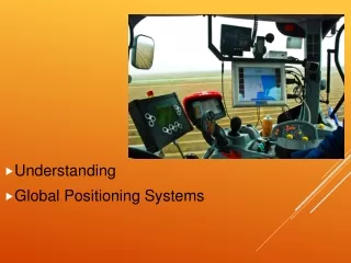
Outline • Why GPS • What is GPS • How GPS works • What you need to know about GPS • What can you do with GPS • Applications of GPS
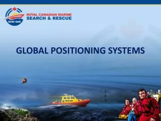
Why GPS at Sea? Location, and Information!
Why GPS at Sea? • There are no street signs or addresses at sea. • There are an infinite number of courses, some of which will take you into dangerous waters, to get to a destination that has no address.
What is GPS? • Global Positioning System is that - a system - not a single unit! • It was developed by the US Department of Defense at a cost of > $12 billion. • Funding was contingent on making the system available to the public.
Global Positioning System There are three major components in this system: • Satellites • Ground Control Stations • GPS Receivers (or units)
Satellites • There are 24-32 satellites up at any given time orbiting the earth at ~11,000 nautical miles. • The EXACT location of each satellite is known, and they have VERY accurate clocks. • The satellites continuously transmit radio signals towards earth. • These radio signals are picked up by the individual GPS receivers.
Control Stations • There are five control stations that continuously track satellites, transmit information to and update the positions of each satellite. • Without control stations, the accuracy of the system would degrade in a matter of days.
GPS Receivers • GPS units are referred to as “receivers”. • They receive information (radio signals) from satellites.
GPS Receivers • The GPS receiver knows how long it takes the signal to travel from the satellite to the receiver. • The Receiver is therefore able to calculate its distance from the satellite. • Distance = time x velocity • Distance = time x 186,355 mi/sec
GPS Receivers • The receiver can calculate the time that signal traveled from the satellite to the receiver. • The receiver is therefore able to determine its exact distance from the satellite.
How GPS Works • GPS uses triangulation • You can find any point if given distances from 3 other points
How GPS Works If your satellite receiver picks up a signal from the yellow satellite, you must be somewhere on the yellow circle. If you're also picking up signals from the blue and red satellites, you must be at the black dot where the signals from the three satellites meet.
Simplified Triangulation • One satellite tells you that you are 64 km from Nanaimo, BC
Nanaimo 64km
If the GPS receiver obtains two satellites, it tells you that you are also 16 km from Sea Island.
Nanaimo Sea Island
x Nanaimo Sea Island x
A third satellite tells you that you are 49 km from Duncan, BC.
Nanaimo Sea Island Duncan
Nanaimo Sea Island x Duncan
These three position circles will give you a position at the Tsawwassen Ferry Terminal (Gift shop) • A fourth satellite is required to determine exact location and elevation.
What you need to know about GPS • Signal Accuracy Issues • Selective Availability • Tricks of the Trade
Signal Accuracy • There are 2 types of GPS Signals: • P-code: (“Precise” code) This is only available to the military and some selected public officials. Very precise, not degraded. • C-code: (“Civilian” Code). Less precise Signal can be degraded (by scrambling the signal) especially in times of conflict.
Selective Availability (SA) • For national security reasons, the military sometimes degrades the C-code signal. This is called selective availability. • These errors are random • Errors be as high as +300 feet
Selective Availability • SA errors can put you on the wrong side of a stream, or even a different city block or street! • 300 feet is a lot of real estate!!! The GPS tells you that you are located here… But your real location is here…
Selective Availability • It is possible to correct for Selective Availability (as well as other inherent signal errors). • However, SA has not been employed for many years. If it was, there would be media attention since it would affect car GPS systems and many others. • This process is called Differential Correction
Differential Correction • There are already established base stations established around the U.S., whose position has been determined precisely. • Each base station has a GPS receiver, which collects incoming (possibly slight incorrect) signals, and determines a position. • The true (surveyed) position is then compared to the GPS coordinates. • The correction values are then sent to other GPS receivers in the field.
WAAS • The Wide Area Augmentation System (WAAS) is a differential GPS system that is being constructed to support GPS accuracy in aircraft. • WAAS also provides additional accuracy “on the ground”.
WAAS Note: Not all GPS receivers are WAAS compatible.
Averaging • Averaging: A GPS receiver can collect points continuously for 15-30 seconds. • The receiver can then average all these locations together • This only works when you are standing still!! GPS Collected Points GPS Averaged Position “True” location
Positional Dilution of Precision • It is better for your receiver to get a fix on 4 satellites spread around the horizon, than 4 clustered satellites. Good Satellite Distribution Poor Satellite Distribution
Multipath Error • Try and stay away from buildings and other structures when using a GPS receiver. • Satellites may not be visible. • This can introduce error.
Loss of Satellite Signal • GPS has worldwide coverage… HOWEVER • You can lose satellite coverage (or received degraded signals) in areas with dense foliage, in “urban canyons”, etc. • You may also lose satellite coverage (or receive degraded signals) in deep inlets, valleys or gorges.
How Accurate is a GPS? • That’s the million dollar question…
How Accurate is a GPS? SA OFF 15m SA ON 100m YOU ARE HERE WAAS 3m
Speed • The GPS can calculate your vessel’s speed over the ground.
Waypoints • Collect and store points (latitude and longitude positions) called WAYPOINTS. • Download the points onto your computer and integrate them with other mapping programs
Waypoints Lat: 50° 24.00’N Long: 125° 12.00’W
Routes • Collect and store ROUTES • Routes are similar to TRACKS, but are created by joining Waypoints together to set up a passage plan.
Tracks • Collect and store the path that you have sailed, - this is called TRACKS. • Activate Tracks and see where you have been. • Monitor tracks for an efficient coverage of an assigned area in a search pattern.
Man Overboard • The Manoverboard is a particular GoTo function, which marks the position on the plotter when the MOB Button is pressed, to allow you to expeditiously return to that spot, and pick up someone who had fallen overboard.