Satellite Derived Mid- Upper Level Winds
This outline discusses the critical importance of satellite-derived mid to upper-level winds in meteorology, particularly over oceanic regions. It covers various instruments used for location tracking, height assignment, and quality control, highlighting methods such as the Dvorak Technique and cloud-drift measurements. The document emphasizes accuracy in deriving wind vectors through algorithms sensitive to cloud brightness temperatures and moisture layers. Essential for numerical weather prediction, it reviews associated sources of error and summarizes its significant applications in oceanic analysis and tropical cyclone forecasts.

Satellite Derived Mid- Upper Level Winds
E N D
Presentation Transcript
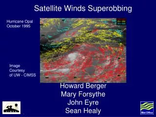
Satellite Derived Mid- Upper Level Winds Cegeon Chan MET 315: Remote Sensing
Outline • Importance • Instruments • Location Tracking • Height Assignment • Quality Control http://apollo.lsc.vsc.edu/classes/remote/index.html • Accuracy • Summary
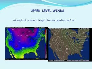
Importance • Over oceanic regions • Dvorak Technique • Wind vectors • Numerical Weather Prediction
Different Types • cloud-drift • 2) Water Vapor • 3) Sounder WV • 4) Visible
What does it look like? • Capable of gathering water vapor fields • Measure infrared energy
Imager Sounder • Responsible for NH and SH • Low Frequency • Responsible for the tropics • High Frequency
Tracking Background • Similar to cloud tracking • Algorithm is housed within McIdas! • Very sensitive • Rule: at least 3 images to derive winds to produce 2 vectors • Measures consistency between successive images
Tracking Procedure • Take a small area • Isolate the lowest cloud brightness temperature within a pixel array
Tracking Procedure (cont.) • Compute bi-directional gradients are computed • Cloud-free environments • Generally in moist regimes
Height Assignment • Goal is to ascertain the height level of the feature you tracked • Can be complicated if there are multiple moist layers
Height Assignment (more) • Convert measured radiance into Brightness Temperature • This value is collocated with a model guess temperature S. Velden, Christopher, Christopher M. Hayden, Steven J. Nieman, W. Paul Menzel, Steven Wanzong, James S. Goerss, 1997: Upper-Tropospheric Winds Derived from Geostationary Satellite Water Vapor Observations. Bulletin of the American Meteorological Society: Vol. 78, No. 2, pp. 173–173
Quality Control Algorithm • Slow – using cloud drift winds • Add 8% for 10m/s • Incorporate satellite winds into analysis • Remove those differing significantly from analysis • Yellow = minus satellite • Red = Plus satellite
Accuracy – how good is it? • A particular single level does not represent a layer • Generally good for 50 mb
Sources of Errors • Assumption of clouds and water vapor • Image registration errors • Target identification and tracking errors • Inaccurate height assignment
Summary • Great applications – oceanic analysis, tropical cyclones • Improved numerical weather analysis and prediction systems • Similar to cloud tracking method • Tendency to be slow