Download
1 / 1
20 likes | 306 Vues
Kangerlussuaq ISR Research Facility. Incoherent Scatter Radar Station operated by SRI and DMI. Ionosonde – Digisonde Observations at DMI

E N D
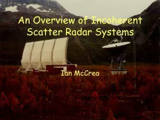
Kangerlussuaq ISR Research Facility Incoherent Scatter Radar Station operated by SRI and DMI Ionosonde – Digisonde Observations at DMI Exploration of the atmosphere by radio wave techniques became a widely used tool from around 1950. At that time the requirements to reliable long-distance HF radio communication started international efforts to deploy a worldwide net of ionospheric monitoring stations. The efforts were coordinated through the International Scientific Radio Union, URSI. Since 1951 DMI has operated an ionosonde station in Qeqertarsuaq (Godhavn), since 1957 a station in Narsarsuaq, and since 1966 an ionosonde station in Qaa-naaq (Thule). More recently these stations have been upgrades to use modern Digisondes. The ionosondes/ digisondes measures the electron content in the upper atmo-sphere, a parameter of great importance for the propagation of radio waves. The altitude range is limited to exploring the layers below the region of peak electron density. Upper AtmosphericResearch Facility in Kangerlussuaq Just north of the Arctic Circle and 100 km inlandfrom the west coast of Greenland lies a research facility dedicated to studying the polar upper atmosphere. Forhistorical reasons, this research station is known aroundthe world as the Sondrestrom Upper AtmosphericResearch Facility in Kangerlussuaq, Greenland. Thefacility is operated by SRI International, Menlo Park,California, under the auspices of the U.S. NationalScience Foundation and in joint cooperation with the Danish Meteorological Institute. The facility has beenoperating in Greenland since 1983 and continues to be inhigh demand by the scientific communities. (Photo by C. Heinselman) Incoherent Scatter Radar Observations A major step for the exploration of the upper atmosphere came with the construction of the Incoherent Scatter Radar (ISR) instrument that uses backscattering from free electrons rather than the specular reflections from electron layers which is the basis fror ionosonde/digisonde operation. Hence the ISR radar can observe electron densities beyond the peak layer. In addition the instrument can measure drift motions, temperatures and composition in the ionised part of the upper atmosphere and turbulence and motions in the neutral lower atmosphere. Sondrestrom Research Facility at Kangerlussuaq Beacon - GPS – Lidar Observations The range of observational tools have been further extended by the use of satellite beacon radio signals for ionospheric tomography (2-D mapping). Using signals from the GPS satellites makes it possible to map the total ionospheric electron contents (TEC) in the upper atmosphere between the satellite and the receiver instrument. With Lidar techniques another major step was taken to explore the neutral atmospheric temperature profile and the aerosol composition. Instrumentation at ISR station This facility is host to more than 20 instruments, themajority of which provide unique and complementaryinformation about the arctic upper atmosphere. Togetherthese instruments advance our knowledge of upper atmospheric physics and determine how the tenuousneutral gas interacts with the charged space plasma environment. The suite of instrumentation supports manydisciplines of research; from plate tectonics to auroralphysics and space weather. The facility instrumentationcovers the electromagnetic spectrum while the dataresults span the spectrum of polar research. LIDAR beam in the polar night with auroral activity (Photo by C. Heinselman) Lidar beam on a background of active aurora. The ISR radar is seen to the right. (Photo by C. Heinselman) Incoherent Scatter Radar The centerpiece instrument of the facility is an L-bandincoherent scatter (IS) radar with a 32 m fully steerableantenna. The IS radar technique is a powerful toolcapable of measuring range-resolved ionospheric andatmospheric parameters simultaneously from the groundto the outer reaches of our atmosphere. Use of asteerable antenna allows spatial coverage in both latitudeand longitude. The LIDAR system at the ISR Station The ARCLITE System is located in themain building of the Sondrestrom facility.The system presently consists of two lidarsystems: The Rayleigh/Mie lidar for middleatmosphere studies of noctilucent clouds (NLCs),polar stratospheric clouds (PSCs), temperatures,density and gravity waves, and the sodiumresonance lidar for mesosphere / lowerthermosphere studies of gravity waves and thedynamics and chemistry of sporadic layerformations. The Rayleigh/Mie lidar has beenoperating since November of 1992. The sodium resonance lidar has been operating since Augustof 1997. The LIDAR instruments have provided core observations of Noctilucent Clouds (NLC) for investigations of greenhouse gases like illustrated below in a campaign logo: Summary of Instrument Capabilities The diagram below indicates the detection capabilities for a range of instruments with respect to parameter as well as altitude range. In this diagram the parameters are: Tn Neutral atmosphere temperature [Nm] Molecular atmospheric density [Naer] Density of special constituents [O3] Ozone concentrations Un Drift motion of neutral atmosphere [Ne] Electron density Te Electron temperature Tm Molecular temperature Vi Drift motion of ionised atmosphere Further Instruments The facility hosts a wide range of additional optical and radiowave instruments including: Lidar (ARCLITE) All-sky imager Meridian imaging spectrometer Multichannel photometer UV spectrograph Auroral photometer Fabry-Pèrot interferometer Michelson interferometer UV spectrometer Three-axis magnetometer MF/HF receiver and imager Meteor scatter radar Search coil magnetometer Three-frequency riometer Imaging riometer Digisonde Satellite scintillation receiving systems ELF/VLF receivers Ozone spectrometers NDSC, May 2002 The Network for Detection of Stratospheric Change (NDSC) has designated the Rayleigh lidar as a primary instrument in their program. ISR Observations in Space Weather Projects The best opportunity to evaluate space weather geo-effectivenessis by combining the identification and monitoring of spaceweather events by interplanetary spacecraft withmagnetosphere-ionosphere observations by geospace and ground-based instruments. The Sondrestrom Incoherent scatterradar operates on an alert basis to capture the onset, mainphase, and recovery phase of coronal mass ejection(CME)-related geomagnetic storms. Since 1997, theSondrestrom radar has been operated in the alert mode 18 times, totaling 430 hours of operation. Coordination with otherradar facilities has been established to measure globalionospheric effects of CME-induced storms. The ISR management office at SRI International is prepared to assist with scheduling site operations and crew, and to help providing access to and interpretation of the data through aSpace Weather Archive. For DMI the availability of the ISR radar is an essential asset for our planned Space Weather activities. • . Users of the ISR Observations Data from the facility are used by hundreds of scientistsannually. Dozens of scientists, engineers, and studentsvisit the site each year to install hardware, implement collocated instruments, and collect datain real time in multi-instrument campaigns. DMI use of the ISR station The ISR station conducts routine operation of various DMI instruments to observe, e.g., Ozone, UV radiation, radio wave absorption, and magnetic activity. In addition DMI is a frequent user of the ISR radar, among other, for campaigns of combined observations of atmospheric disturbances from ground and from the Ørsted satellite. The DMI involvement in the sophisticated observations from the ISR station was an essential motivation for entering the Ørsted satellite project and has strengthened our capabilities to deal with, among other, the GPS observations from Ørsted. Part of the text and some of the images are copied from SRI web site: http://isr.sri.com/ Peter Stauning. Danish Meteorological Institute. September 2002. pst@dmi.dk