Advancing Ice Sheet Science: Goals, Objectives, and Research Priorities For Climate Impact
This document outlines the goals and objectives of the OIB Ice Sheet Science Program aimed at understanding ice sheet dynamics and their contribution to global sea level rise. Key objectives include making airborne altimetry measurements, linking ICESat and CryoSat datasets, and improving predictive models through high-resolution data. It highlights critical questions regarding ice flux, dynamics, and future changes while also addressing the need for robust geophysical data and model accessibility to enhance research and inform policy.

Advancing Ice Sheet Science: Goals, Objectives, and Research Priorities For Climate Impact
E N D
Presentation Transcript
Draft Ice Sheet Science Goals, Objectives and RequirementsplusDraftScience Team Terms of Reference Strawman by KCJ and derived from the draft Project plan and in particular the Table 3 Tracability matrix. Also culled info from ISMASS Report and IGOS Theme page 86. My out-of-thin-air additions are in red
OIB Ice Sheet Program Goals • Make airborne altimetry measurements over the ice sheets and sea ice to extend the record of observations begun by ICESat. • Link the measurements made by ICESat, ICESat-2, and CryoSat-2 to allow accurate comparison and production of a long-term, ice altimetry record. • Use airborne altimetry to monitor key, rapidly changing areas of ice in the Arctic and Antarctic to maintain a long term observation record, improve understanding of glacial dynamics, and improve predictive models of sea level rise and sea ice cover. • In conjunction with altimetry measurements, collecting other remotely sensed data, improve predictive models of sea level rise and sea ice cover, especially the following: • Ice thickness and structure; • Bed topography underlying land-based ice; • Bathymetry beneath floating ice shelves; • Snow accumulation and firn structure; and • Other geophysical constraints that will improve estimates of the geothermal and oceanic heat flux. • Adapt existing instruments for airborne remote sensing of ice by unmanned aerial systems such as NASA’s Global Hawk. • Provide a well vetted data set with ‘modeler-friendly’ formats to the research community in a timely fashion
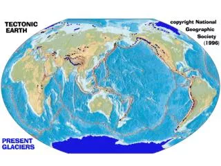
OIB Ice Sheet Science Themes • What is the flux of ice from the polar ice sheets and what is required to reduce IPCC error bounds on the contribution of ice sheets to global sea level rise [1]? OIB will collect surface elevation change data and ice thickness measurements. In combination with available spaceborne radar interferometry measurements of surface velocity, OIB will yield a precise assessment of the mass fluxes from the Greenland Ice Sheet and from important sectors of the Antarctic Ice sheet to reduce error bounds on mass balance assessment. • What causes observed abrupt changes in ice sheet motion? Does a rapid change in a glacier always lead to a large change in the ice sheet volume [2]? OIB will accurately map the sea water cavity beneath ice shelves, depth of grounded glaciers below sea level, how far inland they remain below sea level, and the basal slopes. OIB will inform on subglacial geology and, in the future, yield indirect measures of geothermal heating. These data will feed ice sheet process studies and numerical models assessing areas capable of sustained contribution to sea level rise. • How will the mass balance and dynamics of the ice sheets change in the future [1,2,3]? OIB surface topography and ice thickness maps will constrain estimates of basal friction and identify natural pathways for basal water. High fidelity surface digital elevation models (DEMS) data will refine estimates of the gravitational driving stress that pushes the glacier forward and will also improve estimates of the subglacial hydrologic potential that determines the distribution of subglacial water. OIB surface and base digital elevation models will be a primary input for predictive ice sheet dynamics models. • Is the Greenland Ice sheet, rimmed by outlet glaciers, an analog for the future of the Antarctic Ice sheet, rimmed by outlet-glacier-fed ice shelves? If so, can lessons learned in Greenland be extended to predict future behaviors in Antarctica? Are Alaskan/Canadian glaciers and ice caps an analog for the eventual fates of both Greenland and Antarctica?
Ice Sheet Science Questions • Where are glaciers continuing to thin and where may they be slowing/ thickening • How can the ICESat, OIB, Cryosat, ICESat -2 measurements be optimized to characterize the state of the ice sheets over several decades? • What are the major forces and mechanisms causing the ice sheets to lose mass and change velocity, and how are these processes changing over time? • How does the ice sheet/glacier surface topography, bed topography, bed geology, geothermal heat, ice shelves/tongues, and grounding line configurations effect ice dynamics? • How and how far are horizontal stresses transmitted in the ice sheet? • How far downstream do changing processes near the ice divide effect glacier flow • What is the important scale for measuring geophysical parameters so as to substantially improve modeling fidelity? • Where is the subglacial water produced and where is it going? • What is the sliding law and can repeat measurements be used to refine estimates of the sliding law parameters? • How do ocean, sea ice, ice sheet interactions influence ice sheet behavior • How does the bathymetry beneath ice shelves and the ocean/ice sheet interaction effect ice sheet/glacier flow dynamics? • How does bathymetry in fjords influence tide-water glaciers about Greenland?
Ice Sheet Science Questions • When do ice shelves become unstable? • What creates "granularity" in ice shelves? By granularity, we mean the bumpy texture that creates the meltwater features that exist on entities like the pre-collapse Larsen B Ice Shelf. Why should water fill crevasses on Larsen in a geometry such that the fragments of the ice shelf created during collapse can capsize rather than float "top up" as a tabular iceberg? This (the development of the proper granularity) is the key constraint that differentiates a stable ice shelf from an ice shelf that can collapse explosively. • At what scale are ice rises/rumples important for understanding ice shelf and upstream ice sheet stability? • What are yearly snow accumulation rates over the ice sheets? • How do changing accumulation rates (and hence near surface densities and firn structure) impact altimetry measurements • What is the relative importance of ice sheet surface melt, and melt hydrology on ice sheet mass balance and dynamics? • What are the surface-melt flow-patterns and how much surface melt drains directly from the surface and how much drains through channels within the ice sheet? • How much annual surface melt refreezes in place and how much results in net wastage? • What is the magnitude and spatial distribution of basal melt/freeze on ice shelves? • Are there commonalities in bed geomorphology, surface/base hydrology etc, that can be used to extend IceBridge-derived process-knowledge to glaciers not overflown by IceBridge?
Ice Sheet Observational Goalsoriginally in section 1.3.1 of Draft Project Plan • Monitor changes in Greenland and Antarctic ice-sheet elevations during the gap in satellite coverage between ICESat-1 and ICESat-2. • Provide a dataset for cross-calibration and validation of ice-sheet elevations from satellite lidars (ICESat-1, ICESat-2, DesDynI-Lidar) and radars (CryoSat-2 and Envisat). • Provide a dataset for improving the ICESat-1 ice-sheet elevation time series, including better characterization of ICESat-1 errors. • Provide a data set for investigating unresolved ice sheet processes • Provide a dataset for improving numerical models of ice-sheet dynamics, especially maps of the bed beneath glaciers and ice shelves. • Provide a dataset for improving instrument simulation and performance analysis in support of future missions, such as ICESat-2 and DesDynI-Lidar. • Support, when feasible, field programs in Greenland and Antarctica. • Provide data tailored to support numerical ice-sheet-model inter-comparisons
Science Requirements – Spatial Coverage • Map and characterize the bedrock beneath land-based ice as follows: For Greenland: establish a 100 km by 100 km grid and provide 10 km by 10 km grids over five major outlet glacier catchments. For Antarctica, provide mapping over accessible outlet glaciers that improve numerical models of ice sheet flow according to the priorities in #4. WHAT PROPERTIES, WHAT ACCURACY • For each target glacier, collect data along the grounding line and along a parallel line 20 km upstream of the grounding line • Determine bathymetry beneath ice shelves and sub-ice-sheet bedrock topography that cannot be mapped with radar for target glaciers in Greenland and accessible portions of Antarctica according to the priorities in #4. • IceBridge shall conduct flight experiments that enable the inter-calibration of the flight instruments and the characterization of their errors TO WHAT SPECIFICATIONS • X km swath/Scan requirements on altimetry (proposed requirements on swath basal topography) • Are there requirements for providing photographic data and photogrammetric DEMS? • Observations will be made in Greenland, Antarctica, Alaska and over Canadian Ice Caps. • IceBridge shall fly at least 250,000 total km per year, with 30,000 km per year specifically along ICESat-1 tracks over sea ice and land ice. WHY THESE NUMBERS • IceBridge shall fly at least 500 km per year as underflights along CryoSat-2 tracks over sea ice and land ice. THIS NEEDS A CAL/VAL Plan • IceBridge shall, for at least two field seasons, make altimetry measurements along a swath of the southern limit of the ICESat-1 tracks, enabling direct comparisons of surface elevations for a large number of ICESat-1 tracks. HOW LONG OF A SWATH • One ice thickness sampling grids for fast glacier/ice stream margins, grounding lines, ice rises (adaptive gridding strategy? • One continuous ice thickness record around the ice sheet for flux estimates (located where?)
Science Requirements – Temporal Sampling • Ice sheet data should be collect in the spring and well prior to melt onset • One-time calving events and catastrophic ice shelf collapse events should receive priority when the event is likely to result in significant (30%) changes in upstream ice velocity • Coincidence with field party activities should occur only in the context of a well documented experiment plan integrated with OIB objectives • Cryosat underflights can occur up to one week before or after the satellite pass (weather requirments?). (NEED CAL VAL PLAN) • Is there a seasonal measurement requirement • Is it necessary to collect repeat ice thickness and gravity measurements? If so, how often
Science Requirements: Measurement Accuracies • 20 m vertical ice sheet base height accuracy for all ice covered terrain • 100 m vertical accuracy on sub-ice-shelf ocean-cavity thickness with 6 km horizontal sampling • 10 cm vertical ice sheet surface height accuracy and 2 cm precision across the scan • 20 m vertical accuracy on radar internal layers for ice dynamics (greater than 100 m deep) • 10 cm vertical accuracy on radar internal layers for firn structure (less than 100 m deep) • 10 m horizontal geolocation accuracy • 10% or 5 cm w.eq. accuracy of surface accumulation rate from snow radar • Absolute radiometric accuracy (2 dB) on VHF radar data sufficient to discriminate basal rock from water • Elevation measurements that enable determination of surface slopes to an uncertainty of 0.06° (or about 10 kPa for 1000 m thick ice).
Science Requirements Data Formats • Data products formatted and documented for later integration with earlier spaceborne and airborne data sets • All data products referenced to WGS 84/polar stereographic and DD lat long coordinates • Instrument teams must provide point data. Interpolated grids are highly desirable but not sufficient • If gridded data are provided, how does the interpolation scheme influence model interpretations (resistances to driving stress are related to gradients in HRij so gridding will bias derived results)?
Science Requirements on Future Missions • Provide platform capabilities to extend measurements spatially and temporally beyond the reach of current platforms • Provide 5-10 km wide swath measurements of all key parameters • Addition of magnetometer measurements for characterizing basal sedimentary structures.
Glaciers IceBridge Mountain Glacier and Ice Cap Science Requirements • The objectives are: • To monitor changes in selected mountain glacier and ice-cap elevations during the gap in satellite coverage between ICESat-1 and ICESat-2. • To provide a dataset for cross-calibration and validation of glacier and ice-cap elevations from satellite lidars (ICESat-1, ICESat-2, DesDynI-Lidar) and radars (CryoSat-2 and Envisat). NEED CAL/VAL , Mission Continuity Plan • To provide a dataset for improving the ICESat-1 ice-sheet elevation time series, including better characterization of ICESat-1 errors. • To improve our understanding of tidewater glacier dynamics and the role that they play in the stability of ice sheets. • To map the bed beneath selected mountain glacier and ice-caps. • Science requirements: • IceBridge shall provide annual surveys of the 50 most important glaciers and ice caps around the Arctic to sea level rise estimates. • IceBridge shall provide at least 15,000 km of centerline profiles along these glaciers and ice caps. • IceBridge shall provide swath maps with a 1-m x 1-m lidar point density, 500 meters wide, with a 30-cm vertical accuracy. WHAT HORIZONTAL ACCURACY • IceBridge shall provide at least 50 crossovers with CryoSat-2 and ICESat tracks.
Science Team Terms of Reference • Programmatic charge to the Science Team: The IST will work closely with the IceBridge Project Scientists to provide expert scientific guidance to the IceBridge project in the areas of flight line planning, measurement strategies, data quality control, and data product development. The Science team will: • Assist the Project by • Final development of the IceBridge Science Definition Document and Level-1 Scientific Requirements Document; • Evaluation of the IceBridge mission designs in achieving the goals defined by the Science Definition Document and Level-1 Scientific Requirements Document as requested by the NASA Program Scientist; and • Support to the IceBridge Program Scientist and Project Scientist in the development of the required analyses, documents and reporting during the IceBridge project. • Contribute to the OIB science objectives by • Exploiting OIB data in support of a select set of science objectives • Assuring a level of data and meta data reliability, cross-instrument compatibility and accessibility through use of the data in science investigations • Motivate investigations of all the OIB science objectives by encouraging broad use of the data by the science community • Compile and regularly update a list of target glaciers for repeat monitoring and for continuation of the ICESat record • Support OIB objectives by • Attending 3 team meetings per year • Participating in frequent teleconferences • Providing progress reports before each team meeting to the team leaders in the form of updates to one-page summaries and which will include a schedule for deliverables. • Evaluating mission plans in the context of the OIB science objectives and specific requirements
Science Team Terms of Reference • Science Team Organization • The Program Scientist will appoint an ice sheet and a sea ice team leader for a one-year rotating term and each will serve as co-chairs of science team meetings. • Team leaders will be responsible for consolidating documentation, recommendations, and analyses in support of same from the team, and providing that material to the Project Scientist • Team leaders will organize regular telecons and, with the project, organize 3 team meetings. • Team meetings will be convened at GSFC or JPL. • Team members are encouraged to participate in project-organized outreach activities such as AGU town hall meetings. • All team members will report to the Program Scientist using the usual mechanism of annual renewal proposals and as directed by the Program Scientist. • In contrast to OIB activities to date, neither the team leaders nor the team members are expected to participate in field deployments unless such work was previously proposed and approved. • STILL NEED CLARIFICATION ON THE FUNCTIONAL LINKS TO THE INSTRUMENT TEAM AND THE SCIENCE WORKING GROUP
Issues and Random Thoughts • Cal val sensor intercal plan • Concise explanation/justification on each objective/requirement • Update tracability throughout the bullets • Objectives and Requirements as a check list for flight planning and instrument priorities • What are the risks to the gravity measurement inversions in the presence of undetected basal marine ice?